World Geography
Physical World - GS 1
Geomorphology
Rocks and Its Types
- Introduction
- Definition of Rocks ( Rocks → Minerals → Two or More Elements )
- Any Material which constitutes earth can be hard like Granite and Soft Like Clay
- Minerals
- 32 Most Common Elements
- 12 Dominant Minerals में Present 8 Most Common Elements
- Constitute Whole Earth (Fe O Si, Mg Sul Ni, Ca Al)
- Constitute Earths Crust (O2 Si Al, Fe Cal Na, K, Mg)
- Different Mineral Groups (SiCa SuMe) - TABLE NEEDED
- Silicates (Fel Qua Ferro) - 90% Constitution in Earth
- Feldspar
- Silicates of Al Na Ca K
- Weak Mineral - Easily Weathers ( Under Chemical Hydration )
- Economically Imp
- Chemical Industry - Bone China and Ceramic Industry
- Glass Industry - Gives Toughness to Glass
- Quartz
- Contains Oxygen + Silicon
- Hardest of All
- In Singularity - Chemically Resistant
- In Combination - Can Disintegrate
- Uses - Watch & Prisms
- Ferro-magnesium
- Oxides of Fe+Mg
- Very Weak
- Weathers Easily
- Feldspar
- Carbonates
- Sulphides
- Metals
- Silicates (Fel Qua Ferro) - 90% Constitution in Earth
- Types of Rocks
- Igneous Rocks - Ignis (Fire 🔥) 90% of Earths Crust
- Also Called (3)
- Lava Rock - Made of Cooled Lava
- Primary Rock - First to be Found on Earths Surface
- Parent Rock - Raw Material for Formation of other Rocks ( Sedimentary and Metamorphic)
- Are Fossils Found in Igneous Rocks ?
- No, Due to High Temperature
- Classification of Igneous Rocks on the Basis of
- on the basis of “Location”
Intrusive Igneous Rocks
| Theme | Plutonic Rock | Hypabyssal Rock | | | --- | --- | --- | --- | | Rate of Cooling | Very Slow | Moderate | | | Position | Near to Heat Source, Greater Depth within Crust | Far From heat Source, Just Below the Crust, Closer to Earth | | | Size | Large/Coarse | Medium | | | Example | 1. Pegmatite 2. Granite | 1. Dolorite 2. Magnetite | |
Extrusive Igneous Rocks
- Rate of Cooling : Very Fast
- Due to : Cooling of Lava on Surface of Earth
- Position : Very far from Heat Source
- Size : Finer / Small
- Example :
- Basalt → Disintegrates into → Black Soil → Called Regur Soil in Southern India (maharashtra & Tamil Nadu) → Good For Cotton Cultivation
- Wherever there is Black Soil, we can Expect Black Soil
- on the basis of “Chemical Composition”
- Felsic - Acid Lava - Acid से आदमी Fail (Falsic) हो गया
- Mafic - Basic Lava - एकदम Basic के Mafic ( माफ़िक़) है बावा
- Texture - Not in Syllabus
- on the basis of “Location”
- Landforms of Igneous Rocks
Extrusive Igneous Rock Landforms
- Formation of Rocks through Volcano and Eruptions
- Mountain Lava Formation
- Formations of Acidic Lava
- Conical and Vertically High
- Formations of Basic Lava
- Dome Shaped and Horizontal
- Formations of Acidic Lava
Intrusive Igneous Rocks Landforms
- Formation of Rocks through Volcano and Eruptions
- Types
- Batholith
- Silt/Sheet
- Dyke
- Lappolith
- Laccolith
- Phacolith
- Characteristic of Intrusive Igneous Rocks Bodies
- Also Called (3)
- Sedimentary Rocks
Also Called
- Layered Rocks - Deposition Happened Layer by Layer
- Carboneous Rocks - Organic Materials were deposited at the Bottom
- Clastic Rocks - Klostos Means Fragments, they are made up of fragments
Process of Formation of Igneous Rocks ?
- Deposition by Rivers by Erosion of Lava Rocks - Deposition
- Inc Pressure Downwards, Top Layers Exert Pressure - Compaction
- Layer by Layer Deposition - Stratification
- Moisture acts a Cement & Hence Sedimentary Rocks Formed - Cementation
Lithification
💡 Process Under which Sediments are are converted into Hard Rock under agents of Force are called LithificationIncludes
- Compaction
- Cementation
Classification of Sedimentary Rocks on the Basis of
- Agent of Carrier
- Basis of Formation
- Mechanical
- Organical
- Chemical
- Metamorphic Rocks
- Introduction
- Meta - Change, Morphia - In Form
- Any Changes in the Igneous or Sedimentary or Old Metamorphic Rock due to Pressure and Temperature is called Metamorphic Rock
- Introduction
- Igneous Rocks - Ignis (Fire 🔥) 90% of Earths Crust
- Introduction
Interior of Earth
Inception of Earth
- Big Bang Theory
- Primordial Matter & Black Hole
- Stratification of Earth
Direct Method (2)
- Drilling and Mining - 0.1285%
- Avg 5-6 KM | Per 32 Metere 1 Degree C Temp Rise
- Artificially
- Max Deep 12 Km - Kola Peninsula in Russia - Radius Earth - 6400 KM - Hence only 0.1875% - Negligible Reach
- Natural Gold Mine - Both in South Africa - 3.9 Km Deep
- Mopeng Gold Mine - Deepest
- Tua Tunga Gold Mine - Second Deepest
- Volcano - 6.25%
- Lava Coming Out Forms Rocks which are Studied Later
- Diamond to Surface of Earth
- Maximum Reach 400 KM - 6.25%
- Over All Draw Back
- Can Study Mineral Composition but Depth & Limit is Ambiguous
- Pressure and Density Varies in Mining
- Drilling and Mining - 0.1285%
Indirect Method (3)
Physical Characteristics
Density
Average Earth Density - 5.5 gm/cm3
Density Increases Towards Centre of Earth
Continent → Ocean → Volcanic Rocks → COE
Temperature
- Temp Inc → Down Earth → 1 C/32 Mts → 3.2 KM/100 Degree Increase
- Core Temp - 6000 C = Top of Atm = Surface of Sun
Surface Pressure
By Temperature and Density
Space Objects - Meteorite, Moon, Mars Mission, Comets, Other Planets, Natural Satellite
- Study Meteorite assuming it has same Composition as Earth
- Meteor - Burnt by Earth Atmosphere
- Meteorite - Falls on Land, Called Meteor Rock - Results in Removal of Outer Layer of Meteorite
Earths Energy
Gravity
G=M1*M2/R2 - Radius Constant, M1M2 - Distribution of Mass on Earth is Known
Magnetism - GeoDynamo
- Due to Outer Core of Earth - Geo Dynamic Effect
- Shift in Magnetic Field - Happenings in Earth Core
Seismic Activity - Most Important Method
Seismic Waves - Less Distance Travelled, Less Energy Lost
- Hypocenter - Below Earth - Focus of Seismic Activity - Expected to Travel in All Direction - due to Tension & Compression - Elastic Limit
- Seismic Body Waves - Travel Inside Earth - Travels in All Directions - Reaches Surface of Earth - Help in Understanding Interior of Earth
- Epicentre - Max Energy, Least Distance - Perpendicularly Above Focus
- Seismic Surface Wave / EQ Waves - Seismic Surface waves created by Body Waves wave hitting earth surface - FISH - Travels in All Direction on Surface of Earth from EPIC - Causes Shaking & Destruction - EQ Waves
Movement of Seismic Waves
- Velocity of Seismic Waves Depends upon (RED)
- Rigidity DP HV (High Velocity)
- Elasticity DP HV
- Density DP HV
- Material Obstacle
- Touching Obstacles SW change course due to “Difference in Densities of Material” by
- Reflection
- Refraction
- Touching Obstacles SW change course due to “Difference in Densities of Material” by
- Velocity of Seismic Waves Depends upon (RED)
Summary - Types & Characteristic
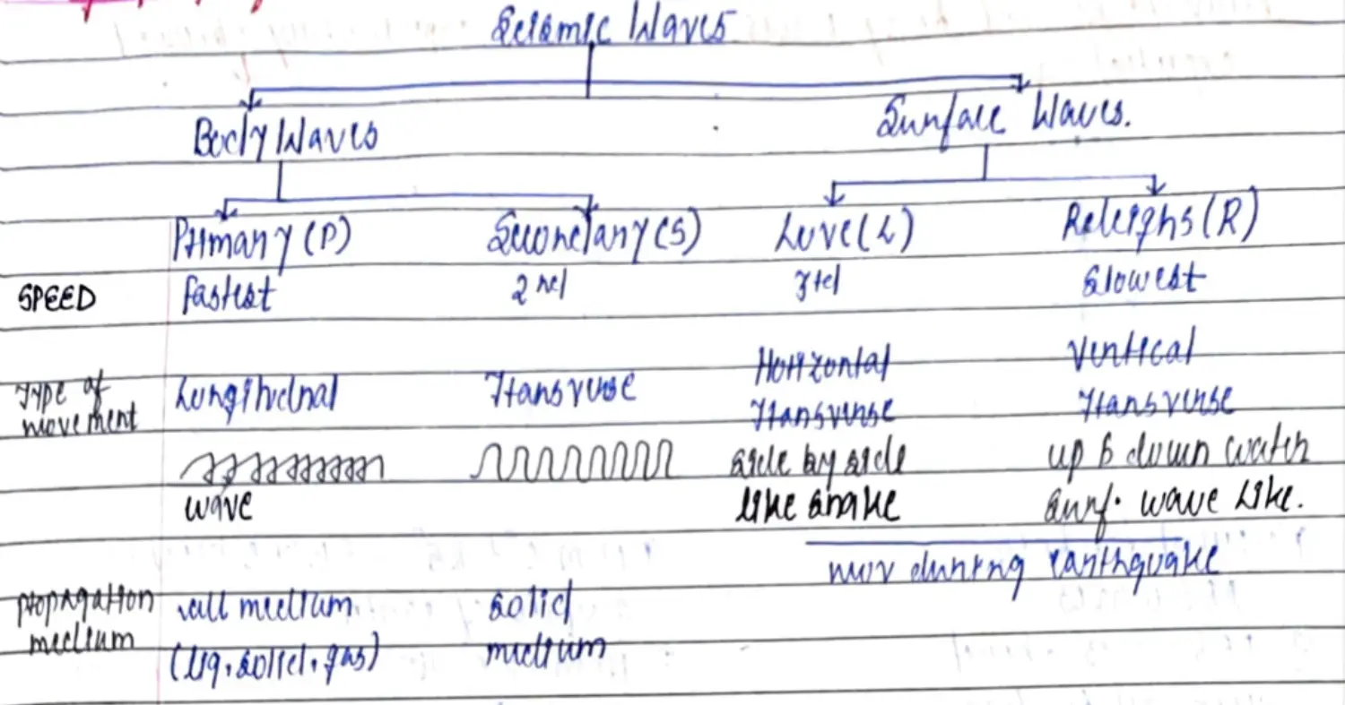
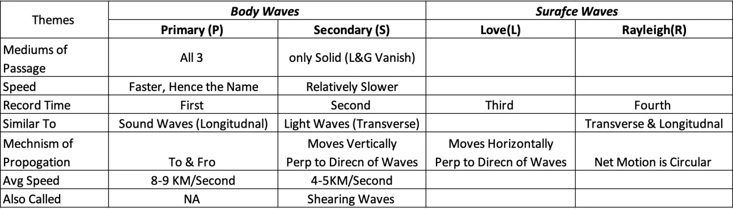
Deductions
- Speed Change - Change in Medium = Change in Density = P&S Waves “BEND” dp “Change in Density”
- P Waves End - Medium Changes - From One to Another S Waves End - Medium Changes - From Solid to Anything
Observation
S Wave Observation - Liquid Core @ 2900 KM
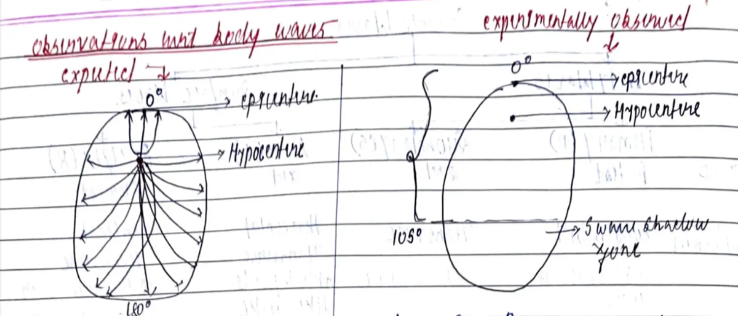
Expected - S Waves should reach all Surface
Observed - S Reaches (0 to 105) S Shadow ( 105-180) { Shadow Region Always Fixed }
Inference 1 - S Travel in Solid - Cant in Liquid - Shadow Zone is 105-180 - Shadow Zone Fixed - Hence Spherical Liquid Region Inside Earth
Inference 2 - From Angle & Density Measurement - This Angle (105-180) = 2900 KM
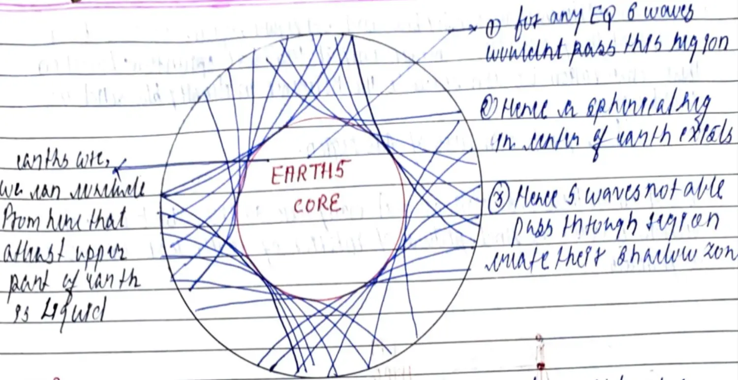
P Wave Observation - Density Difference
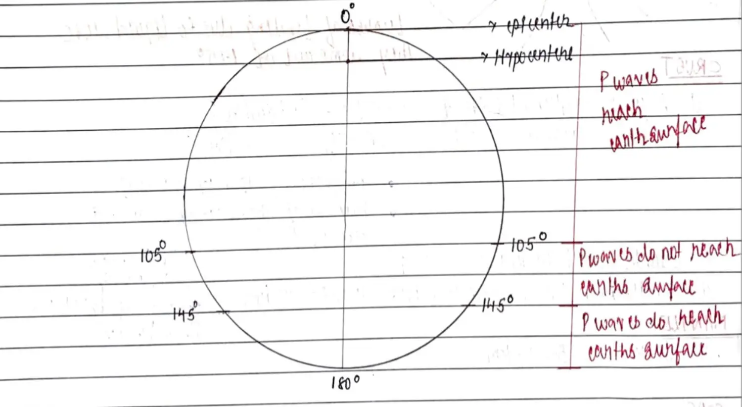
Expected - P Waves should reach all Surface
Observed - S Reaches (0 to 105 && 145-180) S Shadow ( 105-145) { Shadow Region Always Fixed }
Inference 1 - Difference in Density btw Solid & Liquid Regions
Note : Degrees with Respect to Epicentre
Hence Interior of Earth Looks Like
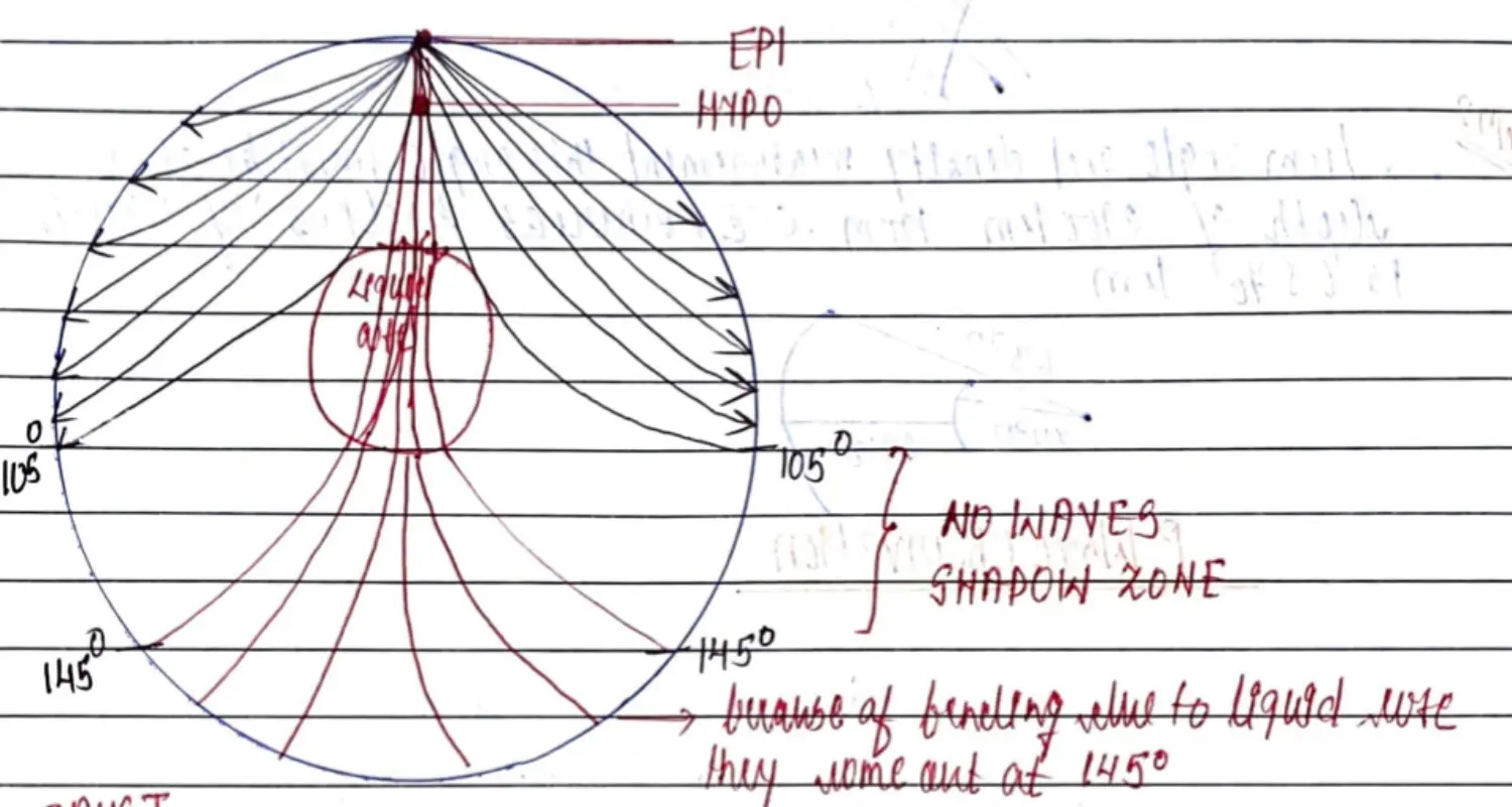
Hence, Interior of Earth
Edward Suess - SiAl SiMa NiFe - Crust Mantle Core
Diagram 1
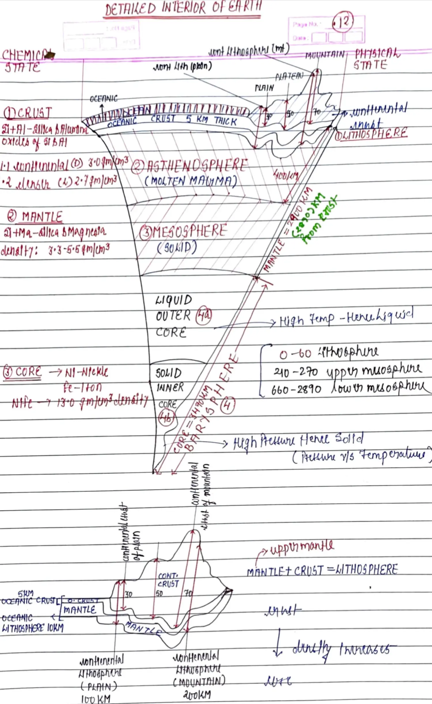
Diagram 2
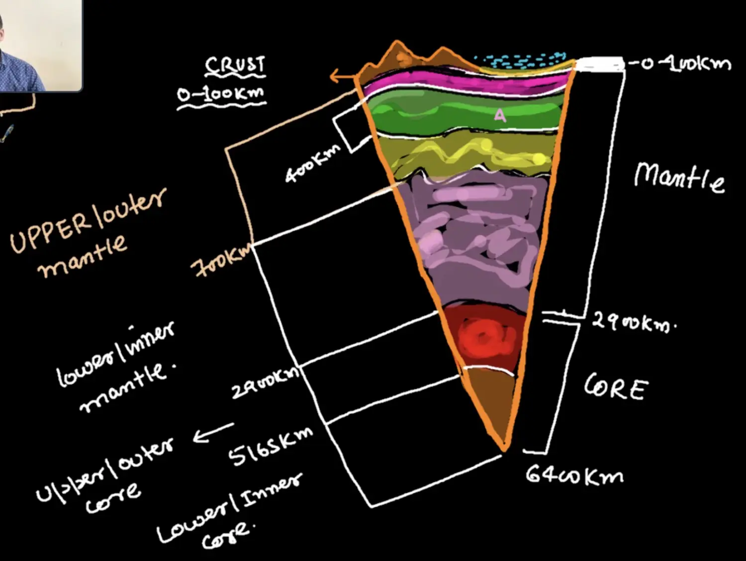
Chemical Composition
- Crust -SiAl
- Continental Crust - LIGHT - SiAl - 2.7 gm/cm3 10 - 70 KM THICK - Avg(35KM)
- Oceanic Crust - HEAVY (Magnesia) - SiAlMg - 3.0 gm/cm3 5 KM THICK
- Max Elements in Oxide Form
- Mantle - SiMa ( 3.5 gm/cm3 )
- Core - NiFe ( 13 gm/cm3 )
- Crust -SiAl
Physical Composition - LAMB (भेड़)
Lithoshphere
- Lithosphere = CRUST + Rockey Part of MANTLE
- Depth - 10 KM (OC) && 100-200 KM (CO)
Asthenosphere
- Weak Solid - Molten Magma State
- Depth 400 KM
Mesosphere
- Depth - 2900 KM
- Lower Meso = End of Mantle
Barysphere
- Depth - 5100 KM - Barysphere Starts
- Barysphere = Liquid Outer Core + Solid Inner Core
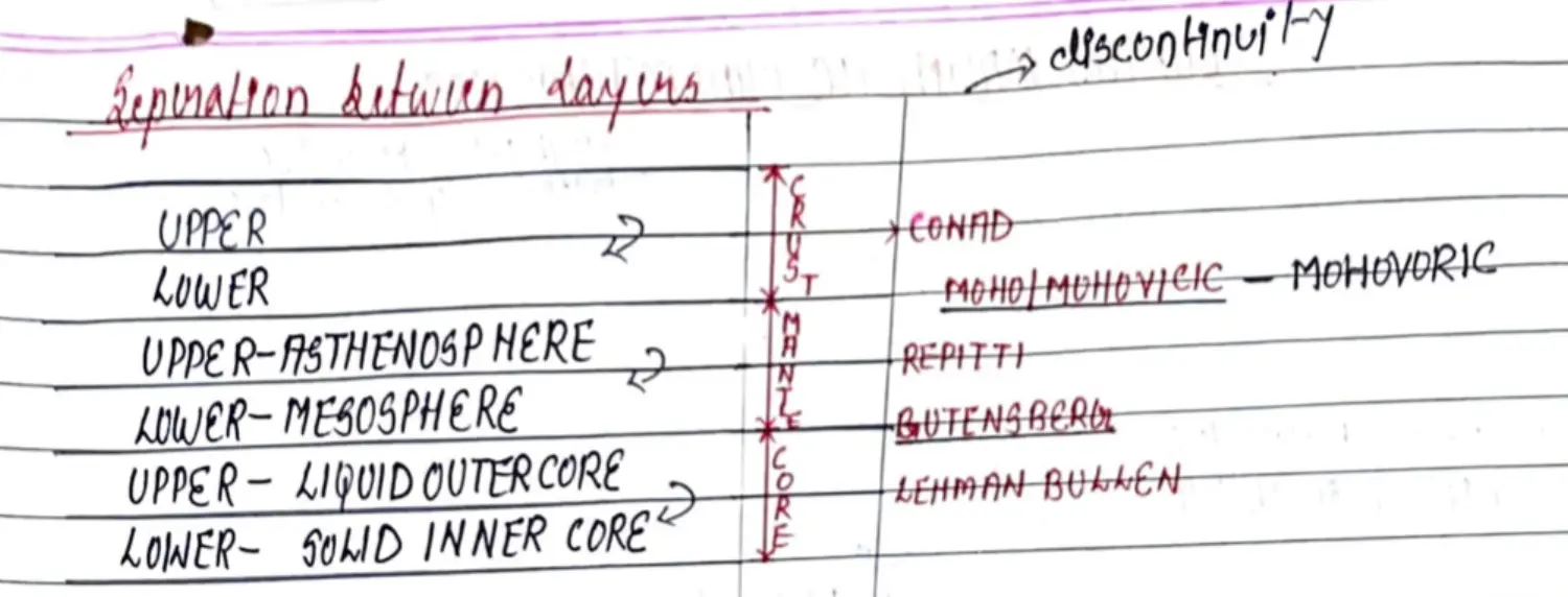
Discontinuity in Layers
Earths Magnetism
Introduction
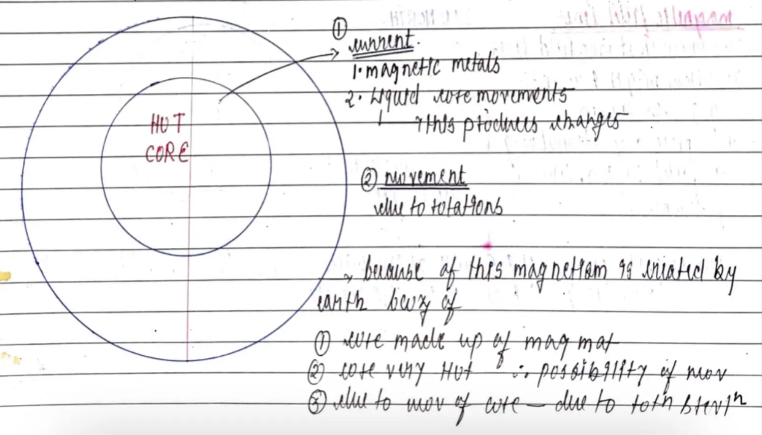
Reason
- Core of Magnetic Material
- Possibility of Internal Movement - Hot Core
- Movement of Core Itself - Rotation & Revolution
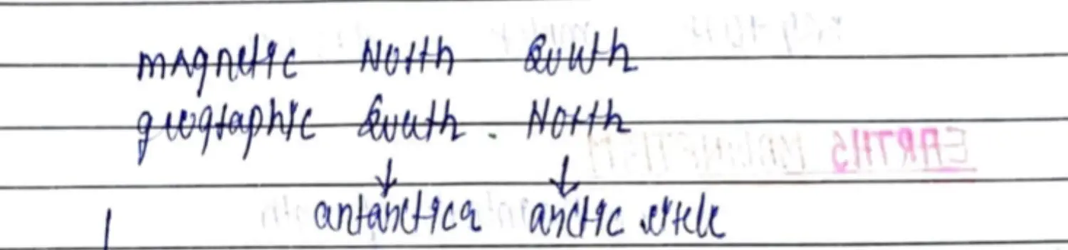
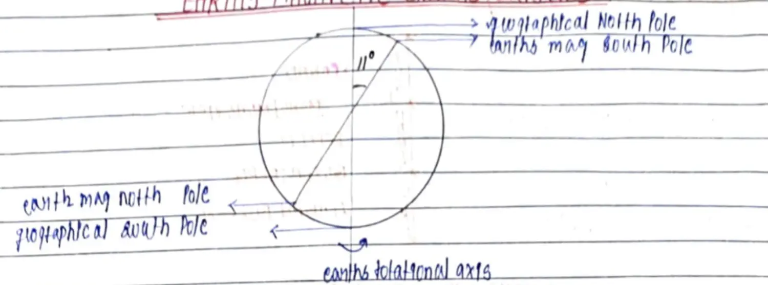
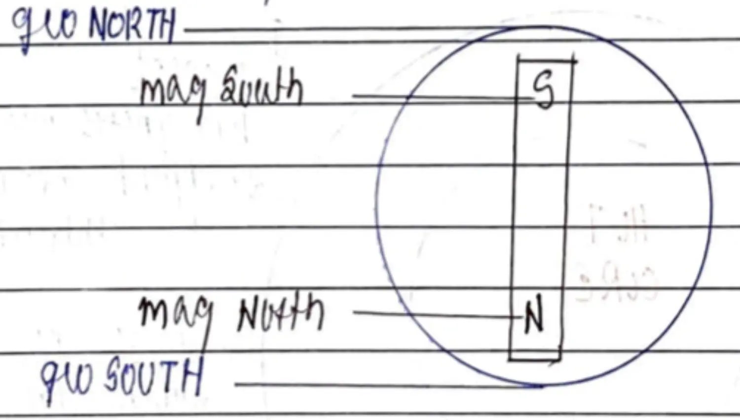
Magnetic & Geographic Pole
Diagram
Importance
- Repeals Charged Particles coming from Sun - Protection from Charged Particles
- Navigation - By Human
- Navigation by Organisms - Bio Magnetism
- Aurora Lights
Movement of Earth's Surface
Historical Background
- Copernicus - Earth Moves Around Sun
- Earth Movement Supported By - Abraham Odium & Antonio Pellegrini in 1596
- Movement of Continents Theory - Continental Drift Theory - By Alfred Wegner 1912 - Wanted to Understand : Paleo-Climatology
- In 1912, Initially in German Language - In 1924, Translated into English by a American Geographer
CDT - Continental Drift Theory / Displacement Hypothesis (Alfred Wegener)
How Theory was developed ?
- Why is there climatic variation in different continents in geological past of the world ? 🤔
- Expected Hotter - Tropical Region Colder - Temperate & Polar
BUT
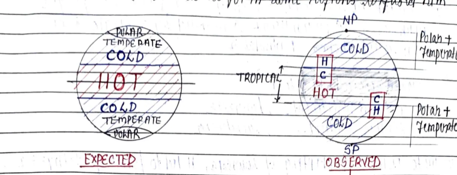
Guesses to Justify this
- Possibility 1 - Land Masses Must be Stationary, Climatic Zones Moving - Not This
- Climatic Zone : Equator, Temperate, Tropical
- Present Day Polar 🥶 = Tropical Climate 🥵 - Polar Must be Towards Sun in past
- Present Day Tropical 🥵 = Polar Climate 🥶 - Polar Must be Away from Sun in pas
- But no drastic Revolution and Rotation Occurred
- Possibility 2 - Land Masses Moving, Climatic Zone Stationary - We Study This
- Continents Must Have Shifted from their Original Position
Diagram
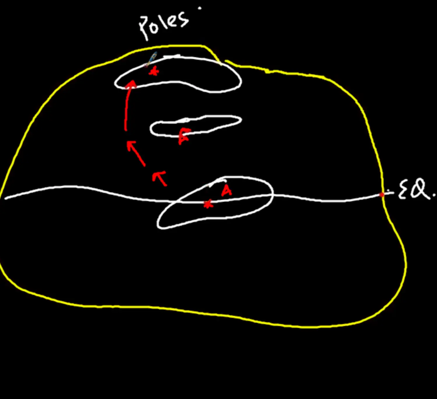
- Possibility 1 - Land Masses Must be Stationary, Climatic Zones Moving - Not This
Postulate PermTri JuraCret
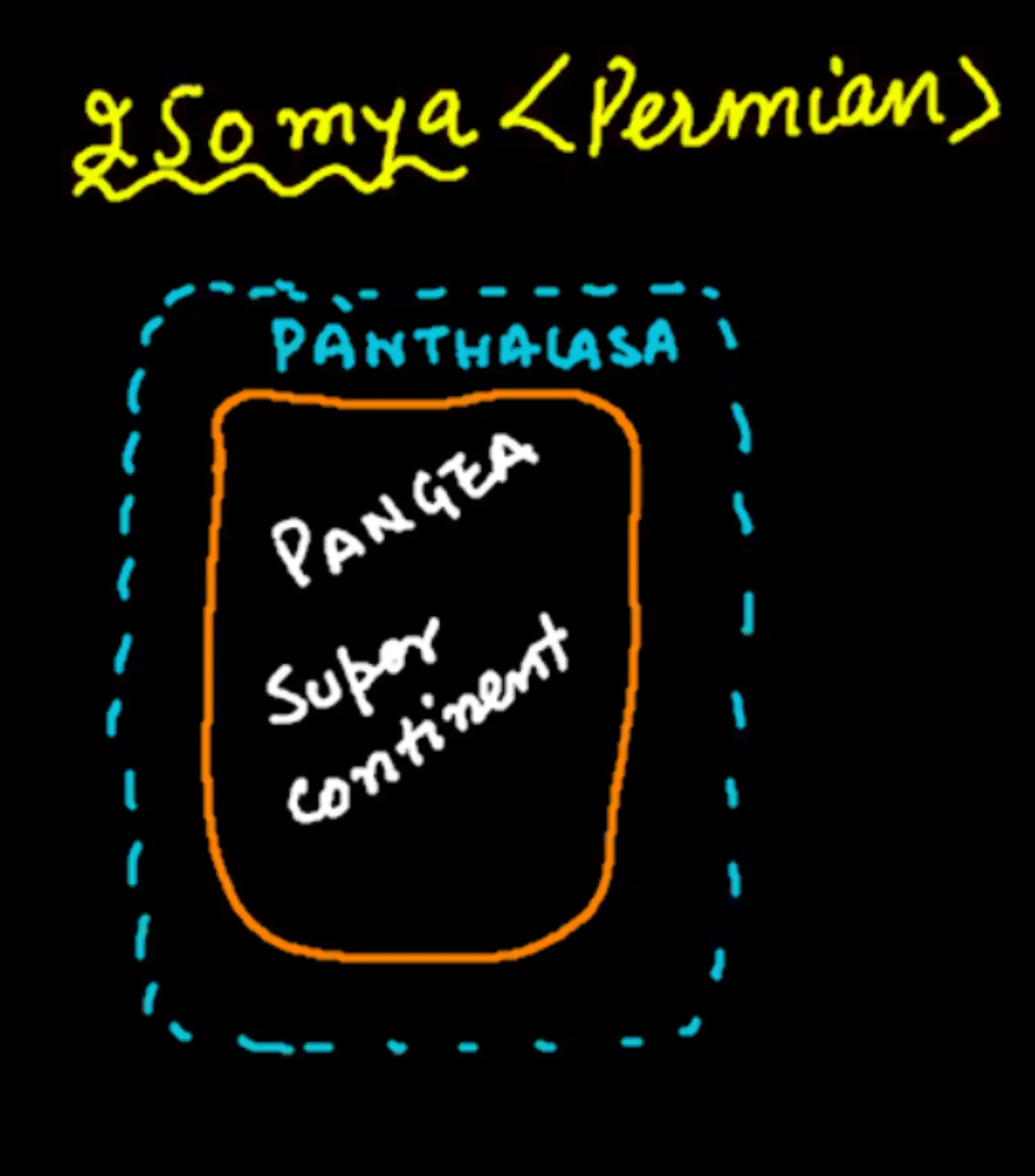
Permian Era - 250 MYBP
There Existed a Single Land Mass on Earth = Paengia or Super Continent
Surrounded by Paleo Water Body = Old Water Body Named Panthlasa
Diagram
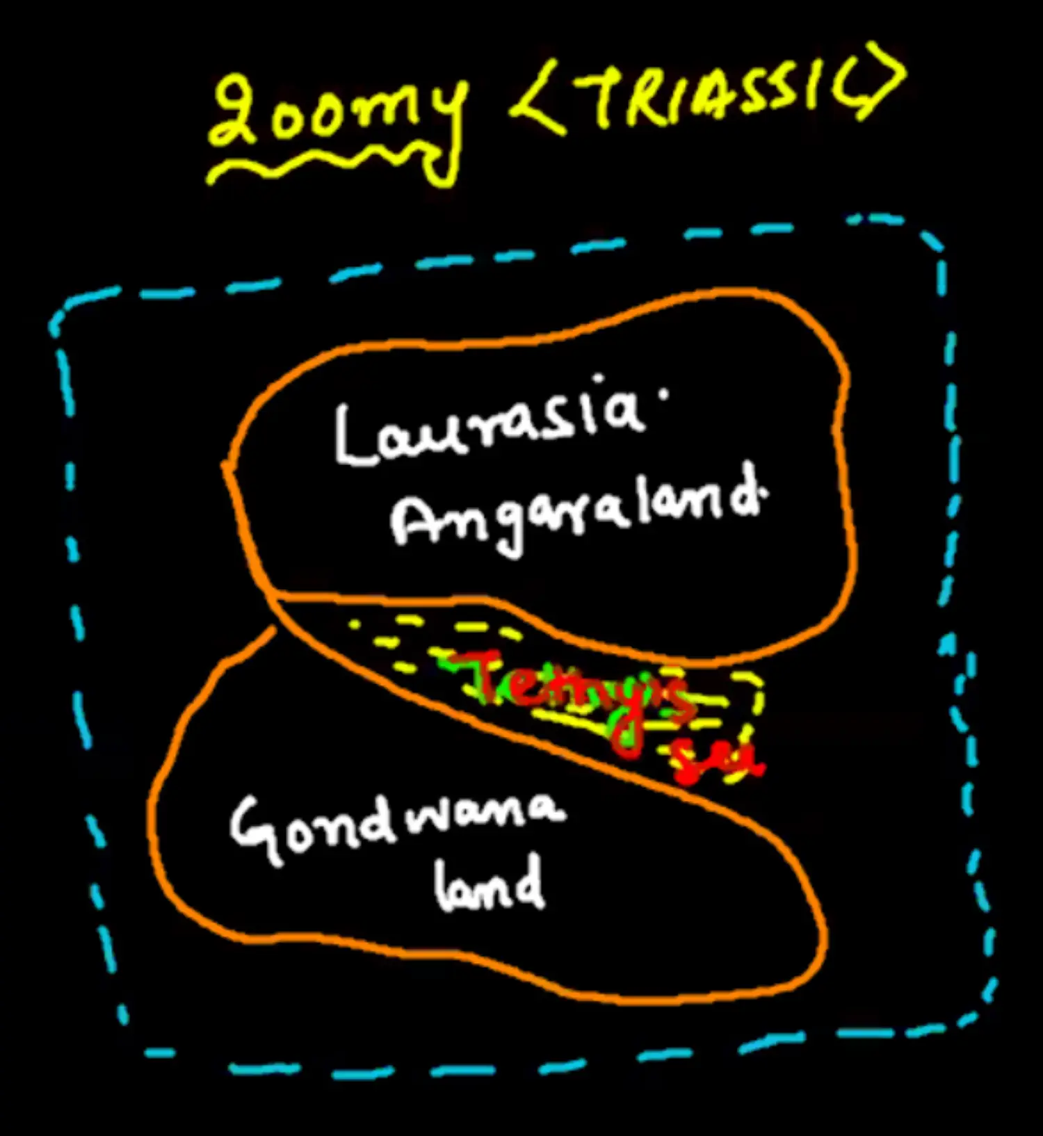
Triassic Era - 200 MYBP
Northern - Laurasia / Angara Land
Gap in Between - Water Rushed to Fill it = Tethes Sea (Narrow & shallow water body)
Southern - Gondwana Land
Diagram
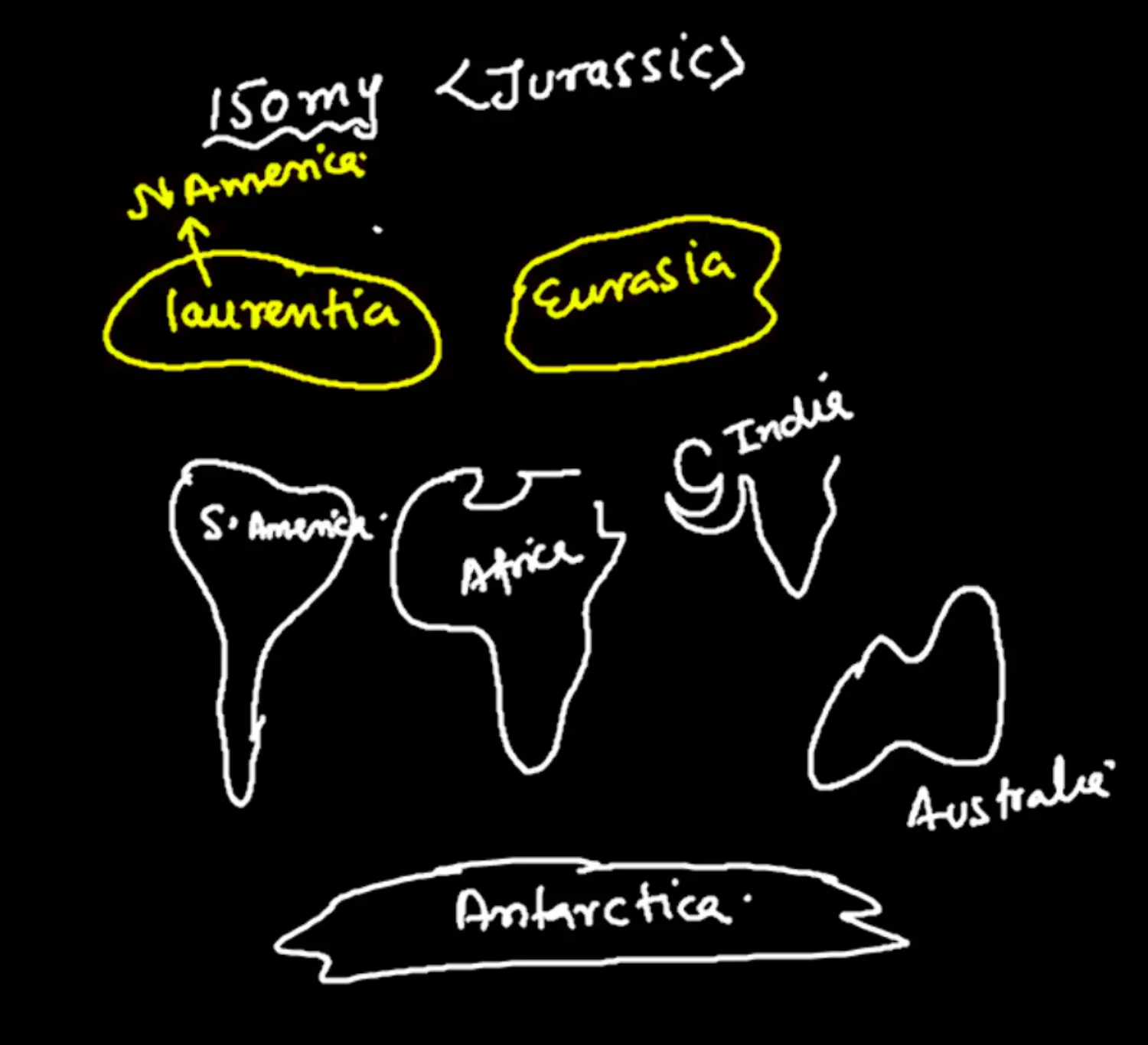
Jurassic Era - 150 MYBP
Laurasia
Laurentia
North America
Eurasia
- Europe
- Asia
Gondwana
- South America
- Africa
- India
- Australlia
- Antarctica
Diagram
Cretaceous Era - 65 MYBP
- All Continued Shifting North except Antarctica
- North & South America - Started Shifting Southward
Summarised (All 4 Era)
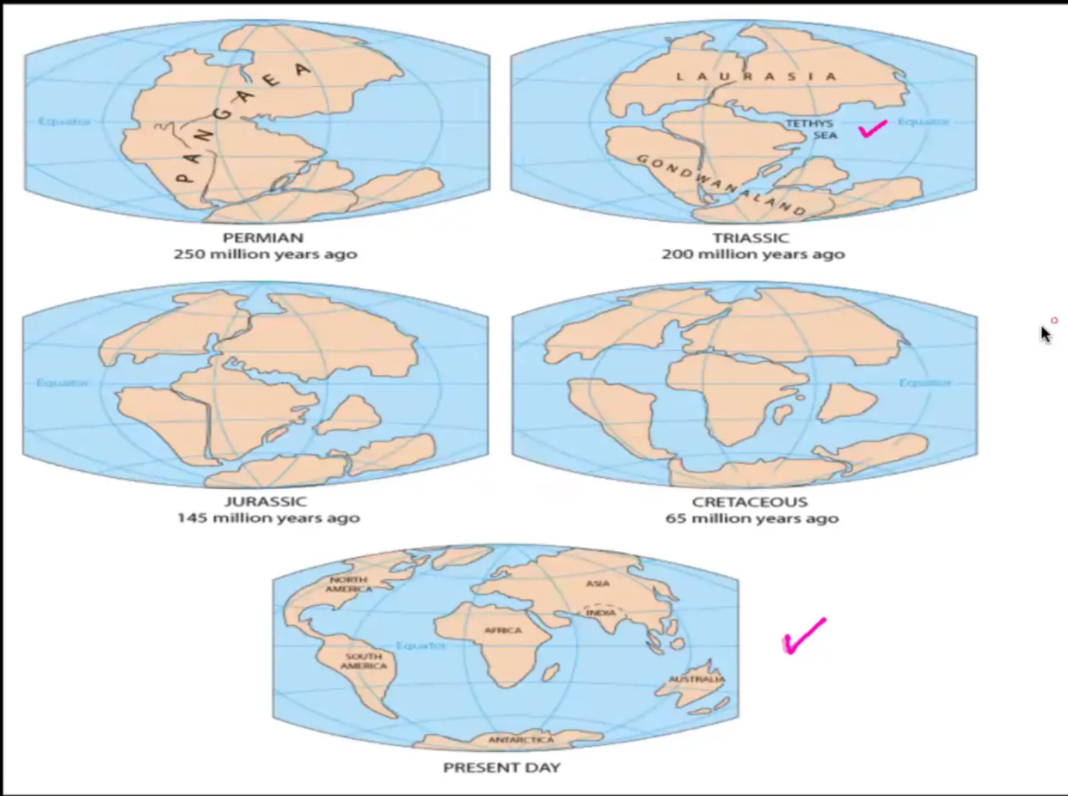
Evidence Given by Wegener
Proof 1 - Jig Saw Matching of Continents
- Propose : Opposite Sides of Continents fit like JigSaw Puzzle, Hence they must have been together at some point of time
- Ex 1 - Eastern Coast of South America - Wester Coast of Africa Near Gulf of Gini
- Ex 2 - North & West of Australia - to Bay of Bengal
- Ex 3 - Horn of Africa - Western India & Pakistan
- Object : Attempt to Match Present Coastline which might have changed due to Waves & Tides in 100MY
- RePropose : Bullard, 1964 - Made Map of Deep Ocean Coastline
- To Rule out Effect of Waves & Tides as no tides in Deep Ocean
- He Went as Deep as 1000 Fathom ; 1 Fathom = 1.82 Meter
- Propose : Opposite Sides of Continents fit like JigSaw Puzzle, Hence they must have been together at some point of time
Proof 2 - Similar Rocks on both Sides of Ocean
- Coastal Deposits(Rocks) From - Brazilian Coast && Western African Coast
- Were Similar - Physical Characteristics
- Hinting 2 Continents must have been together
- These Coastal Deposits had NO Marine Deposits - Hence There was no Sea in Between
Proof 3 - Placer(Gold) deposits on Coasts of Africa
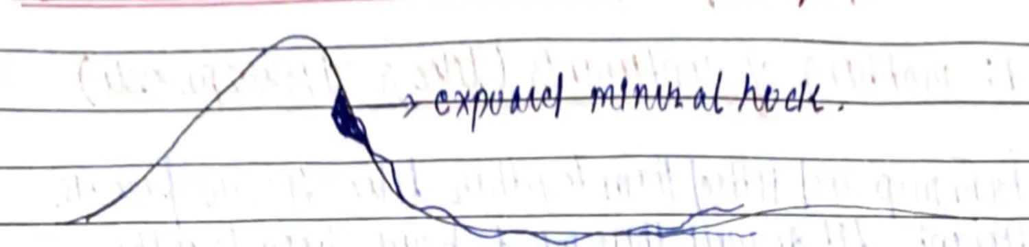
Gold Placers of Ghana - West Coast of Africa = Present in Brazil Plateau Region
Hence Hinting Past Togetherness of South America & Africa
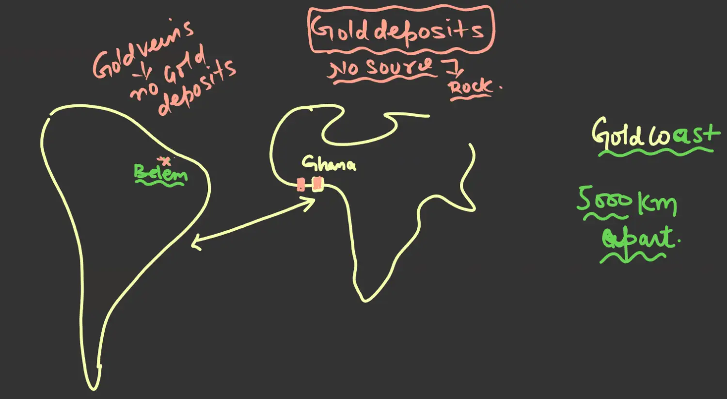
Proof 4 - Tillite Deposits / Paleo-Climatic Unity - 1
- South America (Brazil,Uruguay), Africa, Peninsular India, Australia - Tillites Found - Hence Glaciers were there
- Currently All these Places have Varying Climates - Hot & Cold
- In Past - In Pangea - All these regions would come under Polar Region of Pangea
- He also found Scratch Marks on Rocks, calling them Glacial marks, calling them Glacial Stratification - Paleo Climatic Unity
Proof 5 - Coal Deposits / Paleo-Climatic Unity - 2
- Coal Forming Swamps are Found in tropical and sub tropical environments, but ancient coal belts at present are found in location where it is very cold climate,
- Wagner suggested that when continents after drifting, reached the tropical climates and they stayed there over millions and thousand of years, the warm climatic tropical zones resulted in formation of coal
- later on they drifted to the new locations Ex North America Britain Etc
Proof 6 - Fossil & Botanical Evidence
- Collected Fossils of South America, Africa, Peninsular India, Australia, Antarctica
- If all continents are put as per Pangea Logic, then fossil distribution show a clear pattern across continent
- Hence he Proposed that they lived side by side but moved away when they dies and were fossilised
- Glossopteris
- Fern Seed Bearing, Woody Hence Heavy
- Can Grow only in Temperate (Cold) but is Found in Tropical (Hot) Now
- Heavy Hence, Wind cannot take it this far
- But it is Found in Afghanistan and Persia too (Glossopteris)
- Mesosars
- Swimming Reptile of Fresh Water
- Found in Africa & SA
- Couldn't swim across ocean
- Hence Continents were together
- Cynognathus, Lystrosaurus & Lemurs
- They are Land Reptiles, Cannot Swim
- But Found on Coasts of Africa & SA
Proof 7 - PaleoMagentism
Causes of Drifting of Continents by Wegener
He Talked ONLY about 2 Movements
- Northward - Polar Fleeing Force
When Earth Spins/Revolves - Continents Slide on Earth Surface, so as to Move Outwards
Considered Pangea at South Pole
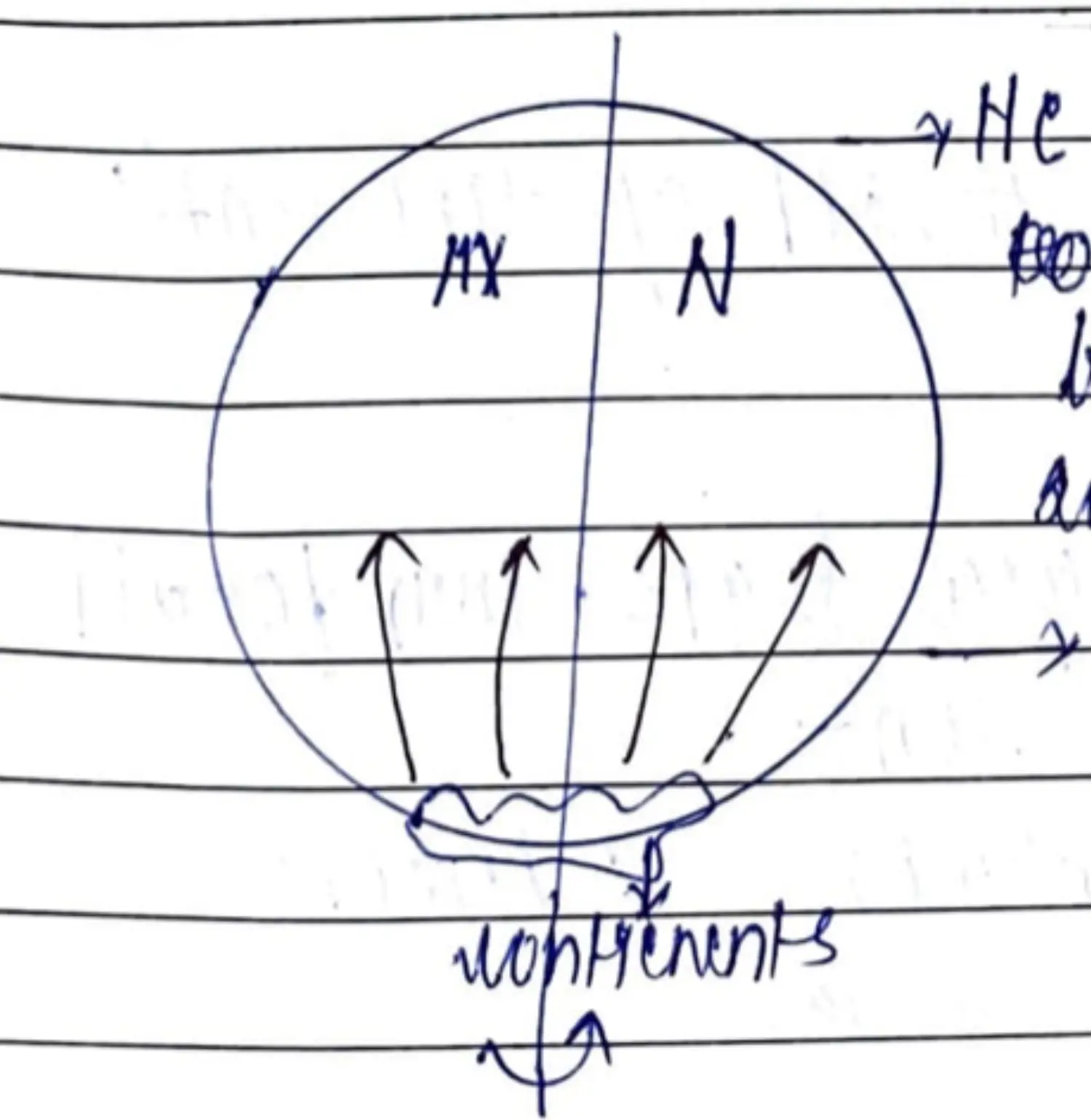
this force is not sufficient enough ot move the continent's, let alone drifting
- Southward - Tidal Force
- Tides are Created due to Gravity of Moon
- Earth Rotates - West to East Bulge Occurs - East to West
- This Tidal Bulge - Causes Westward Movement
- Criticism - This Tidal Force would need to be 10,000 million times as it is today. if it had such kind of value it would stop earths rotation in a year. but earth is still rotating and revolving
- Northward - Polar Fleeing Force
Weakness of Wegener’s Theory
- No Talk About Period Before 250 MYBP
- Only Talked of North & West Movements, thought Drift was East & West too
- Reason for Movement was wrong
- Continents Do Not Slide / Float Over Ocean - SiAl SiMa Self Contradicting Debate
- Didn't talk about Ocean Floor but they move
Contribution of Wegener’s Theory
Despite of several criticism credit should be given to Wegener because
- First Person to give theory about Movement of Continent, His Observation & Evidences were correct
- His weaknesses became point for further researches
- He dies in GreenLand in 1930 working on his theory ; spent his life proving his theory
For Continent - Mantle Convection Theory (Arthur Holmes)
- Not Visible by Naked Eyes - 5/7cm Per Year
- Only Heat Transfer mechanism where ENERGY & MATTER moves together
- Reasons for Convection - Residual Heat of Formation of Earth & Radioactive Element in Mantle
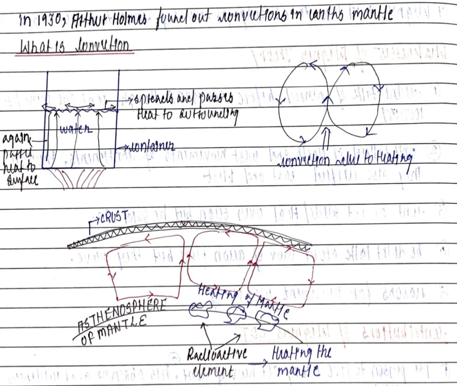
- Types of Plumes - ENERGY
- Vertical Plume - Ascending - Hot
- Lateral Plume - Looses Energy
- Descending Plume - Descending - Cool
- Movement of Matter - MATTER
- Lighter Element - Goes Up
- Intermediate - Stays in Between
- Heavier Element - Moves Down
- Leads to
- Convergence - Compression Force - Lithosphere Comes Close
- Divergence - Tensional Force - Lithosphere Goes Away
Contribution - Gave Scholars option to Disregard Wegener’s Logic of Movements & Probe Further Studies
For Ocean - Sea Floor Observation (Ocean Floor Mapping Expedition)
Before Second World War - Earlier we used to think that Sea Floors are Featureless Surfaces
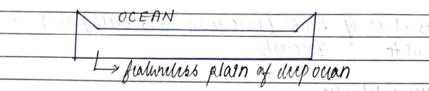
After Second World War - Various Features of Sea Floor was found Ocean Floor Mapping Expedition in search of sunken ships
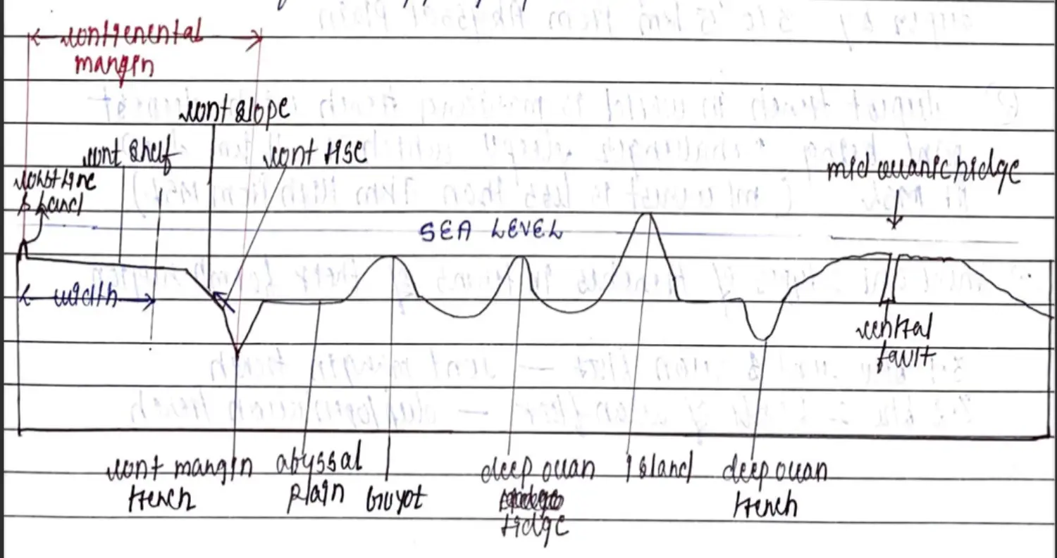
Continental Shelf
- Gentle Slope (<1DC) & Depth 30M-60M & Width 80Km - 1500 KM
Continental Slope
- Slope (2to5 DC) & Depth 3000M
Continental Rise
- Region in Deep Ocean where continent begins to rise
Trench
Vertically Deep - 3to5 KM from Abyssal Plain
Deepest Part of Ocean - Abyssal Plain - Ocean Bottom Deepest Part of Ocean Bottom - Trench
Deepest Part of Trench - Trench Deep
Mariana Trench Challenger Deep 11 KM
Abyssal Plane / Deep Sea Plane
- Flattest & Smoothest - Like Plain in Ocean Deep
- Avg Depth 3000 Mts-6000Mts from MSL
Ridges / Sea Mount
- Like Mt Peaks in Ocean - 3000-5000 M from Ocean Floor but not above Sea
Guyots
- Flat Topped Sea Mount due to Wave & Water Current - BUT Below Sea Level
Islands
- Like Ridges above Sea Level
- Formed Due to - Volcanic / Coral Activity
MOR - Mid Oceanic Ridges
- Gentle Sloping, Tectonic Volcanically Formed with Central Fault
- Total Length of MOR 65000 KM & Avg Height 2500 KM
Sea Floor Spreading Theory (Henry Hens)
Observation
There is Continuous Volcanic Activity along Central Fault of MOR → Magma Makes Rocks
Move Away from Central Fault → Age of Rocks Increases → Oldest Near Trenches
Rocks on Both Sides @ Equal Distance - Same Age, Composition & Other Properties
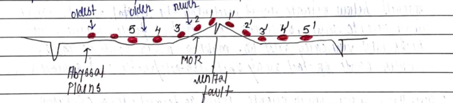
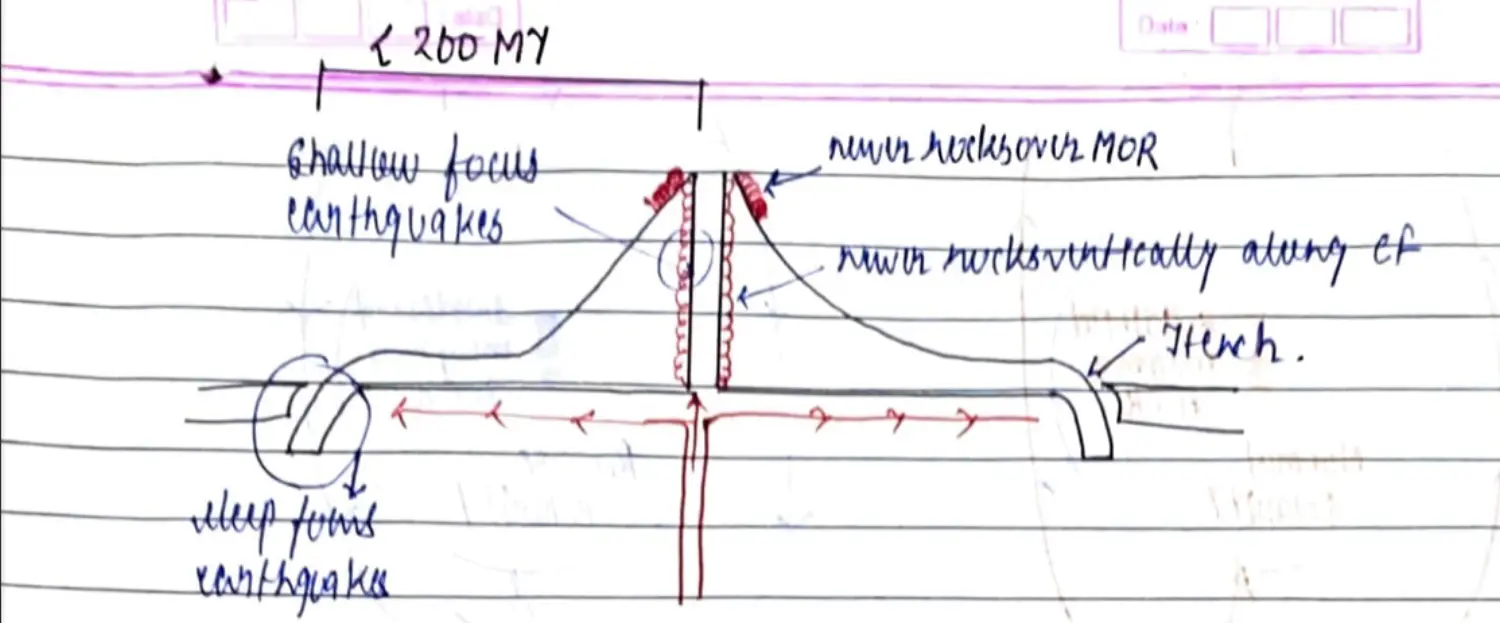
Ocean - 400 MY Old but Oldest Rock 200 MY Old
Volcanic Activity
- Central Fault - Shallow EQ - < 70 Km
- Trenches - Deep Focus EQ - > 300 KM
Explanation in Mind - Vineet Sir’s Video
Magma to CF from MOR
New Rocked Formed at MOR
Magma that doesn't come out, Spreads below to carry away Oceanic Crust this Widening CF ay MOR
Spreads upto Trenches and then Subduct to Asthenosphere
Because of this Compression & Tension EQ Formed at CF & Trench
Magnetic Reversal Observation - Became Proof of SFST
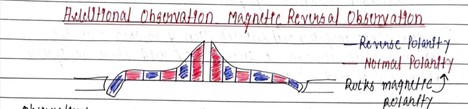
Parallel Strips of Rocks - Normal & Reversal Polarity
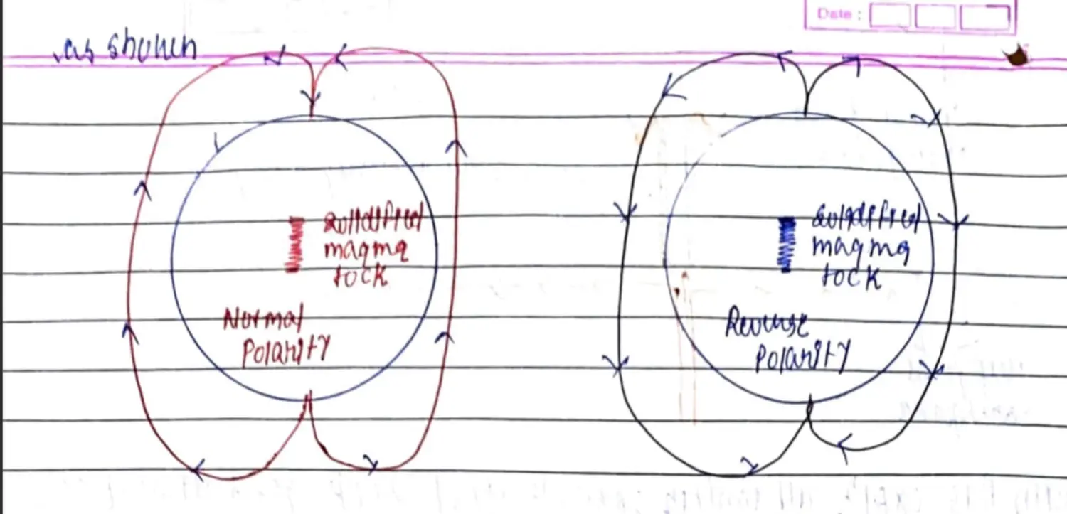
Weakness
- No Talk about Continents & its Mov
- No Talk About Formation of Ridges, Islands & Cont Margins
Contribution
- First Theory to Explain Sea Floor Related Observation, Formation and Movement
SFST Summarised
- Sea Floor is Youngest Near Ridge
- Sediments Thicken away from Ridge
- Volcanic Rocks & Lava is Youngest near MOR
- Age of Sea Floor Increases away from Ridge
Paleo Magnetism (Von & Matthew)
Plate Tectonics Theory (Wilson)
Background
- By McKenzie, Parker, Morgan & Wilson
- PTT = CDT, MCT, SFST
- Parts
- Kinematic - Movement & Interaction of Plates
- Geometric - Measurement & System of Plates
Plate
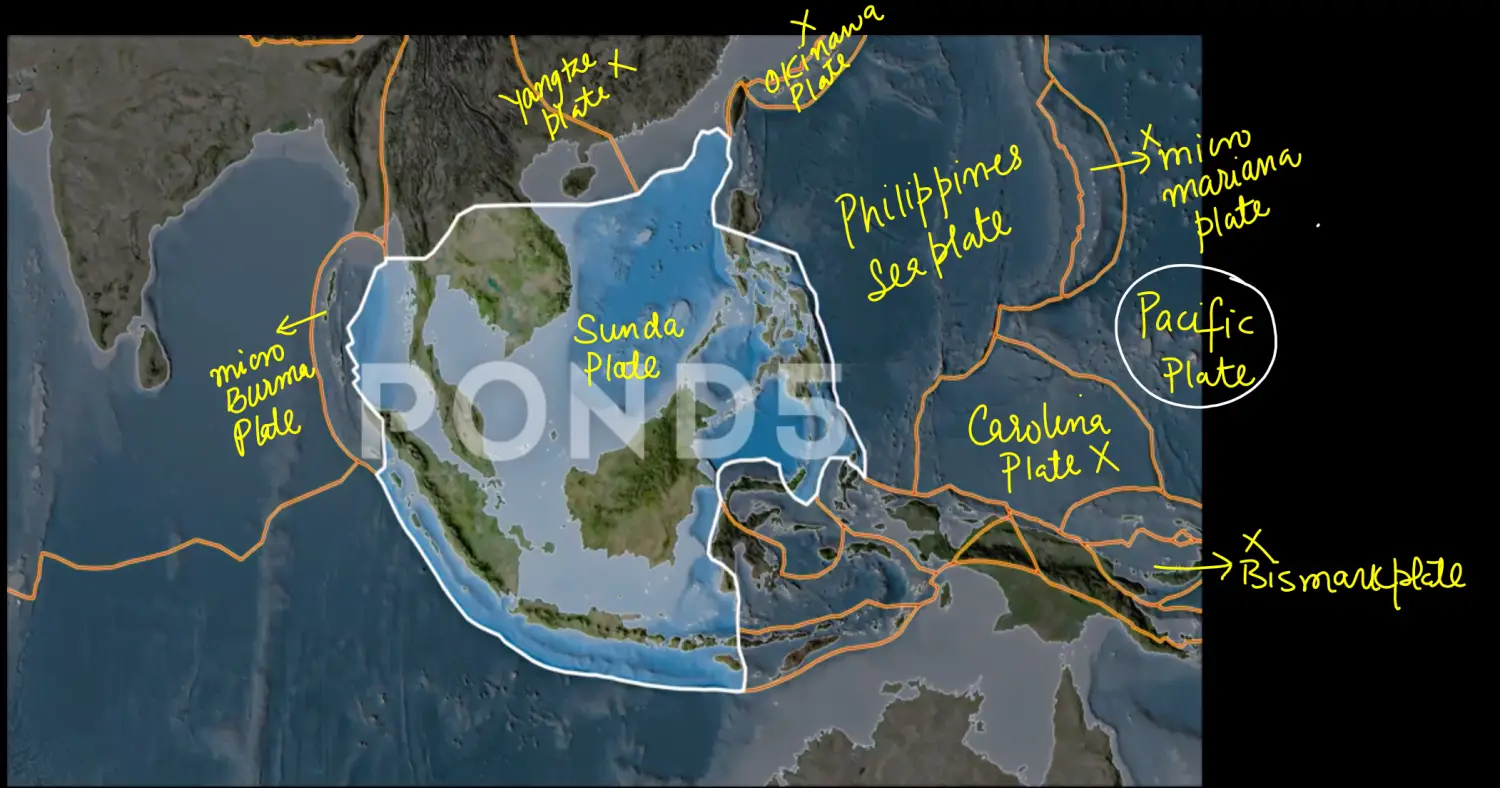
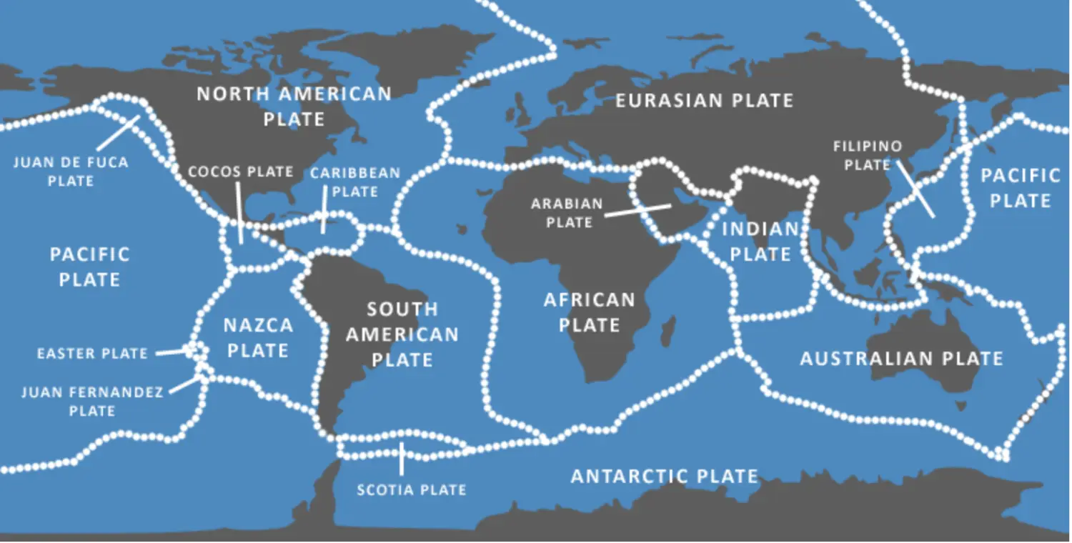
Earths Lithosphere is Cracked in to Pieces - Some Big & Some Small
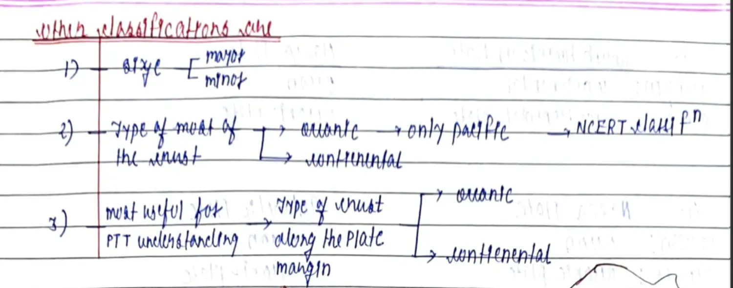
On the Basis of Size (Total 15) + Presence on (Continent + Oceanic)
Major Plates (TSA > 20 M Sq Km) (@ 6 Major Plates) (Only Continental, Only Oceanic, Combination of Both)
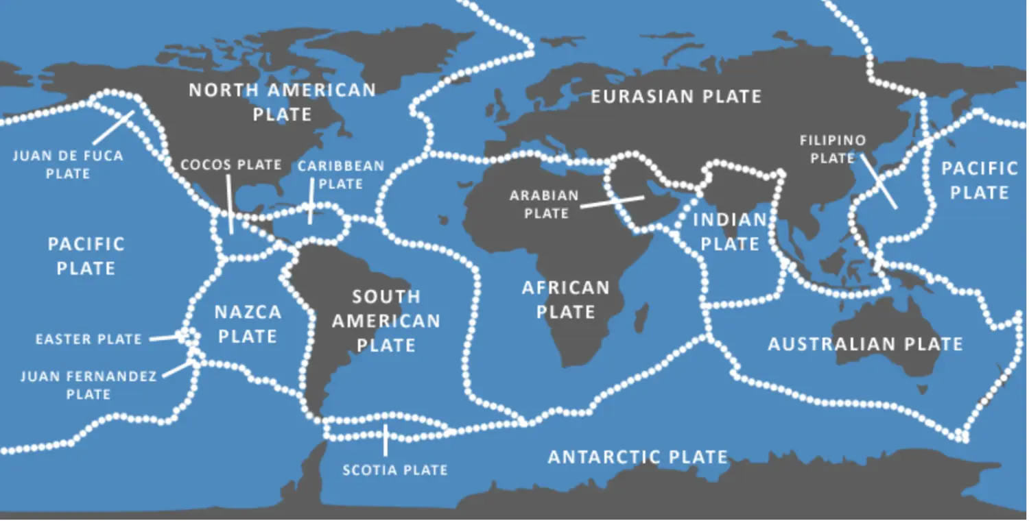
- Pacific Plate - Only Completely Oceanic
- American Plate - North America + South America - Both Con & Oceanic
- Eurasian Plate - Europe + Asia - Both Con & Oceanic
- African Plate - Both Con & Oceanic
- Antarctic Plate - Both Con & Oceanic
- Indo Australian Plate - Both Con & Oceanic
Minor Plates (1 M Sq Km < TSA < 20 M Sq Km) @ 9 Minor Plates
- Juan De Foca Plate - Map
- Cocos Plate - Map
- Carribean Plate - Map
- Nazca Plate - Map
- Scotia Plate - Map - Not so Imp
- Arabian Plate - Map
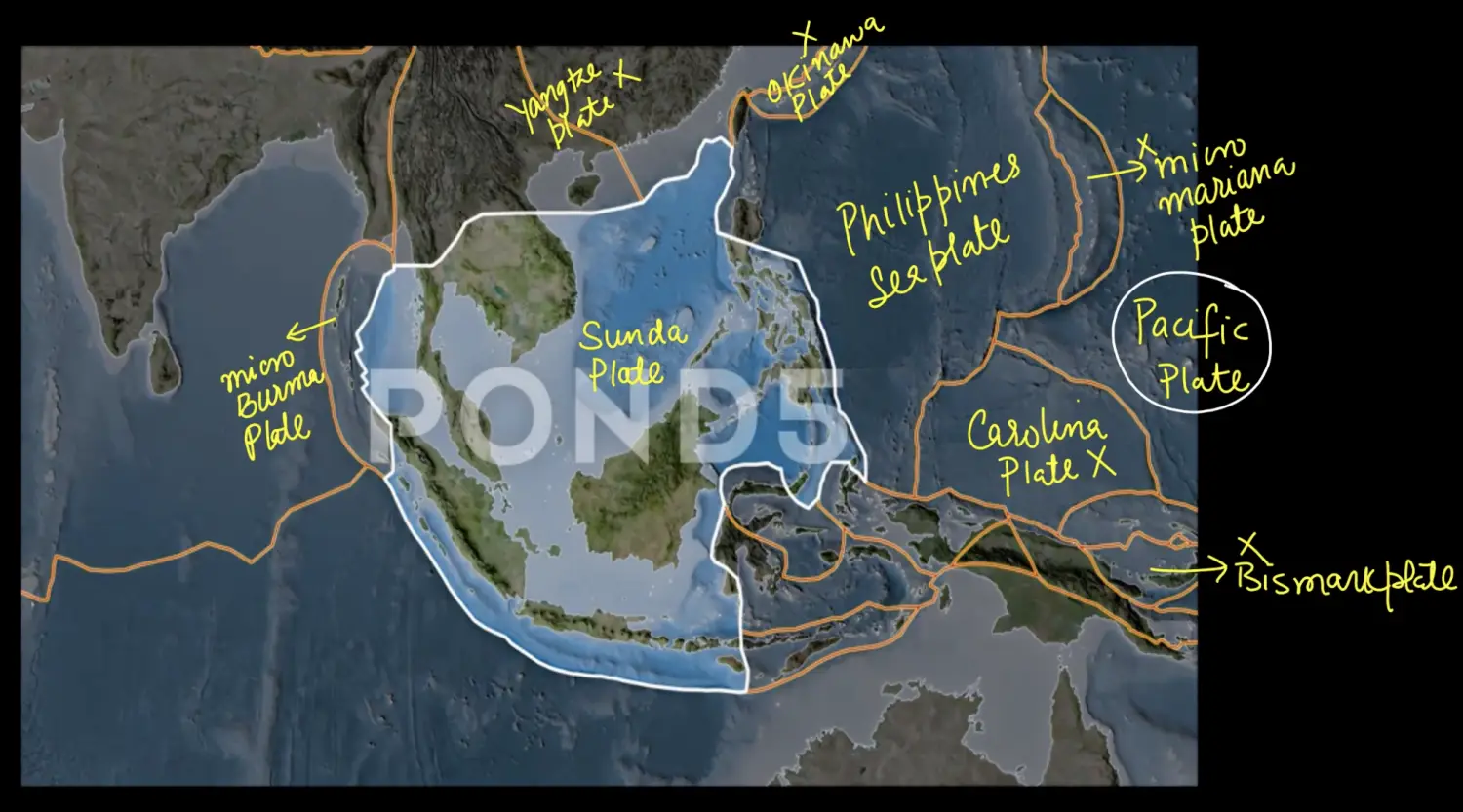
- Philippines Sea Plate - Map
- Fuji Plate - Map
- Caroline Plate - Map
- Bismarck Plate - No Map
- Sunda Plate - No Map
- Micro Burma Plate - No Map
- Initially People Thought Sunda is South East Asian Extension of Eurasia, but Sunda was seen moving, Now 2 conclusions
- Also Believed that Micro Burma was a Part of Sunda
Old Classification
- Primary - Major Plate (TSA > 20 M Sq Km)
- Secondary - Minor Plate (1 M Sq Km < TSA < 20 M Sq Km)
- Tertiary - Micro Plate (TSA < 1 M Sq Km)
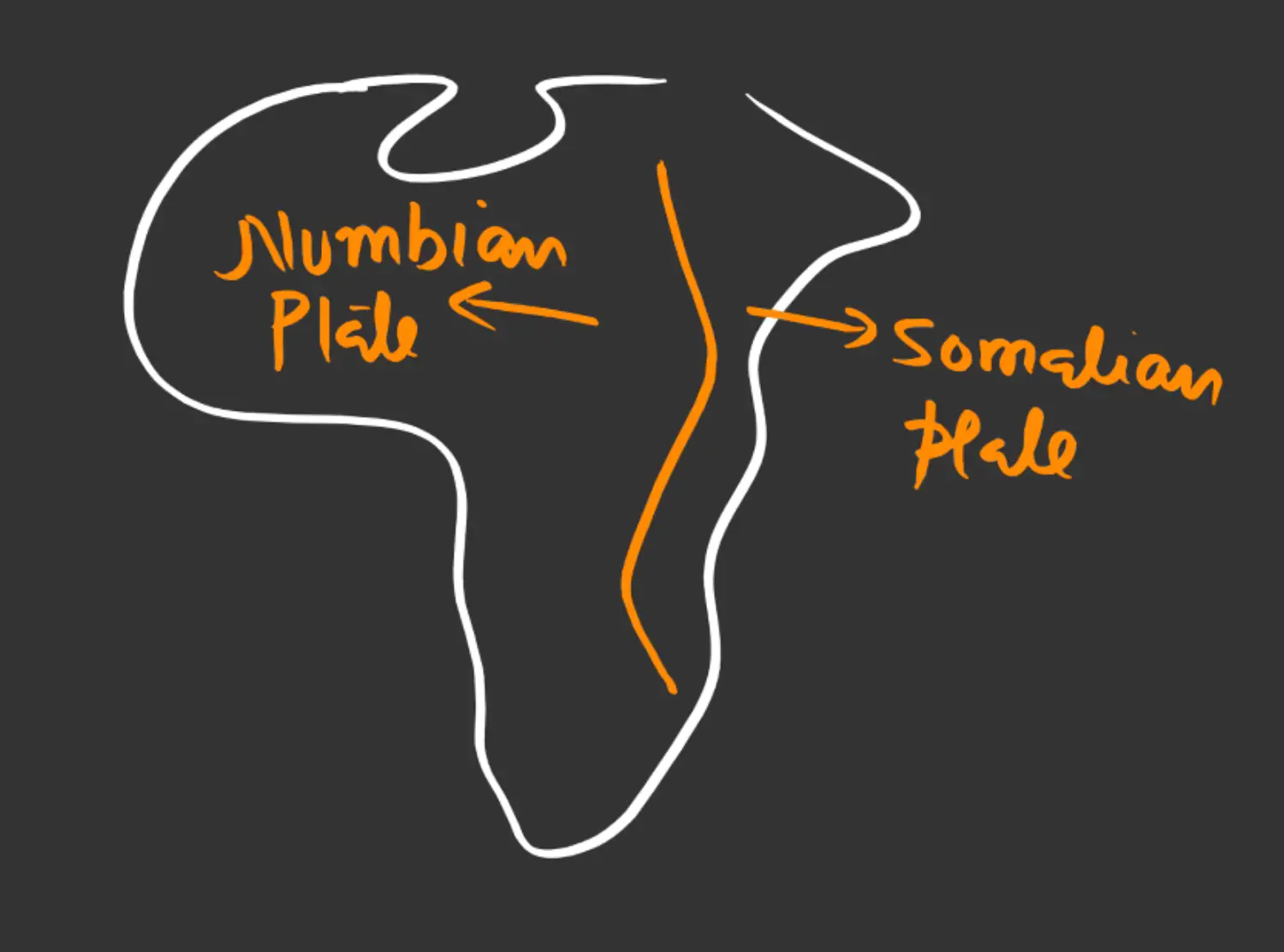
Any Big Plate →? Broken → Minor →Broken →Micro
Example - Numbian and Somalian Plate
On the Basis of Most of Crust - From Diagram
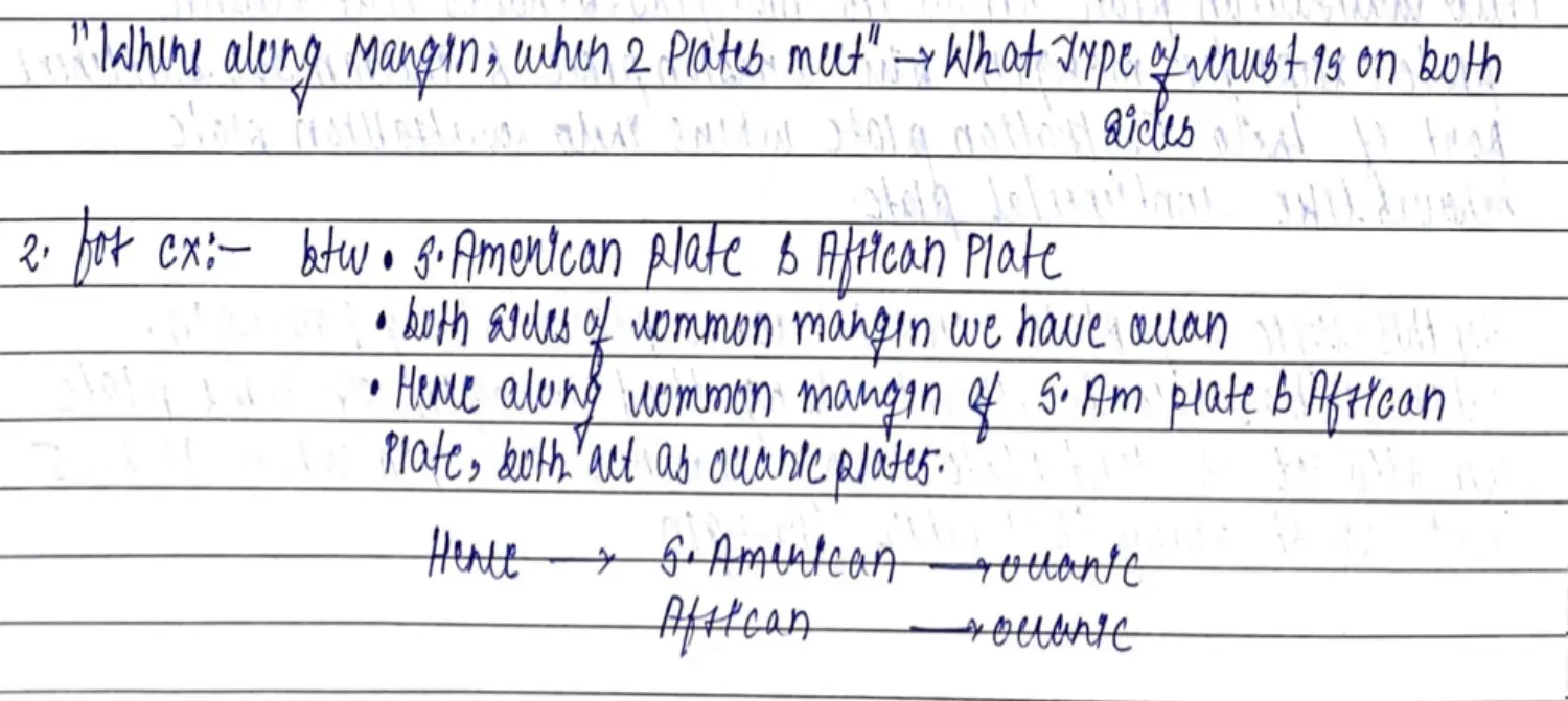
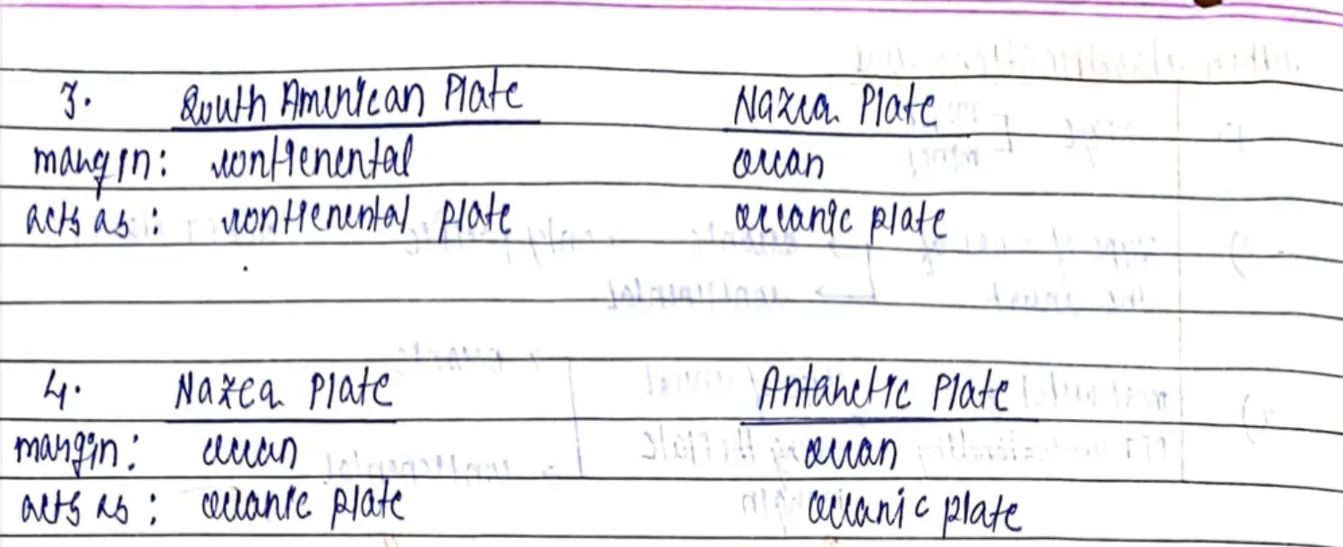
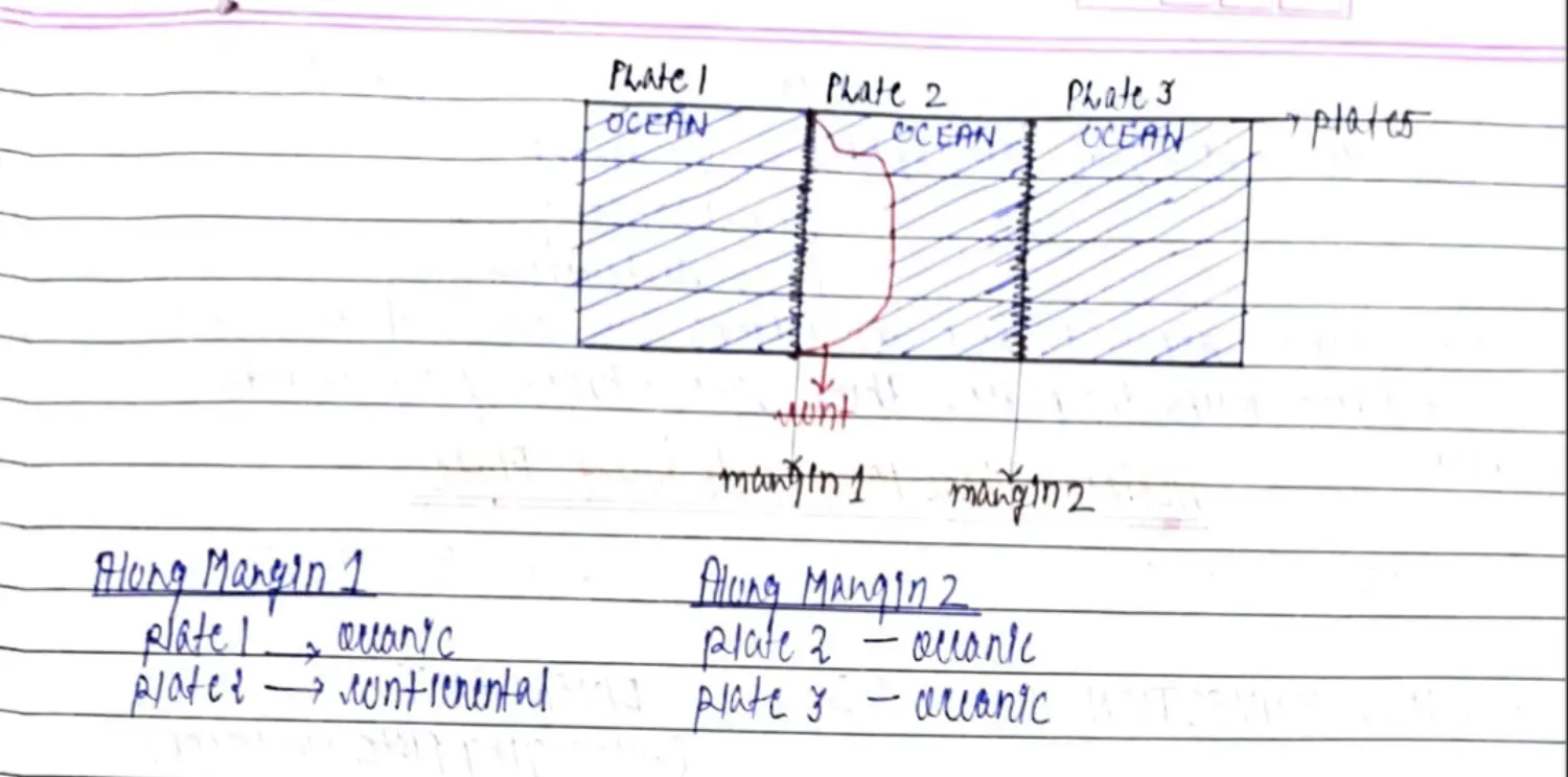
On the Basis of Type of Crust Along Plate Margin
Sides & Corners of Plate - Plate Margin
Example
- SA - Nazca/Antarctica
- Indo Australian - Eurasian
Tectonic
- Literal Meaning
- Means - Construction and Destruction - To Make
- Plate Tectonic - Making of Plates
- Concept
Lithosphere = Crust + Rocky Part of Mantle
Asthenosphere = Weak Solid Region of Mantle in Lava State - Having continuous convections (MCT)
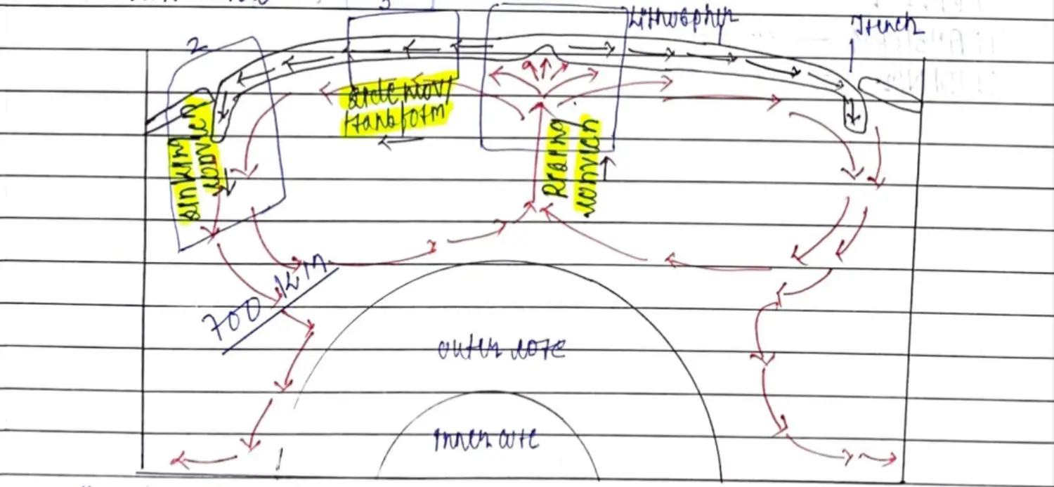
Asthenosphere - 500 KM Deep Convection - 700 KM Deep
Convections + Building & Destruction of Lithosphere
- Literal Meaning
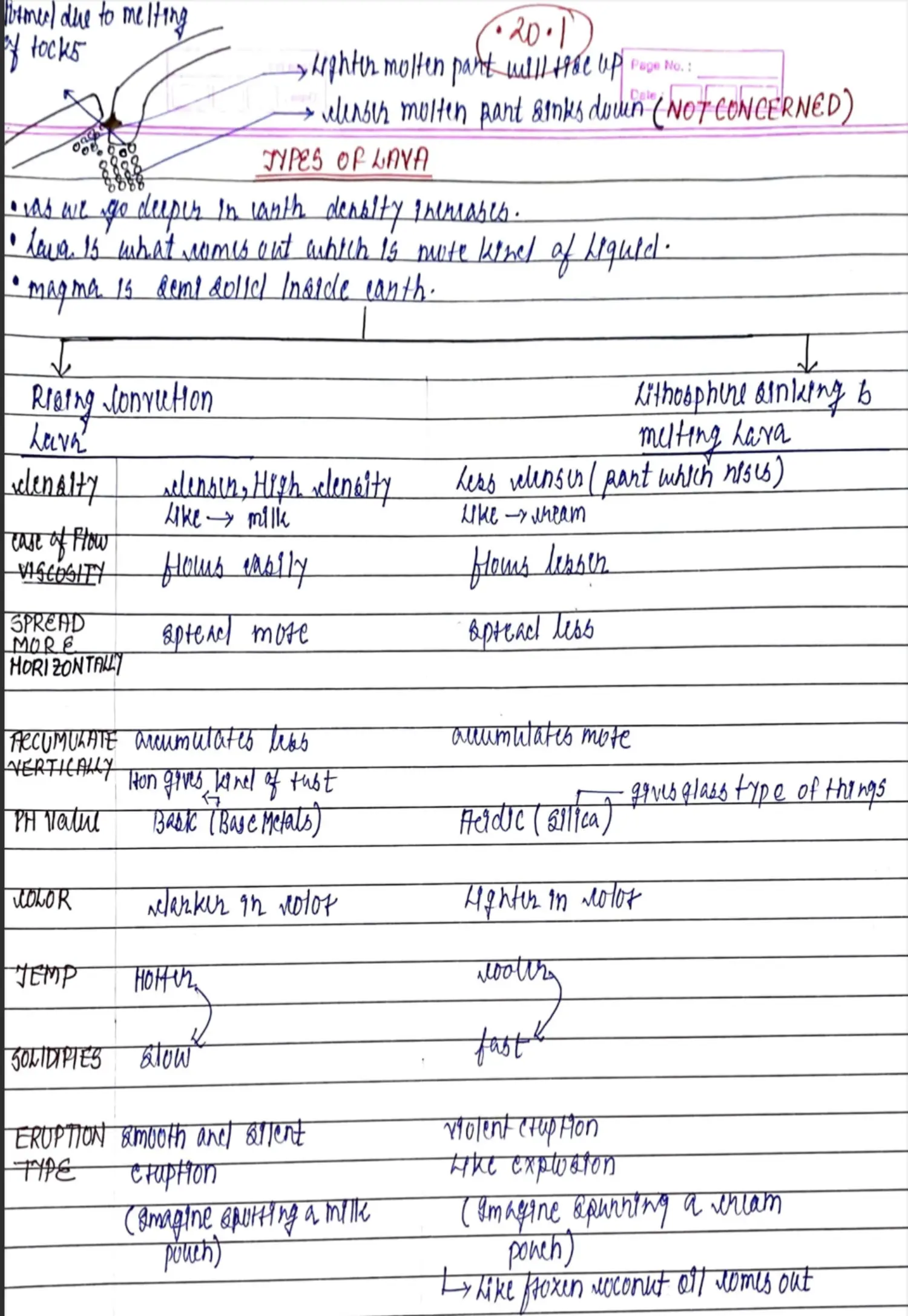
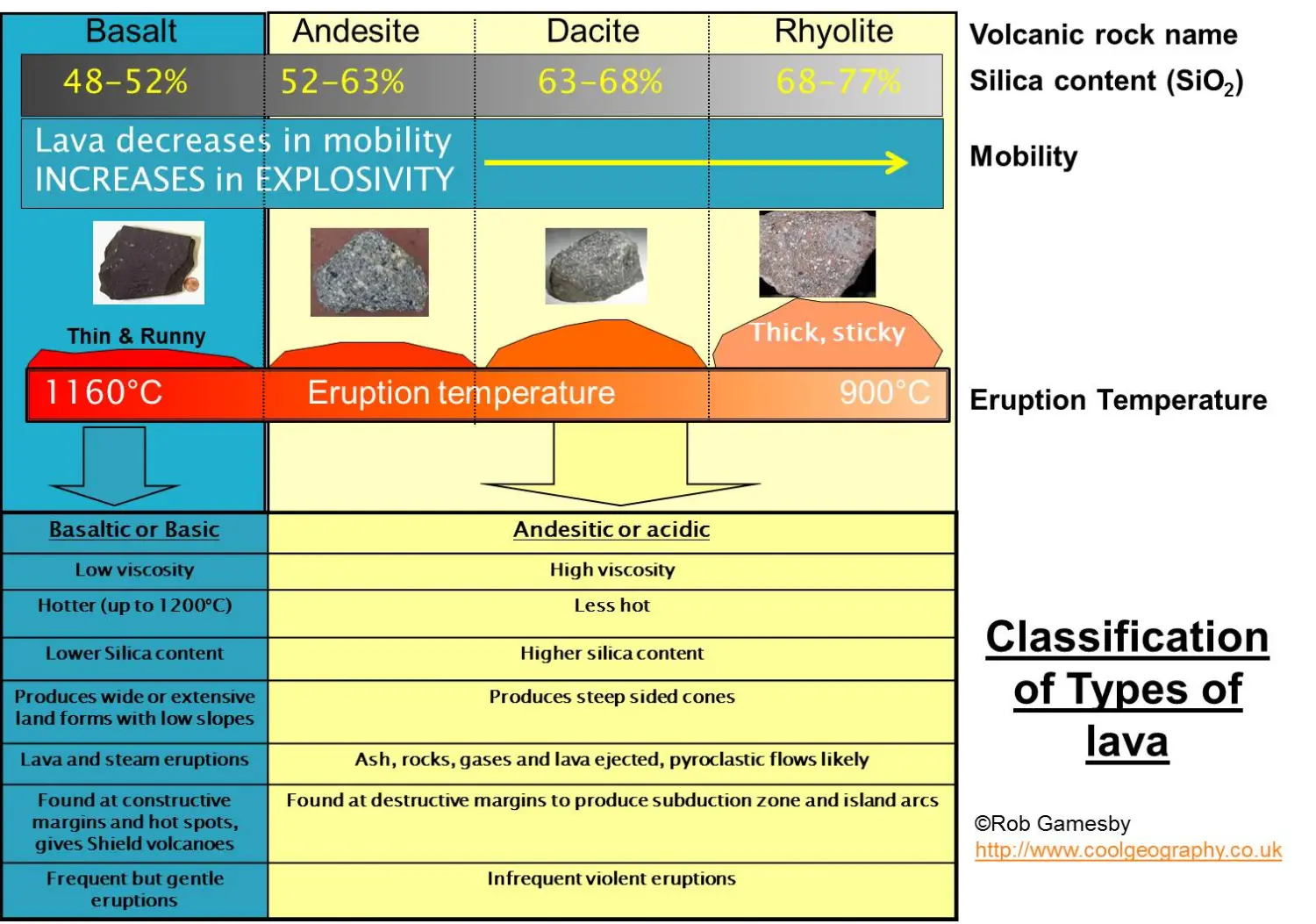
Types of Lava
Difference Between CDT & PTT
Types of Forces Causing Geomorphic Processes
Endogenic & Exogenic Forces continuously work bringing Change(Morph) on Earth(Geo). Hence Exogenic & Endogenic Forces are Together Called Geomorphic Processes
Endogenic Forces - Make Less UnEven - Residual Heat
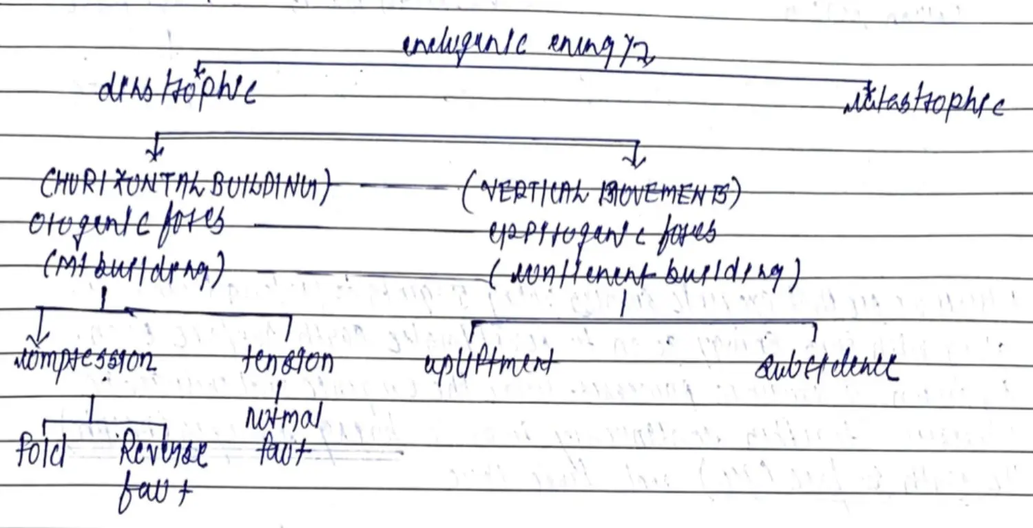
Slow Plate Movements / Diastrophic (PTT)
- Orogenic Forces - Mountain Building - Compression (Fold&RF) & Tension (Fault)
- Epeirogenic Forces - Continent Building - Subsidence & Upliftment
- Theory - Inter-plate Activities
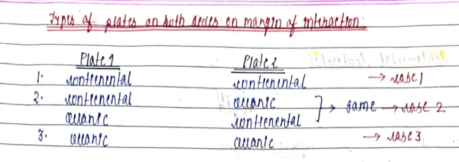
Interaction Between Plates

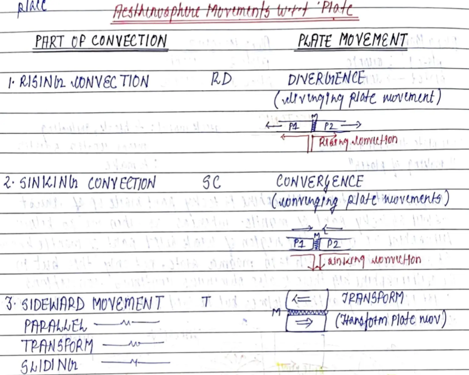
DIVERGENCE - Divergent Plate Movement - Constructive Boundary - Rising Convection
Con - Con (7)
Fault - General Crack
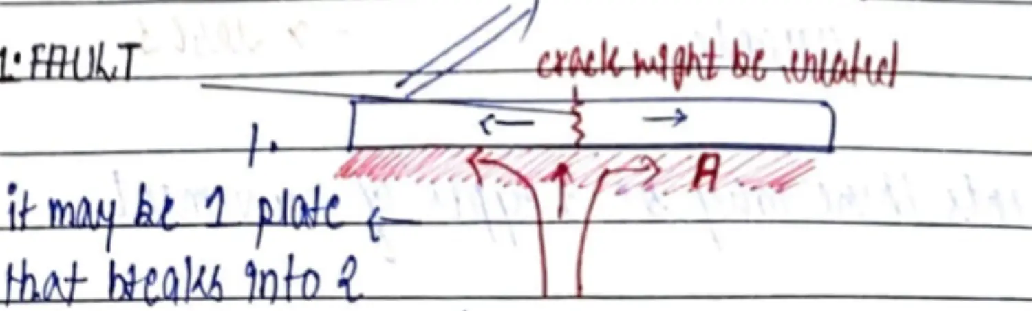
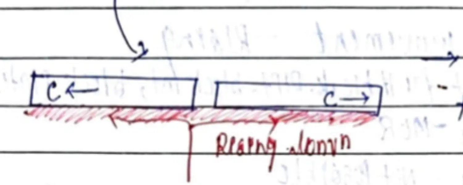
Blocks
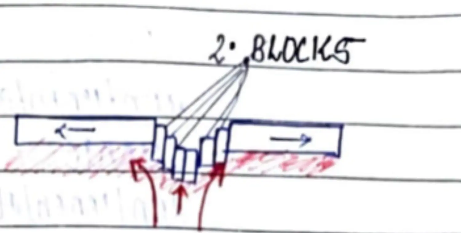
- Depth - 100/200 KM Width - 5/15 KM Length - 100/1000 of KM
- Difference Between Each Block - 1-3 KM Depth
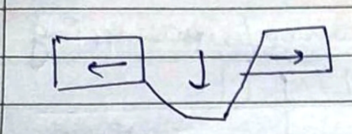
💡 Fault+Block = Rift Valley + Block Mt + Block PlateauRift Valley (Independent)
Formation
- Formed Due to Formation of Faults & Movement of Blocks - Such Depression is called Rift Valley
- Few KM Deep, 10’s KM Wide, 100’s KM Long
Example
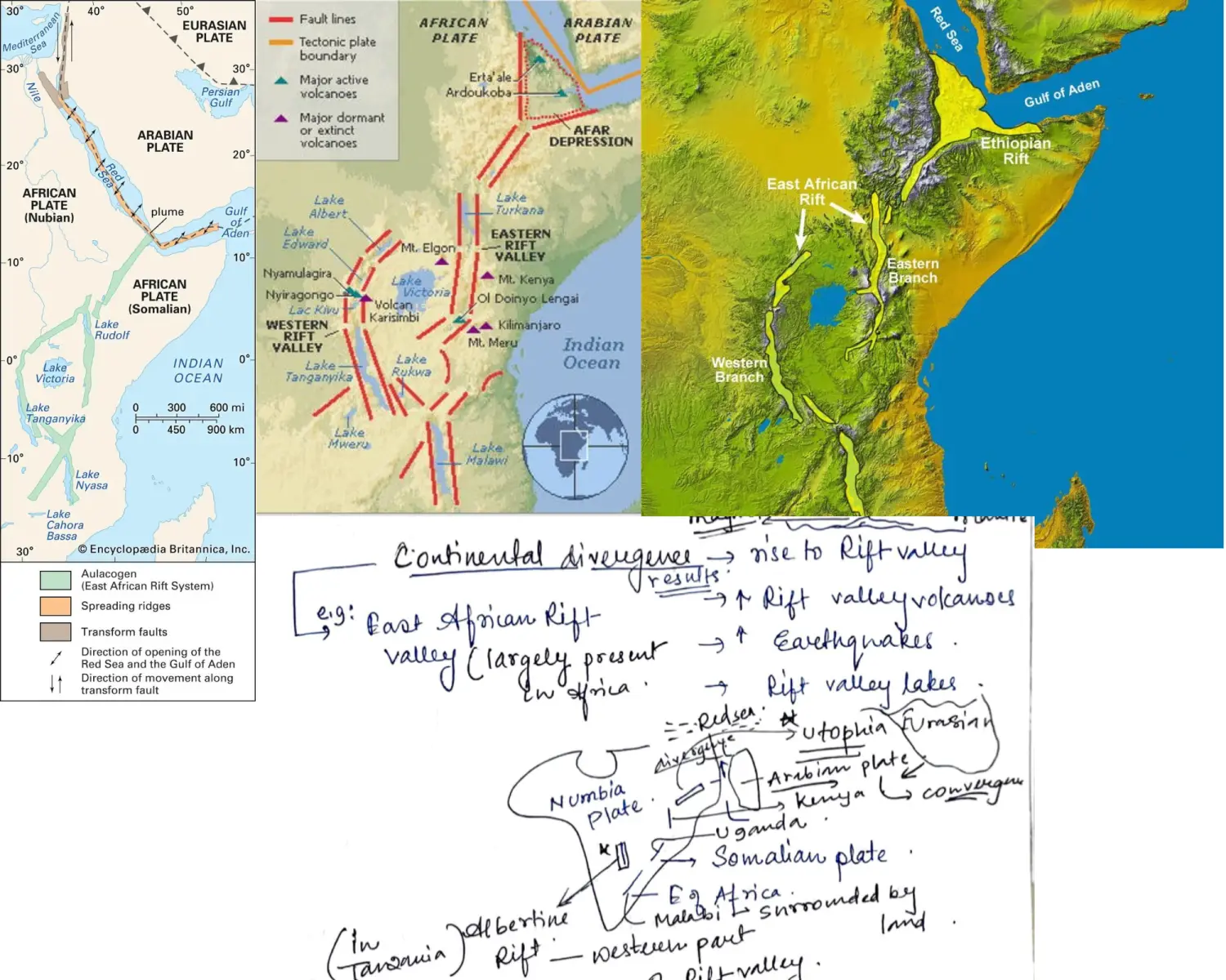
- East African Rift Valley - Gregory Rift
- Western Branch of Rift Valley - Albertine Rift
- Afar Depression 3 Plates (Arabian, Nubian, Somalian) - Max EQ
- Red Sea & Gulf of Aden - Drainage
- Passes Through - Ethiopia, Kenya, Mozambique, Uganda, Rwanda, Burundi, Zambia, Tanzania
- Largest Seismically Active Rift System on Earth
- EAR made Kilimanjaro but now not in EAR (Africa Highest Peak, Snow Capped,
Rift Valleys (Between Block Mountains)
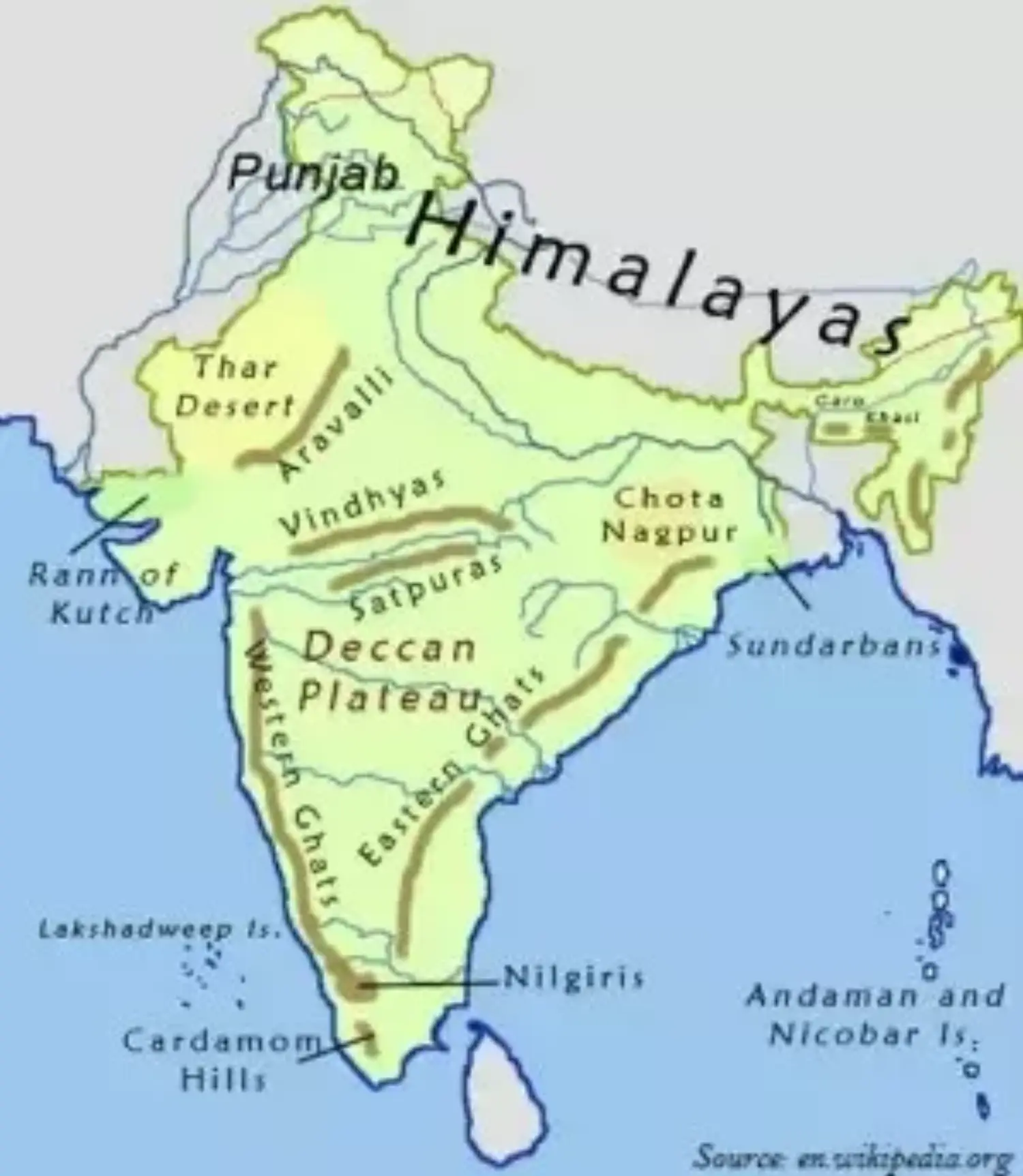
India - Vindhya & Satpura Range - Narmada & Tapi in Between
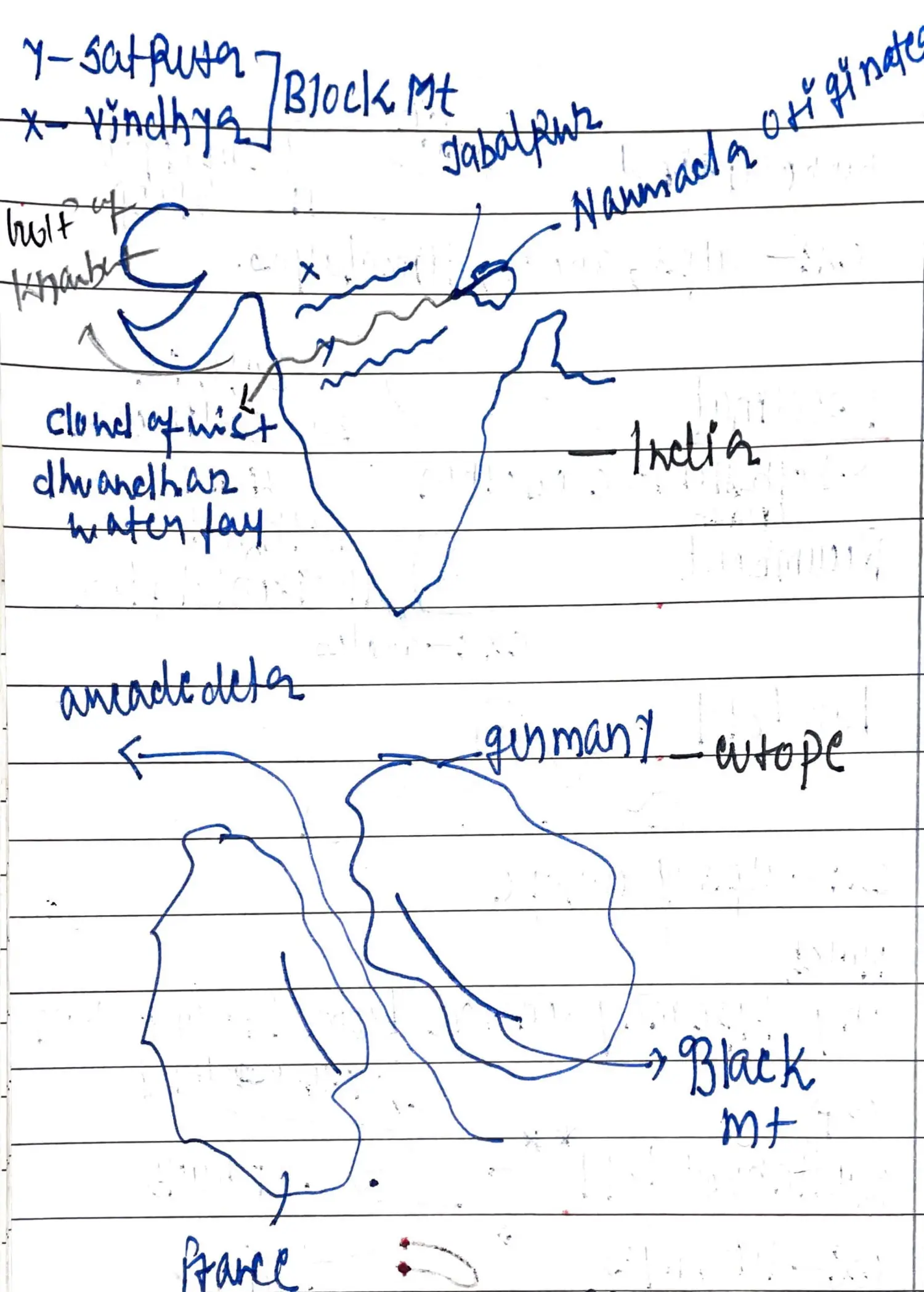
Europe - Black Forest(Germany) & Vosges(France) - Rhine in Between
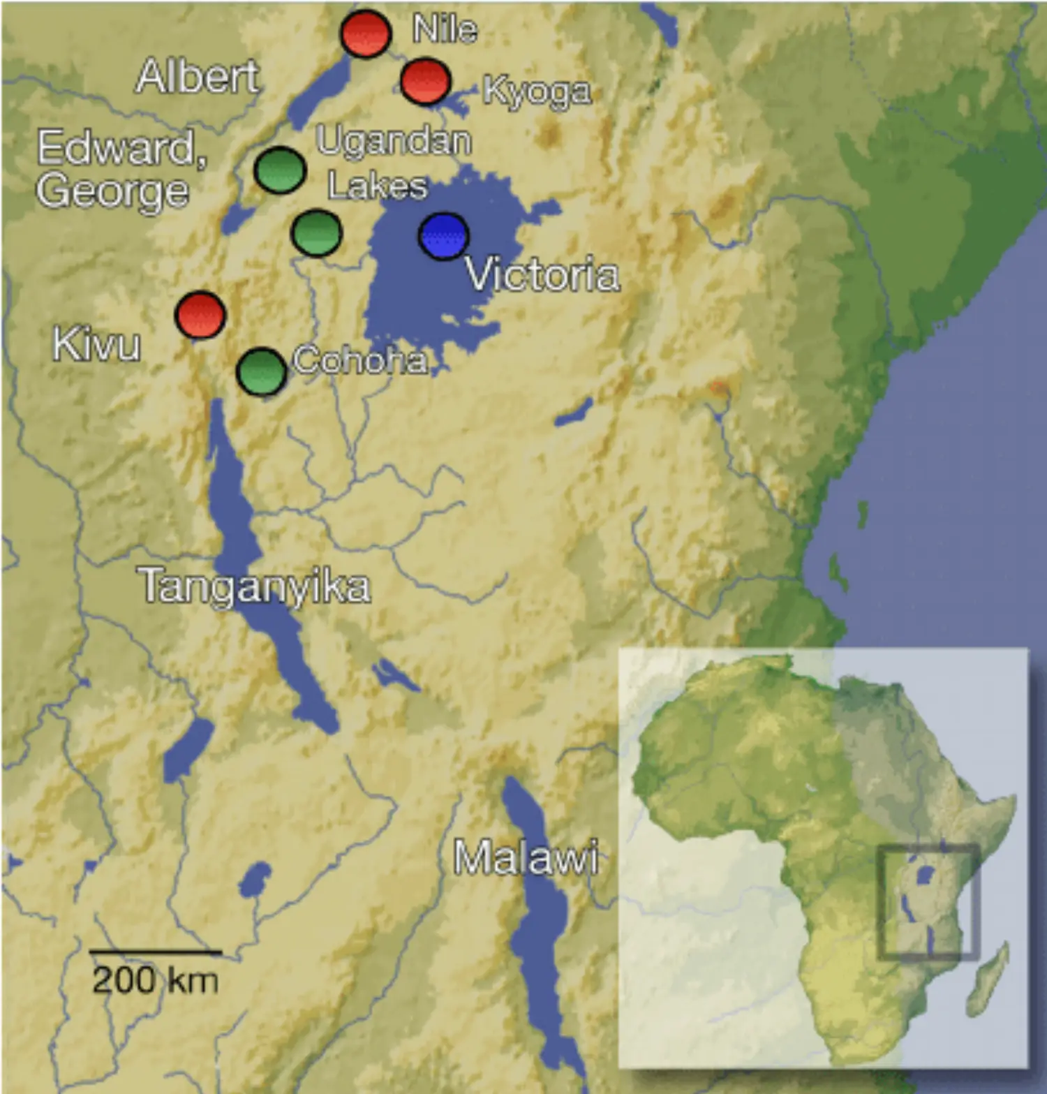
Rift Valley Lakes
Within a Rift Valley - Formed Due to Subduction of Fault within a Rift Zone
Example : Lake Victoria, Lake Tanganyika, Lake Malawi, Lake Albert, Lake Kyoga, Lake Tarkana*
Rift Rivers
- Slope More - Narmada b/w Vindhya & Satpura
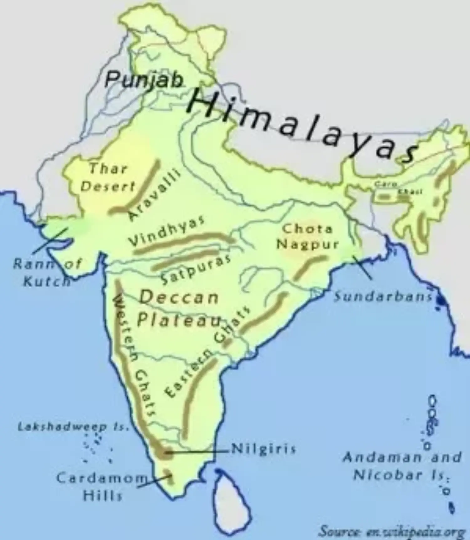
- Slope Less - River Congo Tributaries, West Wing of Eastern African Valley
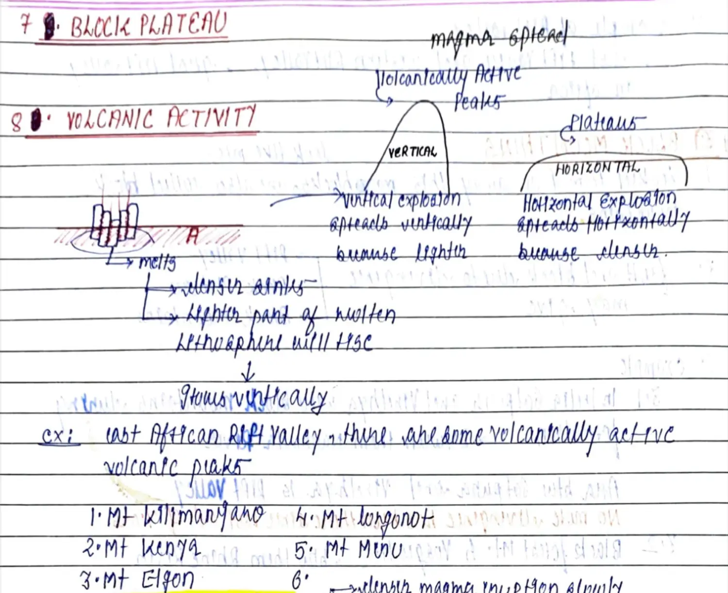
Rift Volcanic Activity & Block Plateau
Con - Oce ❌
- Practically Not Found - Theoretically Not Found
- If Happens One Side Oceanic Lithosphere is Created Another Side Continental Lithosphere is Created Not Possible - Cont & Oce - From Same Lava - Cannot be Dense & Light at the Same Time
Oce - Oce (1)
Mid Oceanic Ridge
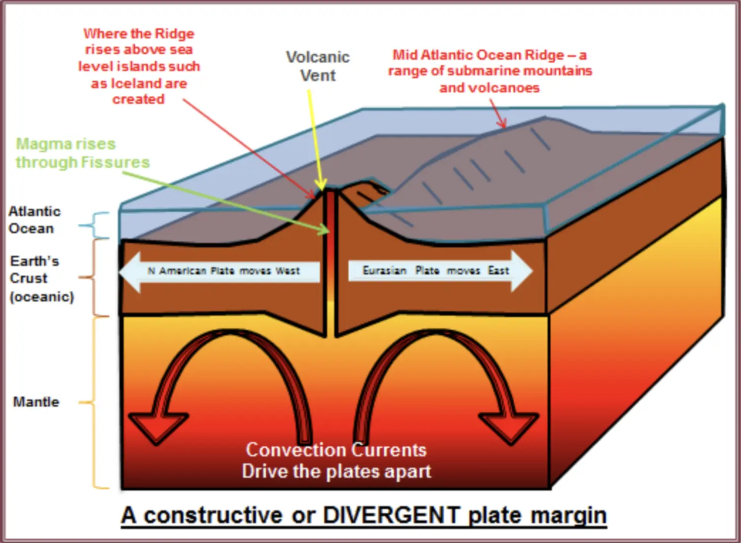
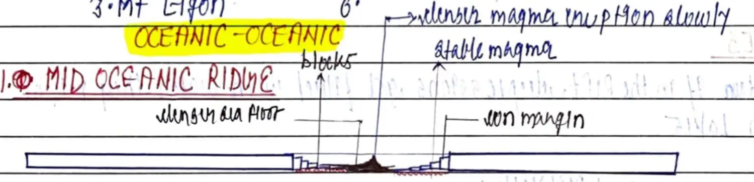

SFST is Oce Oce Divergence of PTT
Example : Mid Atlantic Ridge b/w Africa (Eurasian Plate) & South America (SA Plate)
Divergent Plate Boundary - Value Addition Summarised
- Oceanic - Oceanic
- Higher Temp DP Low Pressure - in Convectional Cell of Lava
- Lithosphere Breaks and Water Tries Going Down and Magma Tries Coming Up
- Landforms Created Are
- Mid Oceanic Ridges - Chain of Mountains Long Linear Underwater Mountains, Found Mid Ocean Hence - MOR
- With Repetition of the Same Divergence
- Oldest Will Move Away MOR
- Nearest Will Be Near MOR
- Newest Will be Near the Fault
- With Repetition of the Same Divergence
- Rift Valley - MOR is centre of Rift Valleys
- Age of Rocks Equidistant on the Opposite Side of Ridge is seen to have gradually increased age moving from MOR
- Temperature of Rocks Gradually Decreases while moving away from MOR
- Thickness of weathered Sediments Increases while moving away from MOR
- Hence the Oldest Marine Sediments of Ridge are Near to the Continental Margins
- This Lava has Ultra Mafic Lava - They Float and Spread More, Hence aren't seen out of water
- Exception out of Water - Volcanic Islands - Greenland
- Mid Oceanic Ridges - Chain of Mountains Long Linear Underwater Mountains, Found Mid Ocean Hence - MOR
- Continental-Continental
- When Convecting Current Hit the Bottom of Lithosphere back to back
- Also Called - Up Dooming & Up Wrapping
- Faulting - Crack Developed
- Currently Largely being observed near Africa - Specially East of Africa
- Ethopia West of East African Rift
- When Convecting Current Hit the Bottom of Lithosphere back to back
- Oceanic - Oceanic
CONVERGENCE - Convergent Plate Movement - Destructive Boundary - Sinking Convection
Oce - Oce → Islands
Concept
When Two Oceanic Plates Converge ; One is Old (Less Dense due to Wear) & One is Relatively Newer (Denser)
Oceanic Plate is Dense - Tends to Sink Towards Asthenosphere
Between 2 - Whichever is Rel Denser SINKS
Once is Always Rel Denser to Another - cuz Not Formed in Same Place & Not Travelled in Same Distance
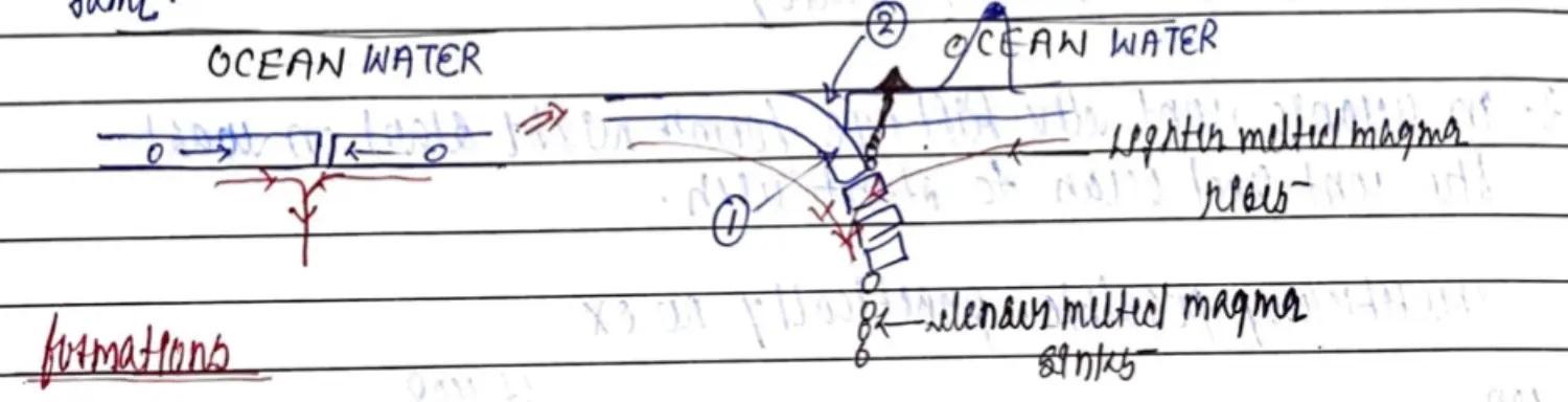
Formations & Processes
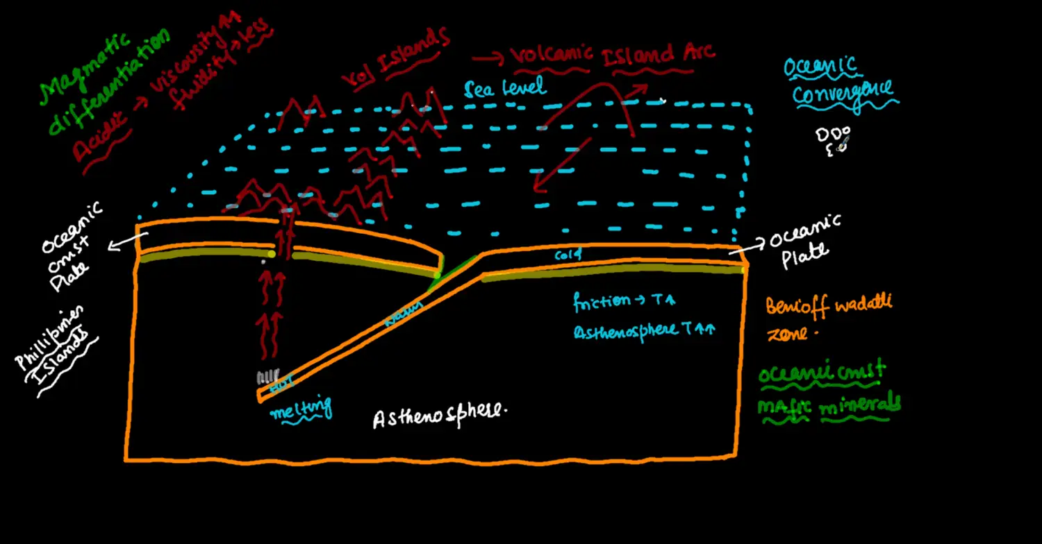
FORMATIONS
- Sinking Oceanic Lithosphere - Plate Destruction
- Open Ocean / Deep Ocean Trench - Away From Formation → Towards Continent
- Magma Rise when Lithosphere Melts
- Strato Volcanic Peaks
- Ridges / Sea Mounts
- Volcanic Islands / Archipelago / Chain Island / Island Arc
- Volcanically Active Peak on Such Island
PROCESSES
- At Convergence
- Subduction - Trench
- Non Subduction - Islands
- Parallel to Islands || There will be Trenches
- Some Deep Ocean Trench → No Island Parallel to them → Form$^n$ of Ridges & Sea Mounts NOT above Sea Level
Examples -
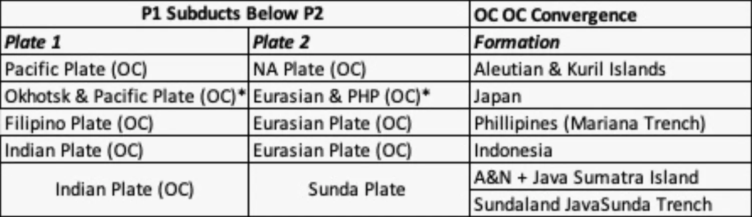
Con - Oce → Fold Mountains with Volcano
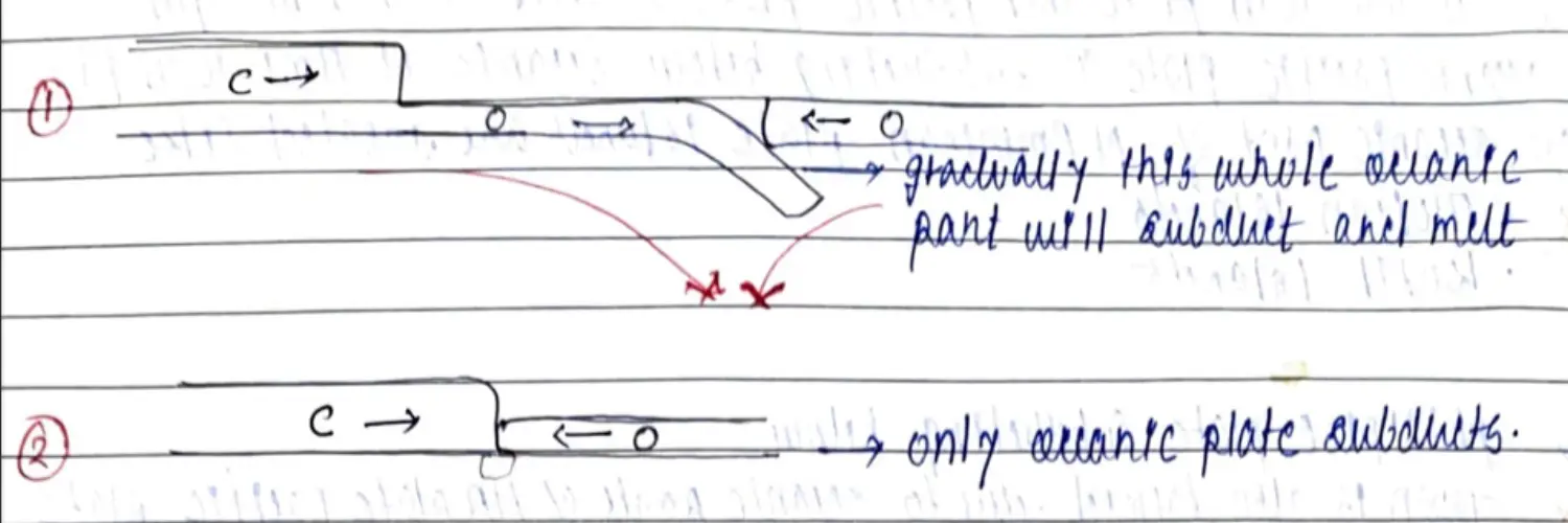
**Crustal Doubling / Overlapping**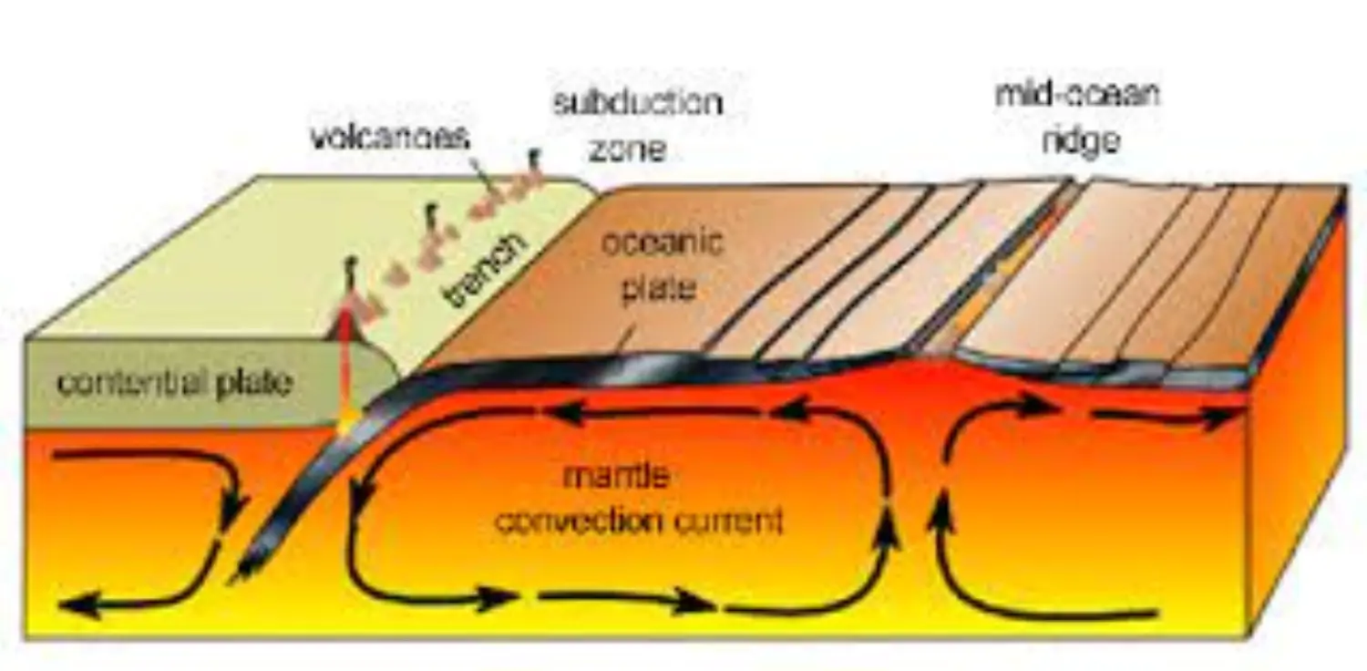
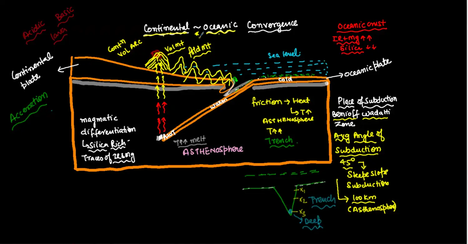
CONCEPT
Con Plate Never Subduct ; Point of Subduction Benioff Wadati Zone
Average Angle of Subduction 45
- Steep Slope Subduction < 40
- Gentle Slope Subduction > 40
In Complex Situation Like Indian CO & Eurasian CO
Crustal Doubling or Overlapping → In Turn is called Con Plate Subduction
Lighter Plate → Con Plate → Tends to Fold UP
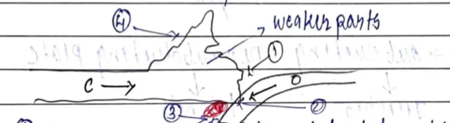
FORMATIONS
- Continental Margin Trench
- Subduction / Destruction Ocean Plate
- Lighter Magma Formation
- Fold Mountains - Weaker Part of Lithosphere
- Volcanic Peaks in Fold Mountain
EXAMPLES
- Andes Mountain (Fold) * && Peru Chile Trench - South America
- Cotopaxi, Chimborazo, Sangay, Hudson, Maipo, Aconcagua
- Rockey Mountain (Fold) - North America
- St Helens - Volcanic
- Atlas Mountain (Fold) - Africa
- Andes Mountain (Fold) * && Peru Chile Trench - South America
Con - Con → Fold Mountains w/o Volcano
After Sometime when oceanic plate subduct completely, Con Con Margin Come Near

In Con Con Convergence → No Plate Subduct → Rathe they Tend to Fold & Rise → Creating Fold Mountain
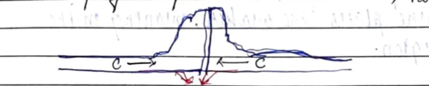
EXAMPLE -
- Himalayas - Indian Plate and Eurasian Plate (Tibetan Part)
TRANSFORM - Transform Plate Movement - Conservative Boundary - Horizontal Convection
Con - Con - Ridge Ridge
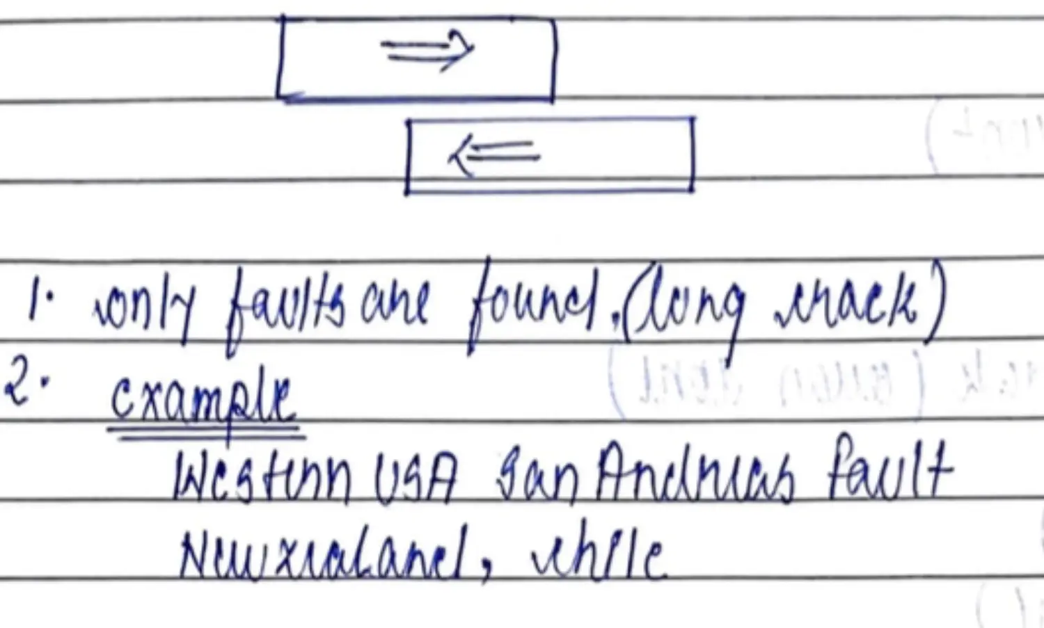
Oce - Oce - Ridge Trench
- Occur Perpendicular to CF of MOR
- Not because of Two Plates Sliding but Plates Moving in Same Direction at Relatively different Speeds
- Example : Along All MOR
Con - Oce - Trench Trench
Theory - Yes & Practical - Not Yet
Types
- Trench Trench
Some Important Inferences
💡 1. **Convergence** Creates Bigger Continents & Destroys Ocean Floor 2. **Divergence** Creates Ocean Floor & Destroys Continents 3. **Fold** **Mt** are Generally Away from Coastal, In Continents 4. **Difference Between Margin and Boundary** ; Interacting Part of Plate Margins = Boundary 5. One **Divergence** is another **Convergence**SUMMARY - Movements & Formation
- Theory - Intra-plate Activities
Tectonic Hotspot & Mantle Plume
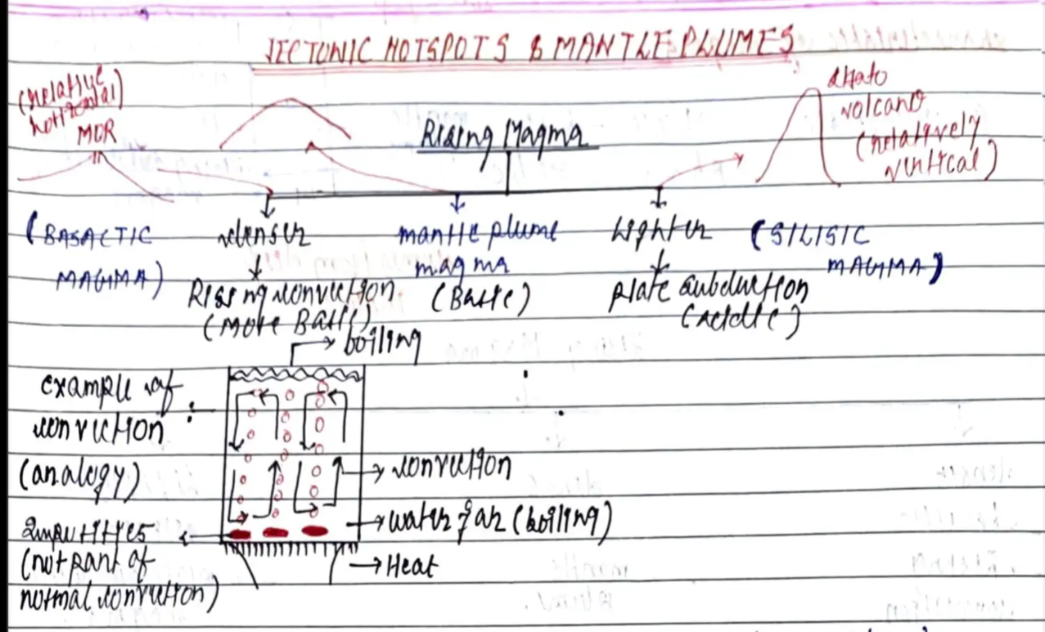
Concept
Not Necessary that Asthenosphere & Mesosphere - Have Uniform Material
Because of Heating this Uniform Material would Melt & Rise as Huge Bubble of Magma(1000’s KM Wide) also called MANTLE PLUME
Normally Mantle Plume Magma doesn't mix with Asthenosphere Magma. Like Impurities in Water
Mantle Plume is Stationary - Doesn't Move with Convection Current
Mantle Plume comes from deepest of Mantle even from Mesosphere → Lighter but Denser than Asthenosphere Magma
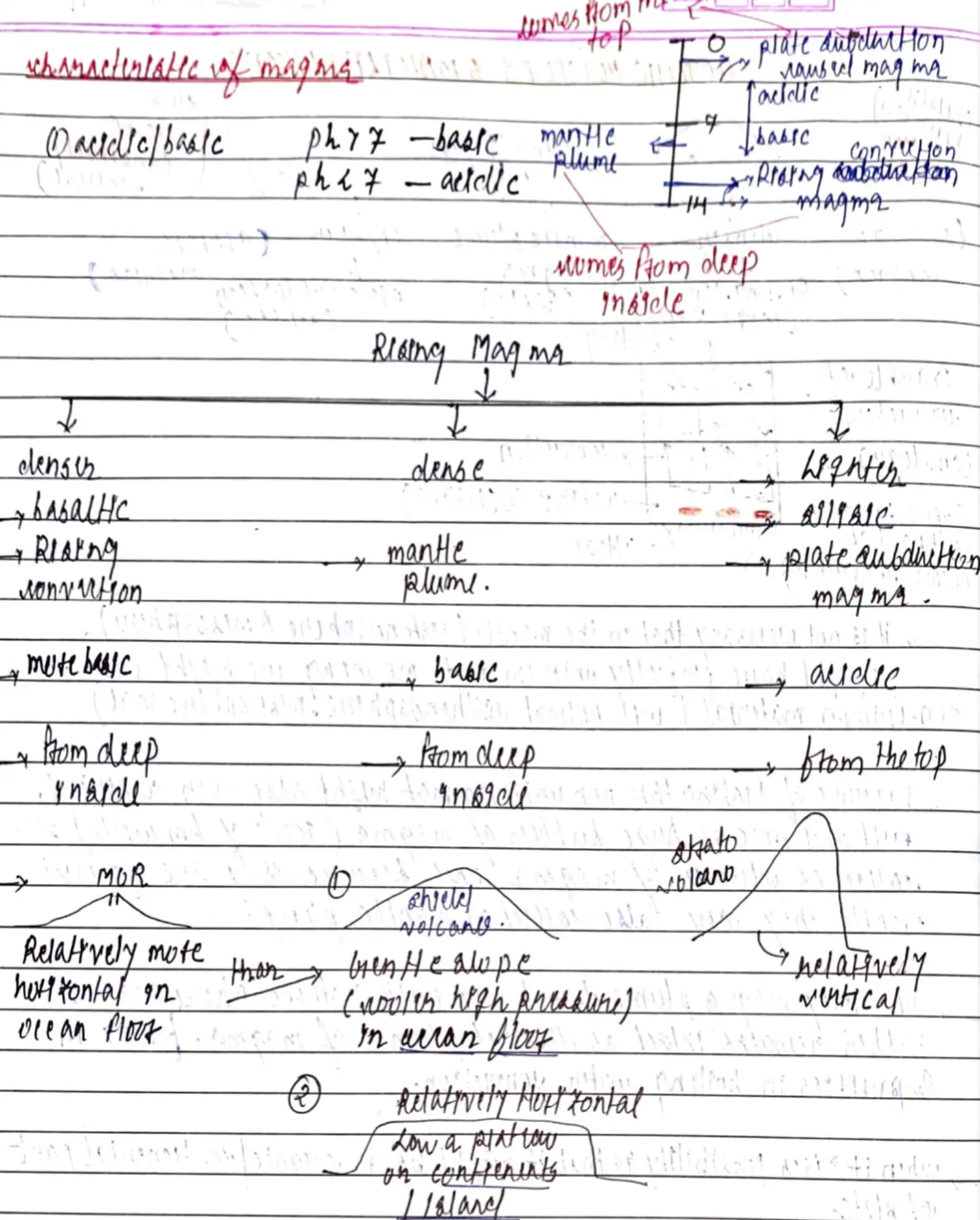

Formations - Due to Mantle Plume
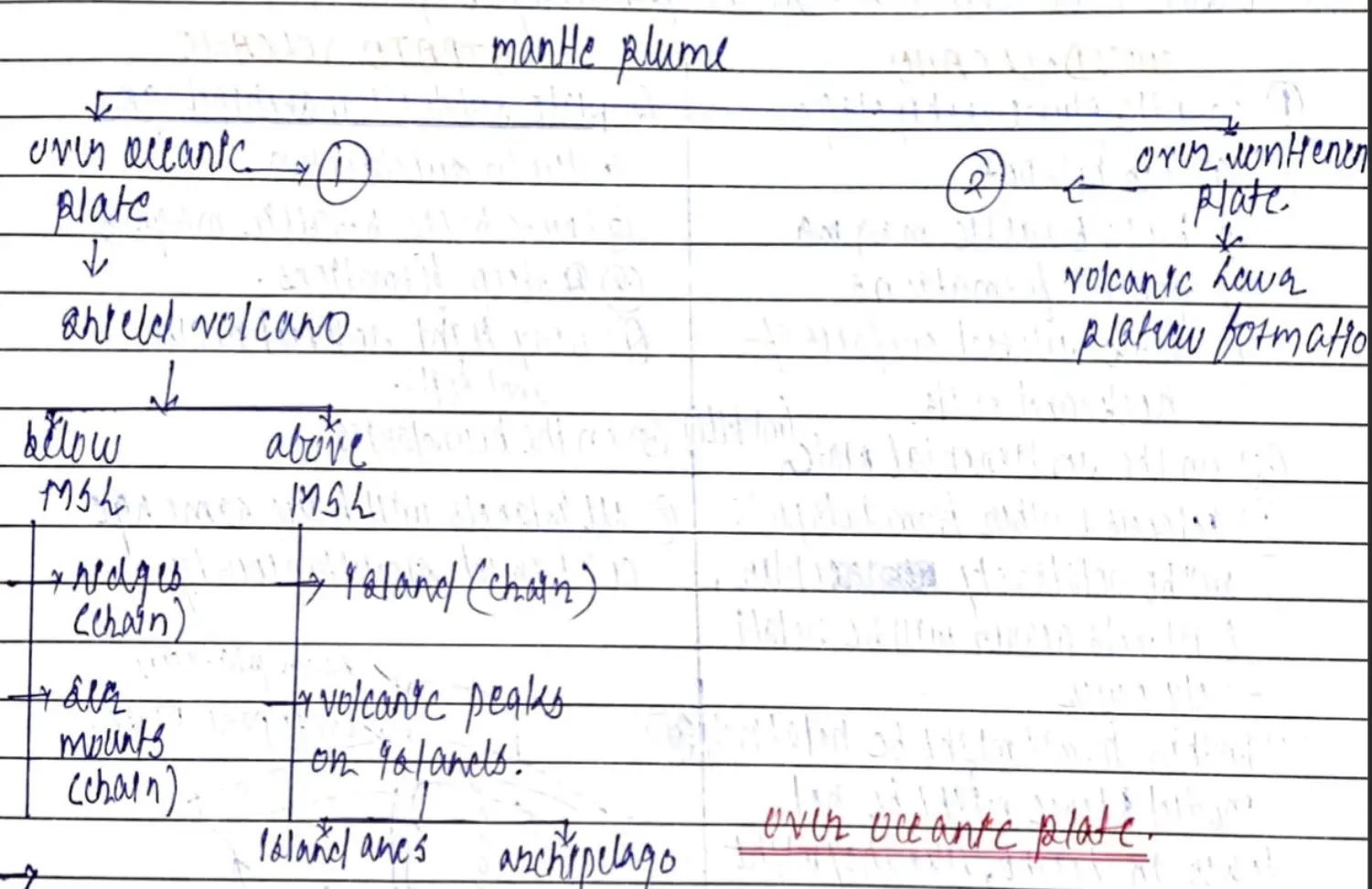
On Oceanic Plate
When Mantle Plume Rises & Up Dooming Occurs - Its Stationary
Where as Asthenosphere Convection Current is Moving
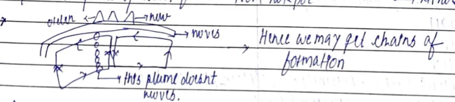
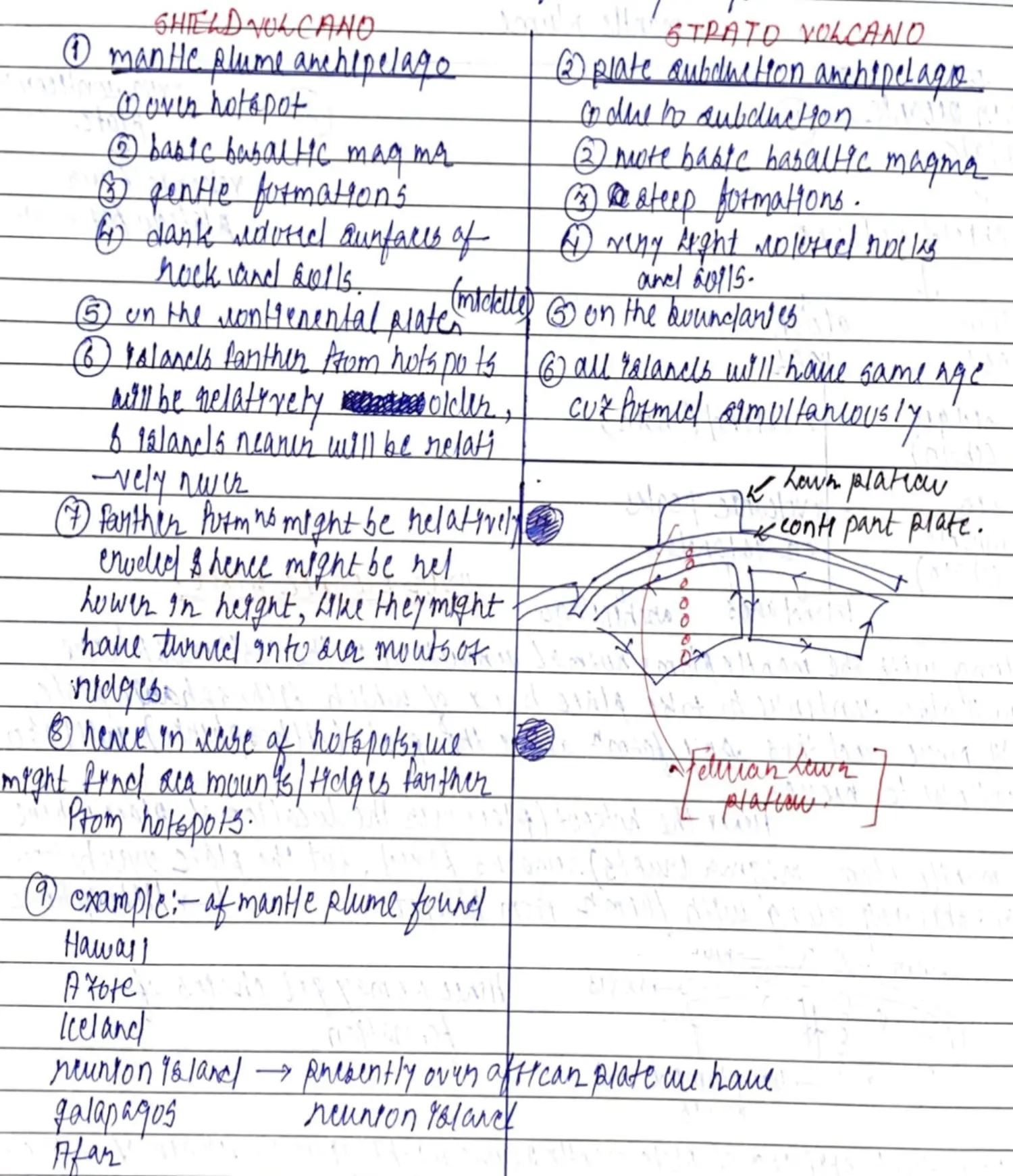
Hence Chain of Islands(Archipelago) or Chain of Ridges & Sea Mounts are Formed
Difference b/w Islands due to Mantle Plume (Shield Volcano) & Islands due to Subduction (Strato Volcano)
On Continental Plate
When Mantle Plume Comes out on Continental Plate → Forms Lava Plateau
Ex : Deccan Lava Plateau 65MYBP
Indian Sub Continent Part of Indo Australian Plate over Re-Union Hotspot
Then Sub Con Part Moved to Join Asia & now theres ReUnion Island
Other Examples
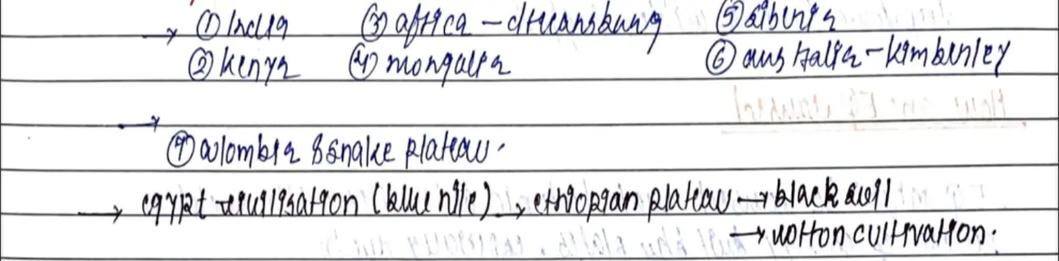
- Theory - Inter-plate Activities
Fast Plate Movements / Catastrophic (PTT)
Earthquake
Seismometer/Seismograph & Seismogram - Measures Waves PSRL
Focus / Hypocenter - Inside Earth at Origin = Focus of Seismic Activity
Epicentre - Perpendicularly Above Focus on the Surface, Maximum Damage
Occurence
- 90% Focus - Crust
- 10% Focus - Mantle (300-700)KM
Measured By - Prelims Imp
| Richter Scale (Energy) | Mercalli Scale (Intensity) | | --- | --- | | Easily Quantified | Cannot be Quantified | | Logarithmic | Normal | | 0-10 | 1-12 | | Unit Increase - 10 Times | Linear Increase | | Universal in Approach | Depends on Topography | | >8 Catastrophic | Varies Invariably |
Volcanoes
Tsunamis
Springs & Geysers
PTT Explain Both Diastrophic & Catastrophic Movements
Exogenic Forces - Makes More Even - Solar Energy
- Exogenic Forces
- River = Fluvial Forces
- Glacier = Glacial Forces
- Winds = Aeolian Forces
- GroundWater = Karst Forces
- Ocean Waves = Wave Forces
- Exogenic Process / Gradation Processes
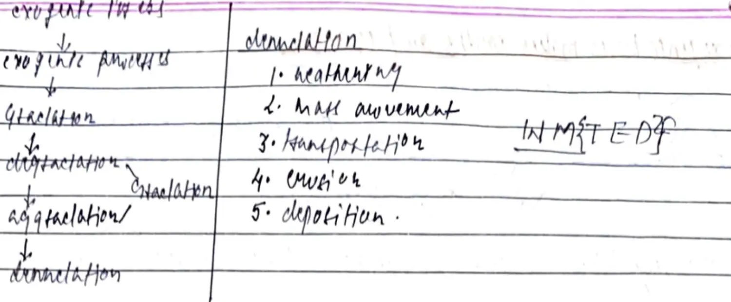
Gradation/Levelling Up = Degradation(Denudation)+Aggradation

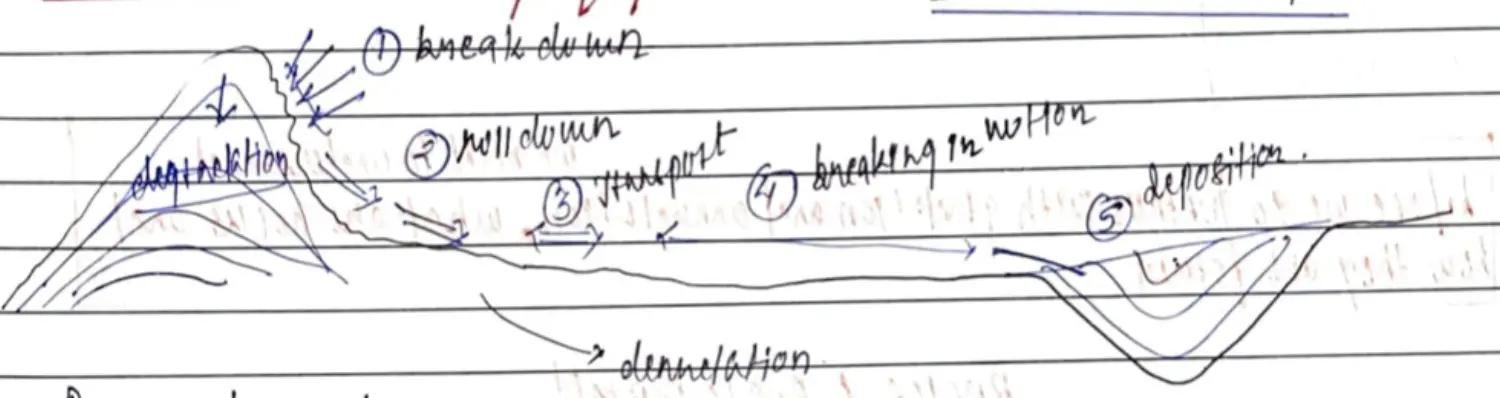
Relation between Denudation & Gradation
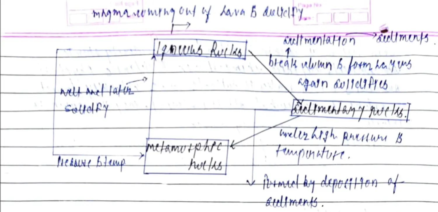
Gradation occurs of ROCKS

ROCK CYCLE
Detailed Process of Denudation (5) - Create 3rd Order Landforms created on 2nd Order Landforms
Denudation/Destructive/Gradational Forces
Denudation = Weathering + Erosion (Dynamic Process)
Imp : Weathering of Parent Rocks → Soil
Erosion : Most Planation Agent of All
- Weathering
- Intro to Weathering
- Due to Atmospheric Pressure, Moisture, Ecological Agents ; Makes Rock Weak → Eventually Break
- Causes Physical & Chemical Changes
- Occurs at IN-Situ
- No large scale transportation of weathered material except for Mass Movement
- Types of Weathering
- Physical
- Intro
- Disintegration & Reduction in Size of Rock w/o Change in Chemical Composition
- In Dry & Cold Regions
- Types
- Exfoliation
- Due to Vertical Pressure Release ; Layer by Layer Peeling
- Primarily in Intrusive Igneous & Metamorphosed Rocks
- Can Occur Slowly & Rapidly
- Forms Crack Parallel to Curved Landforms → Exfoliation Slabs → Exfoliation Domes
- Frost Wedging / Freeze Thaw
- Caused by Freeze Thaw Action of Water
- Water Freezes (Anomalous Behaviour) → Expands Applies Pressure to Accommodate Expansion of Ice
- Generally Produces Angular Blocks
- Salt Wedging
- Salt in Stone Crystallises as Solution with Evaporation of Water
- As Salt Crystal Grows → They Apply Pressure to Surrounding Rock → Weakening & Breaking
- In Drier Climate - Deserts
- Temperature Change
- Due to Diurnal (DailY) & Seasonal Temp Changes
- Causes Expansion & Contraction of Rocks Faults & Surfaces
- Dominant in Desert Climates
- Granite - Smooth Surface - Rounded Small to Big Boulder - Tors
- Not Main Reason for Weathering but accelerates other forms
- Abrasion
- When Rocks Collide Against Each Other
- Constant Collision or Fall due to Gravity - Causes Weakening & Breaking
- Flowing Water - Primary Medium of Abrasion - Makes Fluvial Sediments
- During Abrasion - Bed Rock Surfaces also weathered
- Exfoliation
- Intro
- Chemical
- Intro
- Dissolve, Alters & Weaken rocks through Chemical Processes
- in Humid & Tropical Climatic Region
- Types
- Carbonation
- CO2+ Rainwater - Weak Acid - Carbonic Acid → Carbonate Rocks (CaCo3) → Calcium Bi-Carbonate (Ca(HCO3)2)
- Easily Dissolved in Water Now - Weakening & Breaking
- IN wet & Moist Climate
- Lime Stone & Dolomite & Fine Clayey Particles
- Oxidation
- O2+H20 → Iron Rich Minerals → Rusting → Red Pellets on Rocks
- Weaken Structure → Changes Colour
- Oxidation Accelerates Rock Decay
- Hydration
- Addition of Water to Minerals
- Mineral Absorb Water → Positive Change of Volume
- New Compound Larger than Previous One → Expansion
- Now this New Compound Formation → Stress & Strain in Rocks → Weakening & breaking of Rocks
- Can Cause Colour Change as well ; Accompanies by Hydrolysis & Oxidation
- Hydrolysis
- Reaction Between H+ & OH- Particles
- H+ ions + Mineral → Weak Acid
- Reaction creates new Compound → Soft & Weak
- Hydrolysis → Mineral Expand → Causes Further Expansion of Rocks
- Ex : Anhydrite (CaSo4)+2 Molecules = CaSO4.2H20)
- Solution
- Minerals & Rocks Directly into water
- Generally on Rocks Containing Carbonate → LimeStone
- Affects Rock with Larger Amount of Halite → Rock Salt
- Solution of Large Areas of BEDROCK → Cause SINKHOLE
- Carbonation
- Intro
- Biological
- Caused by Chemical and Physical Agents of Organisms
- Types
- Plant (Floral)
- Bio Chemical - Plant Roots
- Bio Physical - Organic Material of Dead Flora & Fauna
- Secretion of Organic Acids by Dead Flora & Fauna by - Humic Acid / Bacterial Acid
- Produces Sulphides, Oxidise Iron, Help in Solution of Silica
- Animal (Faunal)
- Burrowing, Tunneling
- Acid Secretion - Biological Weathering + Mechanical Weathering
- Mosses & Lichens
- Small Animals, Worms, Termites & Other Insects
- Anthropogenic Weathering
- Mining, Blasting of Hills, Dam Construction, Mineral Extraction
- Weathering on Hill Slopes → Modified Ground Structure → Via Deforestation → Reduces (Mech Reinforcement + Cohesion of Unconsolidated Rocks) → Slope Instability → Slope Failures → Mass Movement
- Plant (Floral)
- Physical
- Differential Weathering
- Rate of Weathering Varies with Rock(Softness/Hardness), Texture & Other Characteristics & Varied Climatic Condition
- Contributes to Unique Land Forms Pedestals, Waterfalls, Monadnocks
- Ex : Limestone weathers Quickly in Wet Climate rather than in Dry Climate
- Intro to Weathering
- Erosion & Transportation
- Intro
- Process of Extrusion, Extraction, Transportation of rock & rock material by mechanical agent is called Erosion.
- Intro
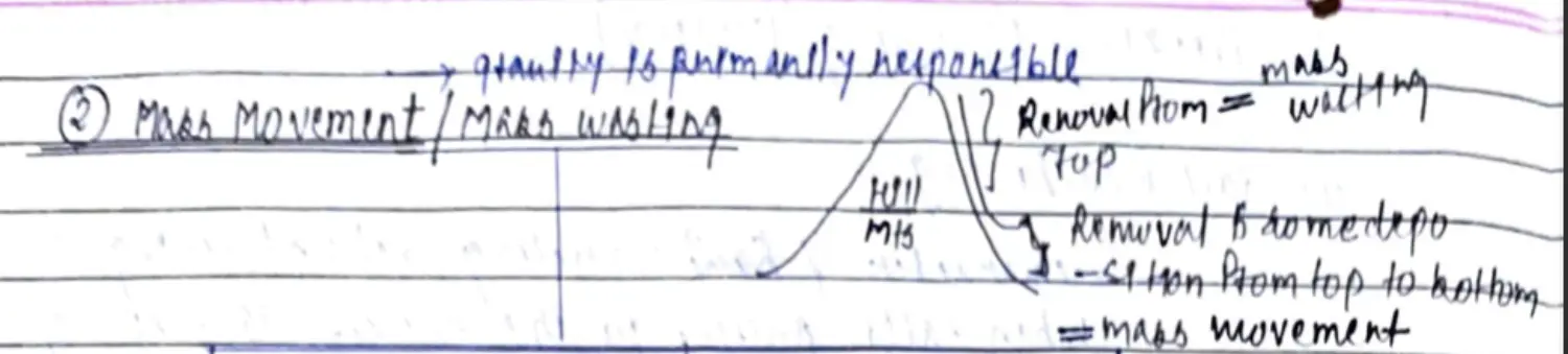
- Mass Movement
- Weathering
Depositional Forces
- Deposition - Collection at a Point
Delta Formation
Characteristic Features Stages of Rivers (3)(Table) - Development of River Valley
Diagram of Phases of River (3)
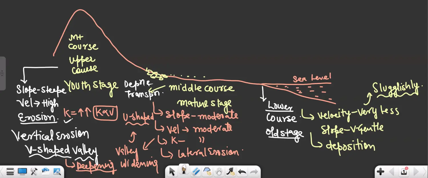
Example with the Help of River Profile
Diagram
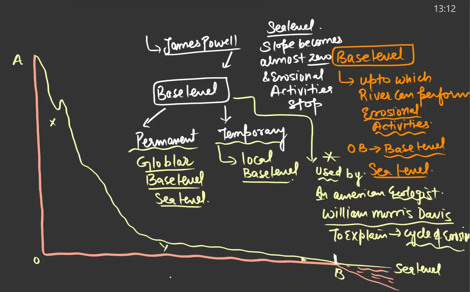
Erosional Activities between OB - i.e Sea Level
Question : Establish a Relationship between Gradation, Degradation and Aggradation
- Upper Course - Erosion Role - Degradation
- Middle Course - Deposition (Coarser Sediments ) & Transportation (Finer Sediments) - Gradation - Example - North Indian Planes
- Lower Course - Deposition Role - Aggradation
- Above Actions Depend upon - Velocity & Slope Primarily
Formation of Delta in the Lower Course of the River
Silt Moves to the Last, Mud Already Present, Mud with Water becomes sticky
Sticky Mud + Silt - Obstruction to Flow - Will get distributed into Distributaries
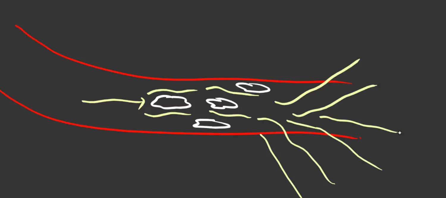
Now Water With Bifurcation → Speed of Water will Reduce → Mud More Sticky → Complete Obstruction
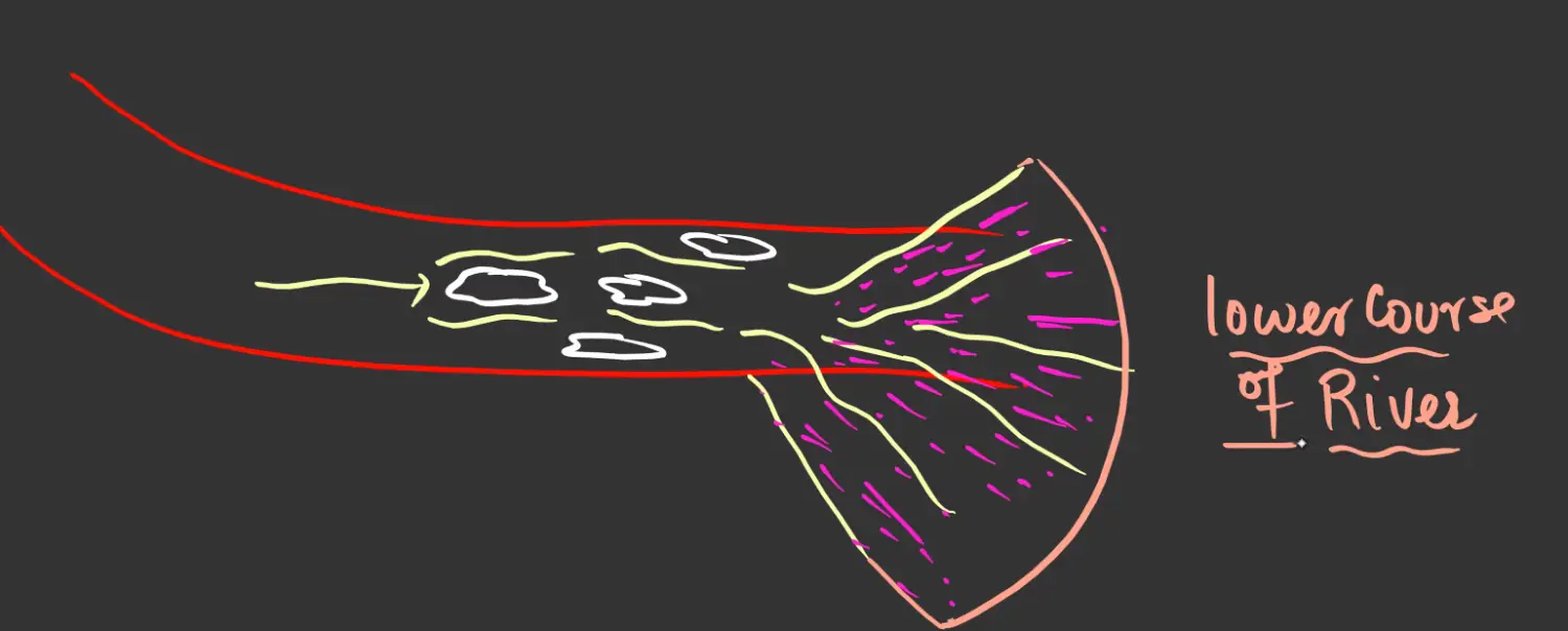
Characteristics of Delta
Why is it called Delta ?
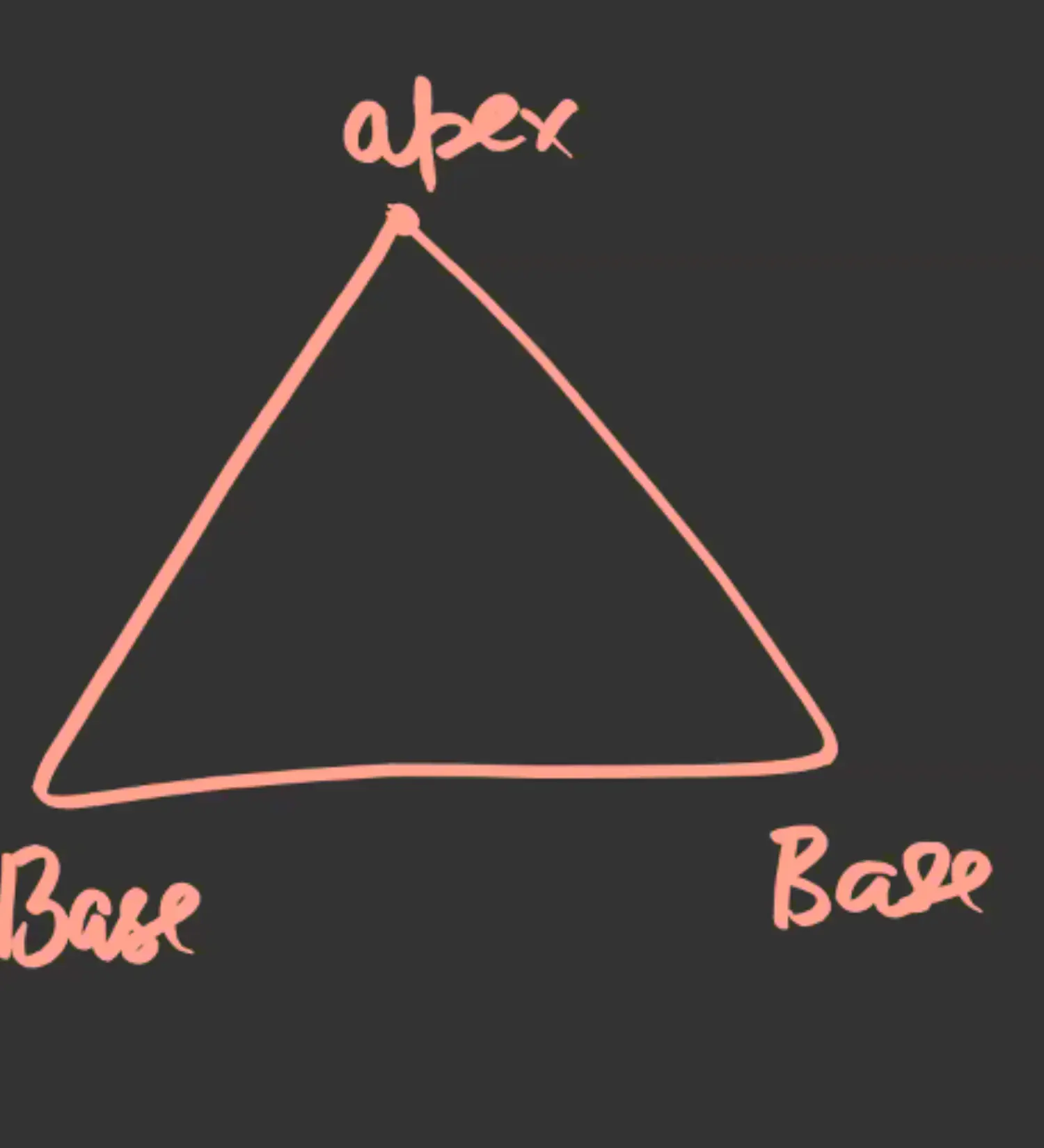
Apex and Base of Delta
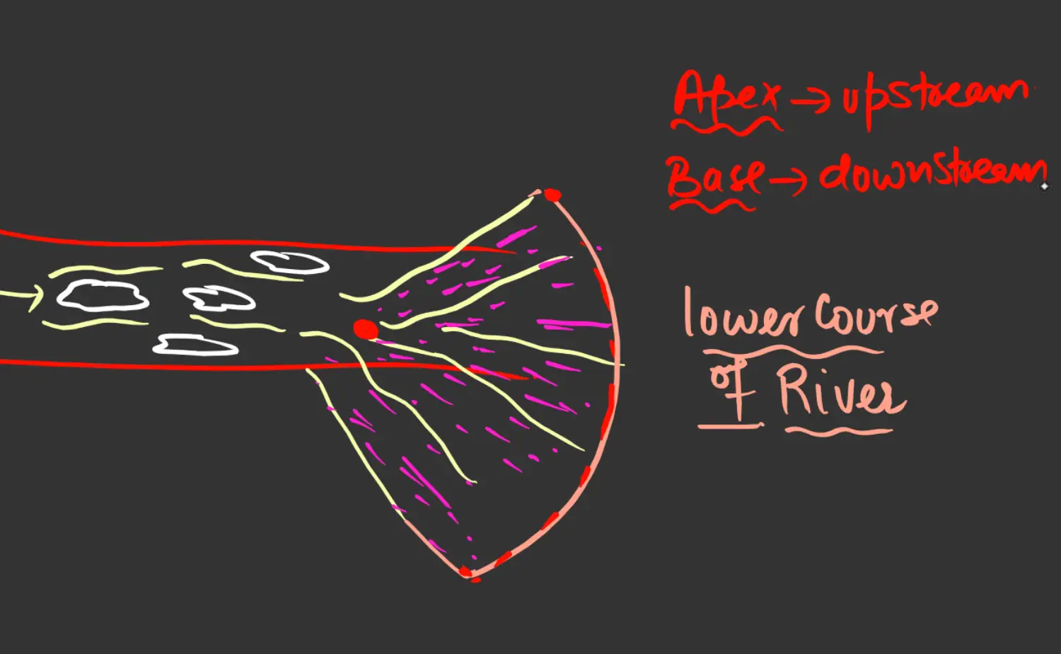
Progradation - Development of Delta
- Phenomenon of Growth of Delta is called Progradation - Growth of Delta - Seawards
- Size Shape and Rate of Growth of Delta
Conditions Required for the Formation of Delta ( World Wide Condition )
- Large Quantity of Water in the Upper Course, So that Sufficient Sediment is available through its erosion work. Slope gives X Speed to river, High Amount of Water gives 2X Speed to River
- Large No of Tributaries should be join main river to add sediments
- River should have a long course so that speed is sufficiently reduced before it enters sea. This is necessary for deposition to take place
- No Lake or Any Other Obstruction in the course of river, sediments will be deposited there and left out sediments will not be sufficient for creation of delta
- Vast Plain in course of river helps in - Inf( Slope Should be Gentle)
- Reduction of Speed
- Helps in Deposition of Sediments
- Strong Waves and Tides in Sea was away sediments brought by river and hinder formation of delta.
- Indian Slope Towards East
- West - No Delta
- East - Many Delta
Diagram
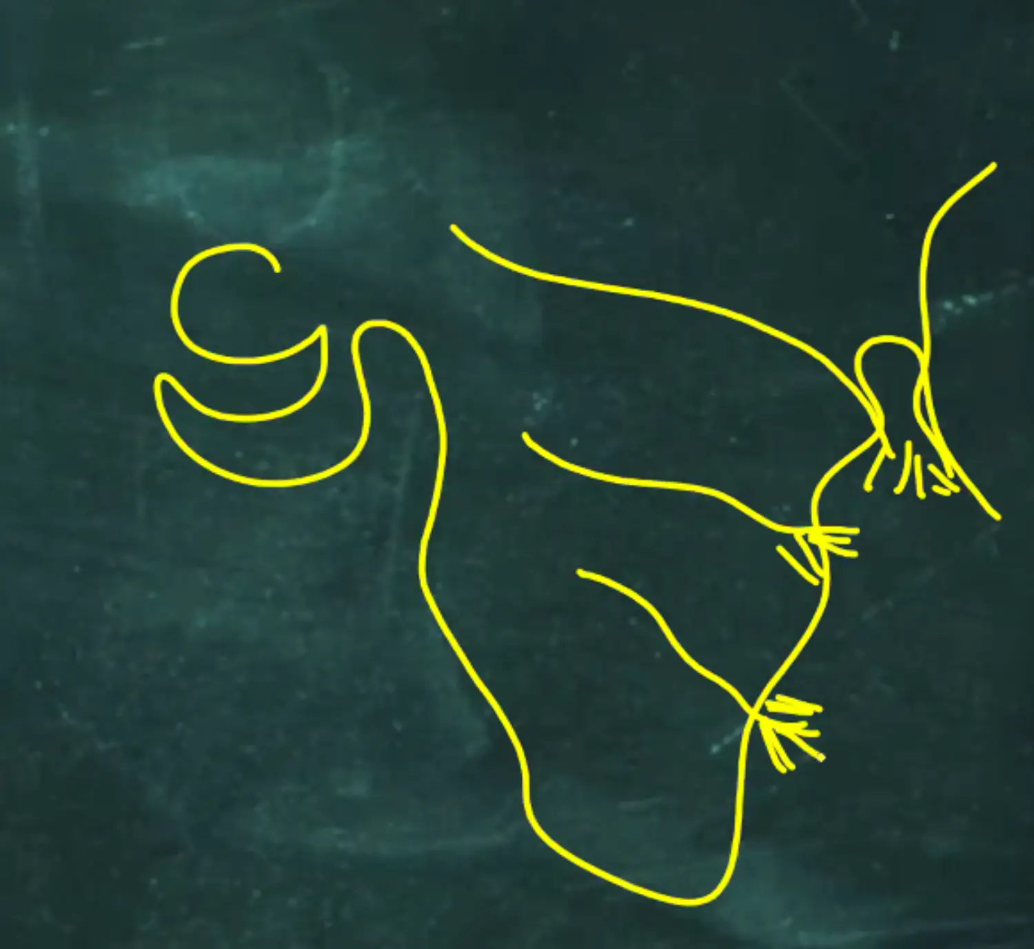
- Indian Slope Towards East
Example of Delta
- Ganga Brahmputra Delta - Sunderban Delta - 1,25,000 Sq Km
- Forest - Mangrove Vegetation - Sunderi Trees - Hence Called Sunderban Delta
- Specific Characteristics of Mangrove Are
Salinity Resistant - Can Easily Grow on Saline Water
Royal Bengal Tigers are Present Here
More Carbon Sink - Carbon Sucrocession -
One of the Largest Delta in the World
Shared Between India and Bangladesh - Majority with Bnagaldesh
Paddy and Jute Cultivation in Delta - Bnagaldesh Tough Comeption on Jute
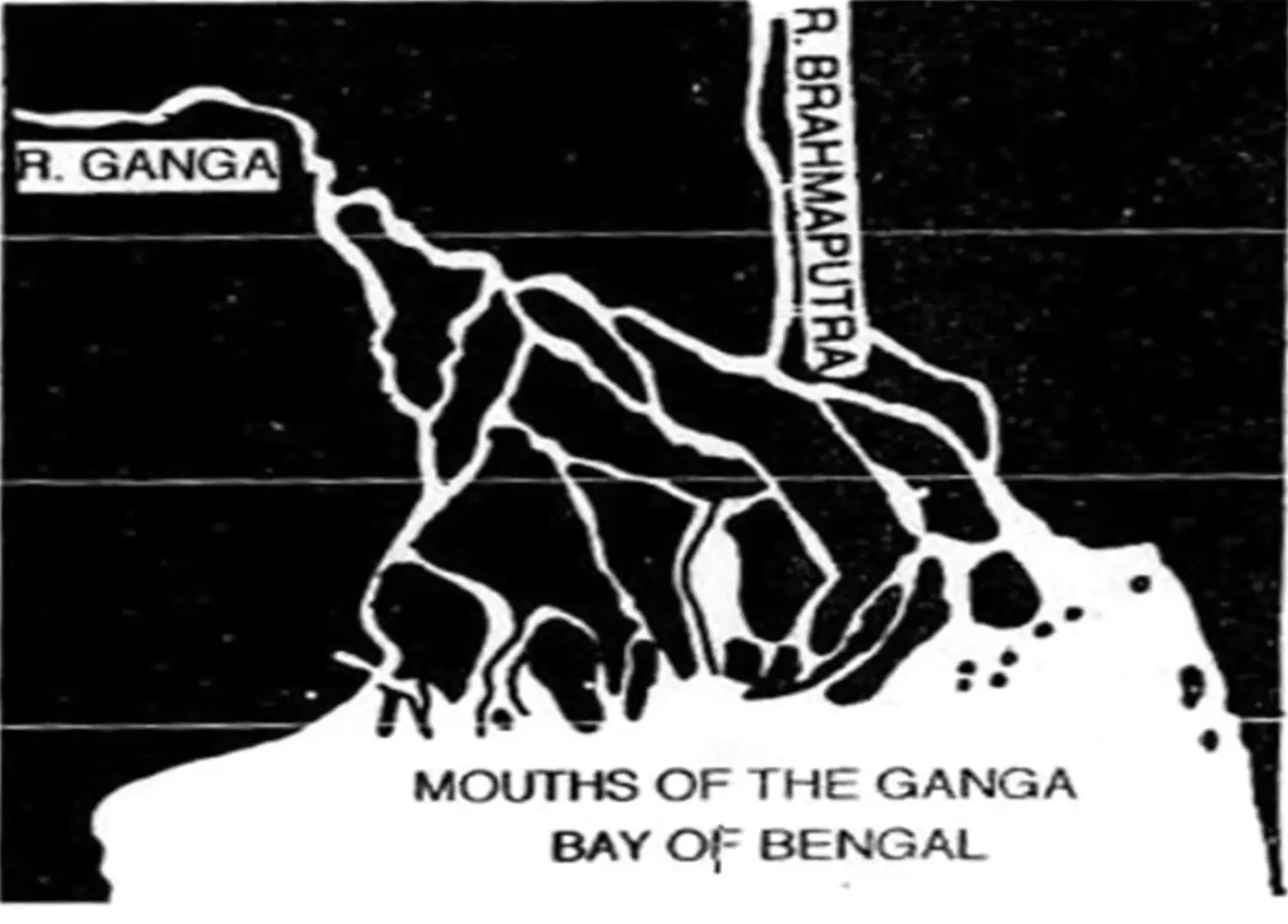
- Ganga Brahmputra Delta - Sunderban Delta - 1,25,000 Sq Km
Facts
- West - Allmost No Delta
- East - Allmost All the Deltas
Classification of Delta - On Basis of Shape & Growth
Arcuate Delta - Rhone Rhine Po - Arcuate
- In Shape of Arc / Semi Circle / Lobate Form - Like Tongue
- Middle Portion - Max Extent towards Sea
- Margin Portion - Narrowed Down
- When River Water (Fresh Water) = Dense as Sea Water
- Formed of Coarser Material including Gravels, Sands & Silts
Diagram
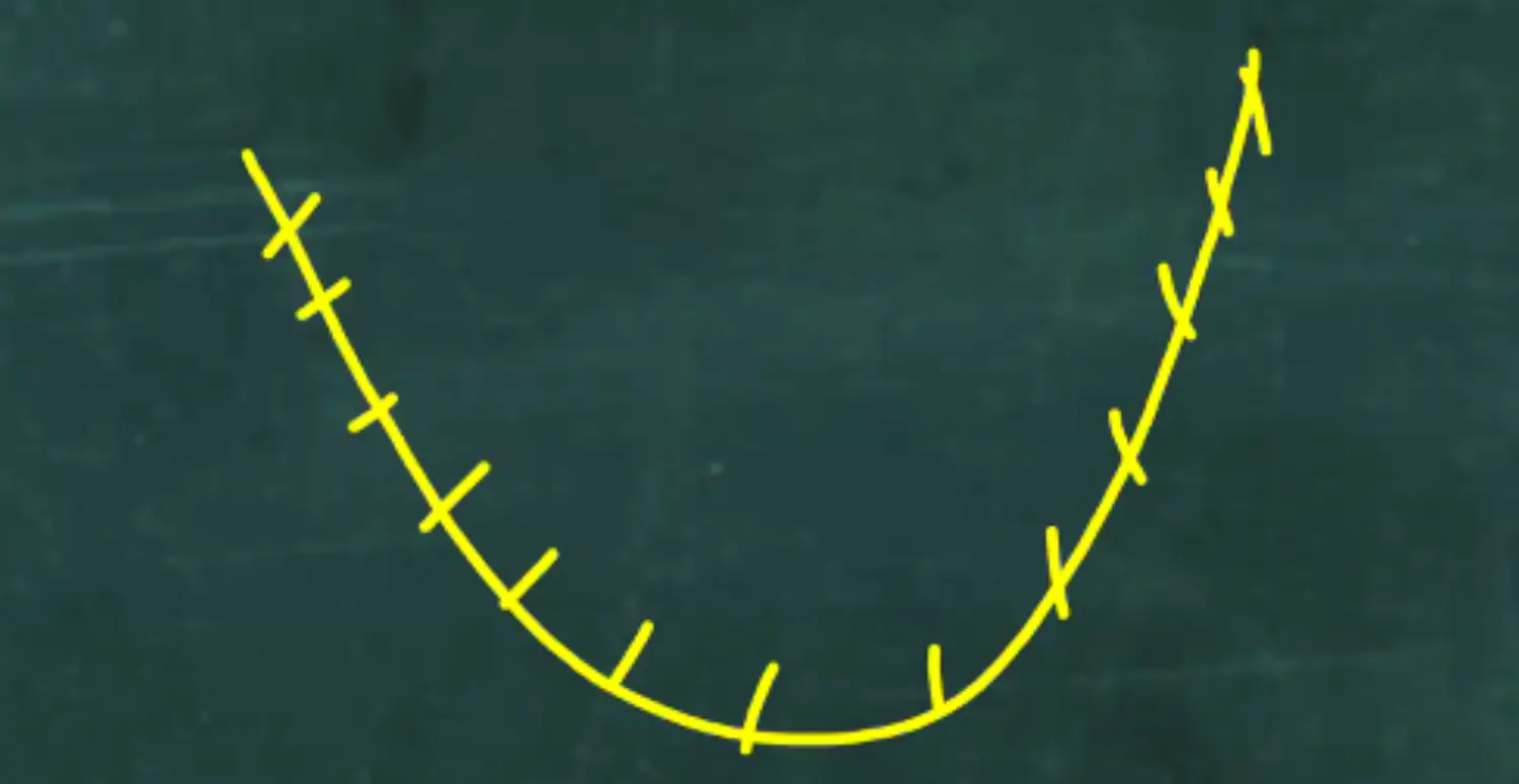
Examples Diagram
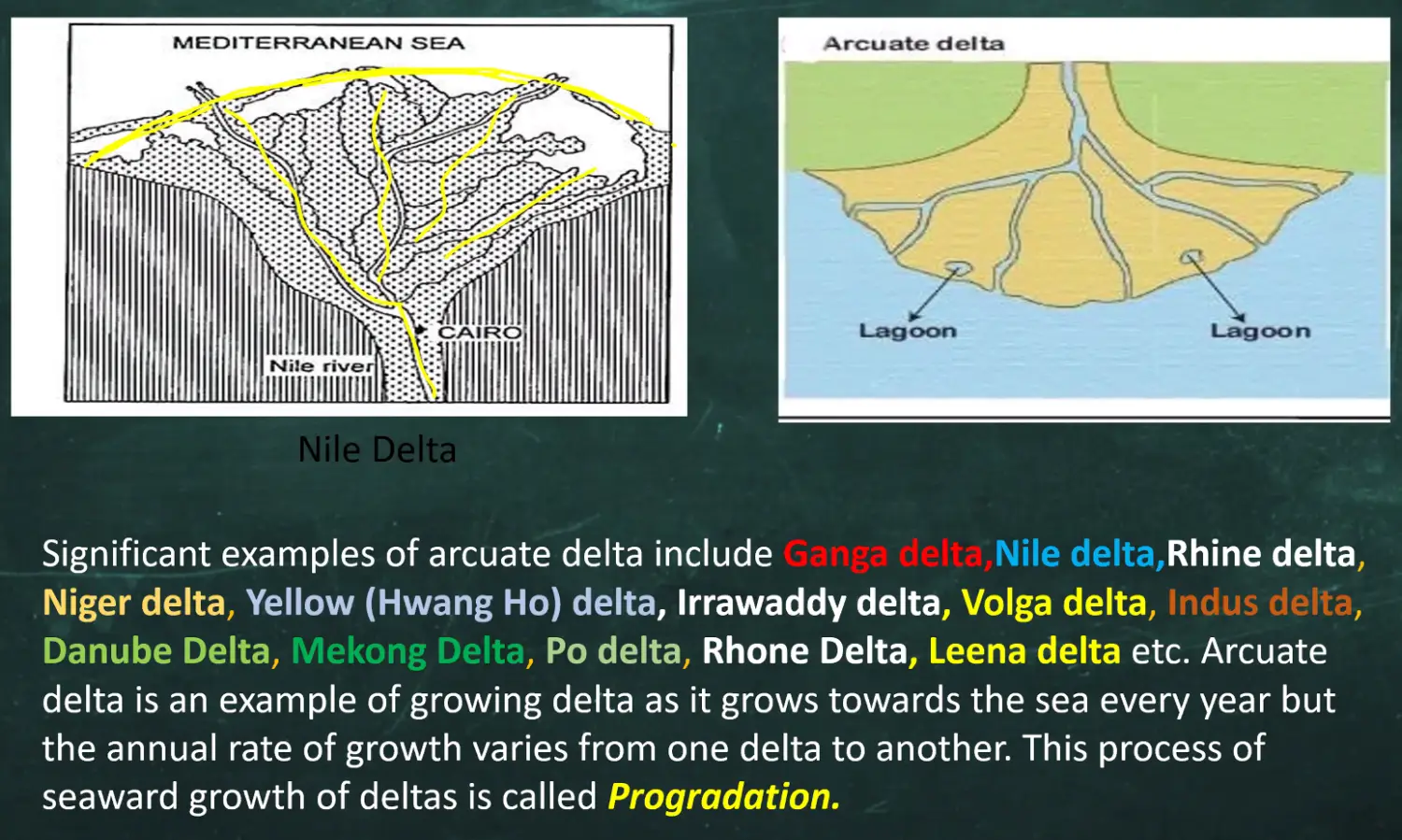
Examples - Ganga, Nile, Rhine, Niger, Yellow (Hwang Ho), Irrawaddy, Volga, Indus, Danube, Mekong, Po, Rhone, Leena
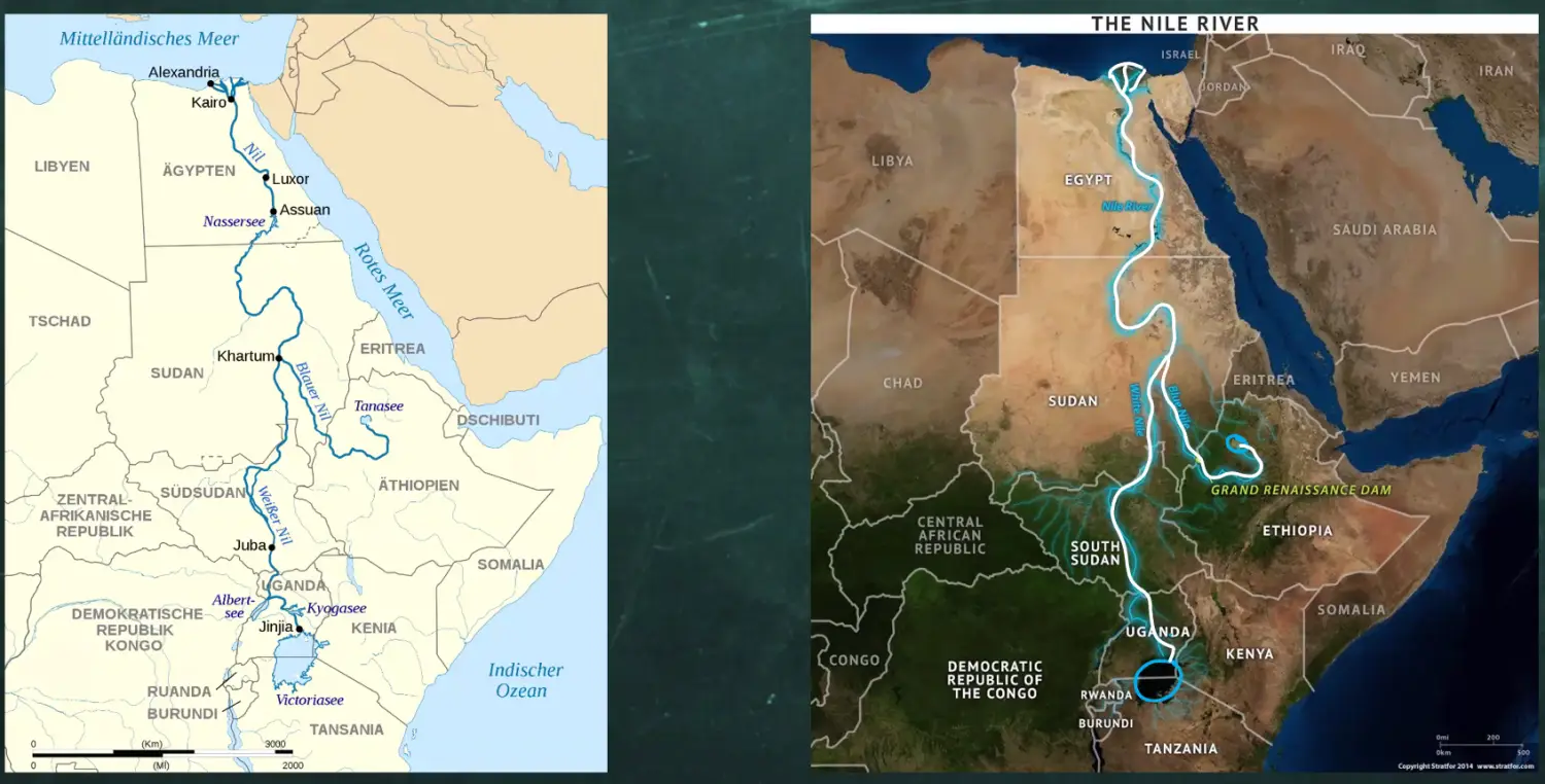
Nile
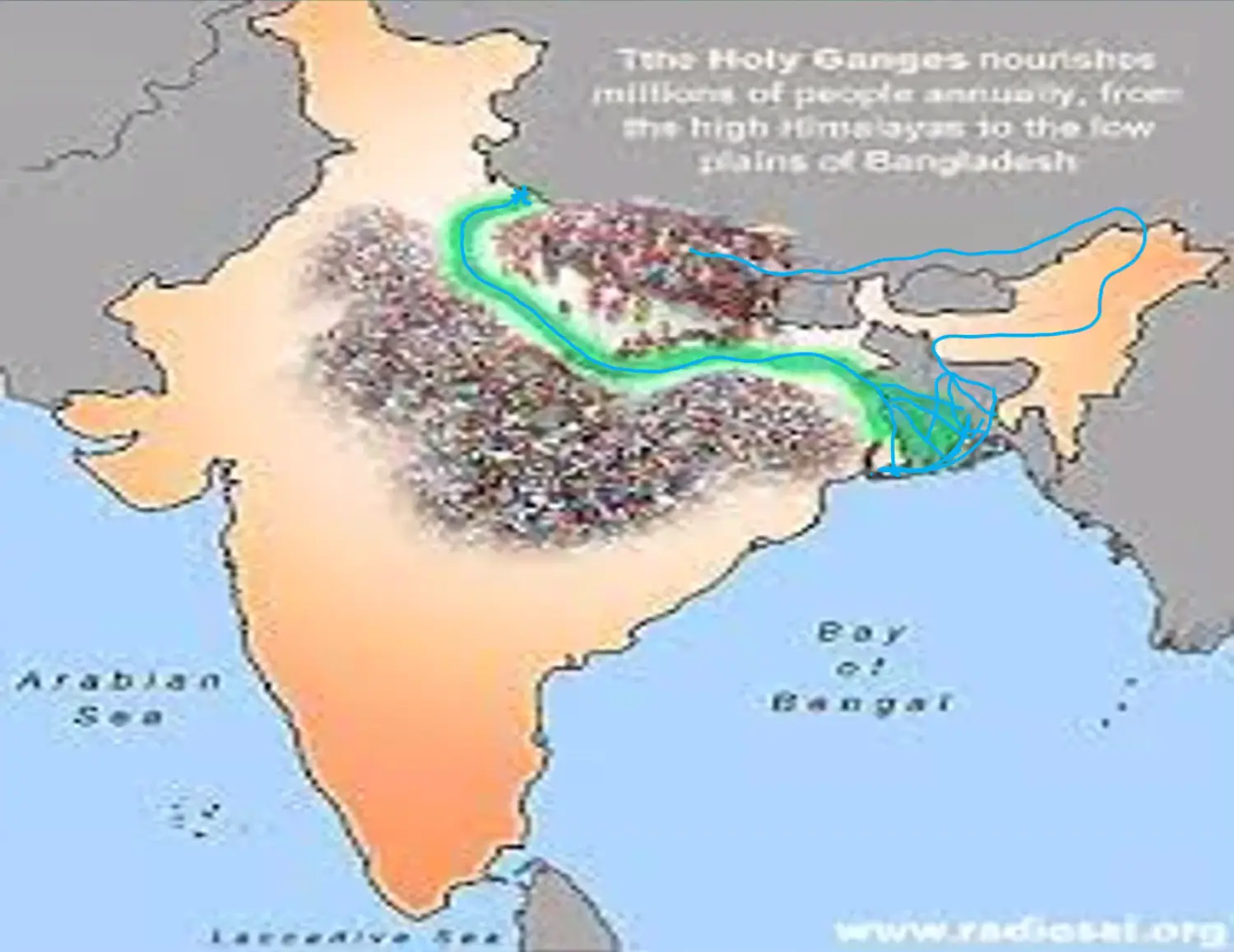
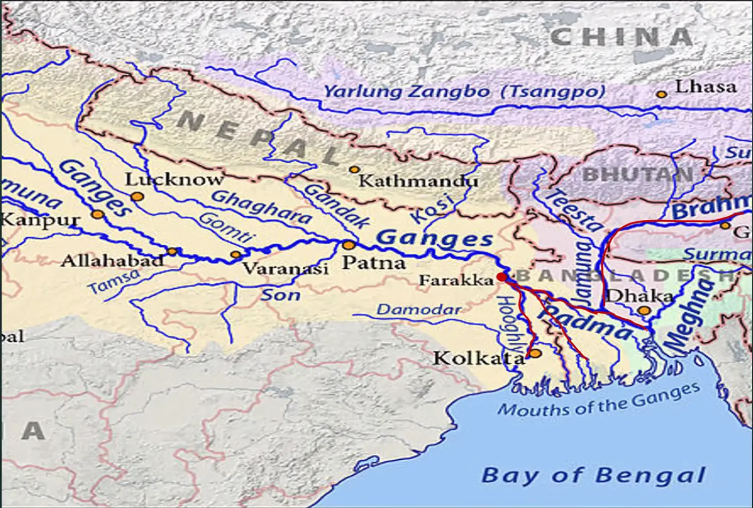
Ganga Brahmputra
Place - Gaumukh, Glacier - Gangotri, Next to Gangotri - Glacier - Yamunotri
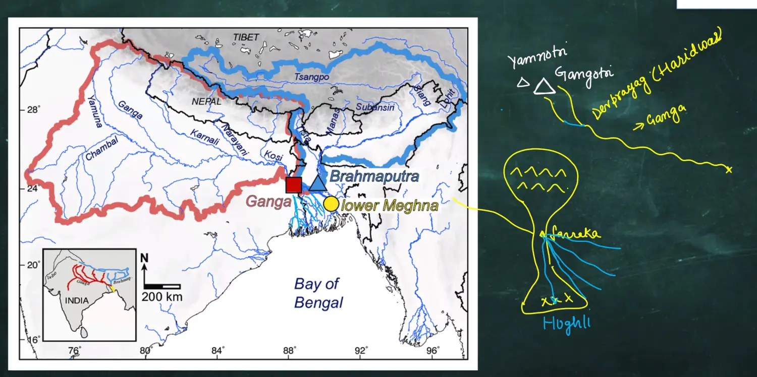
Bifurcation of Ganga
Bangladesh - Padma
Meghna
Sikkim -
Rhine
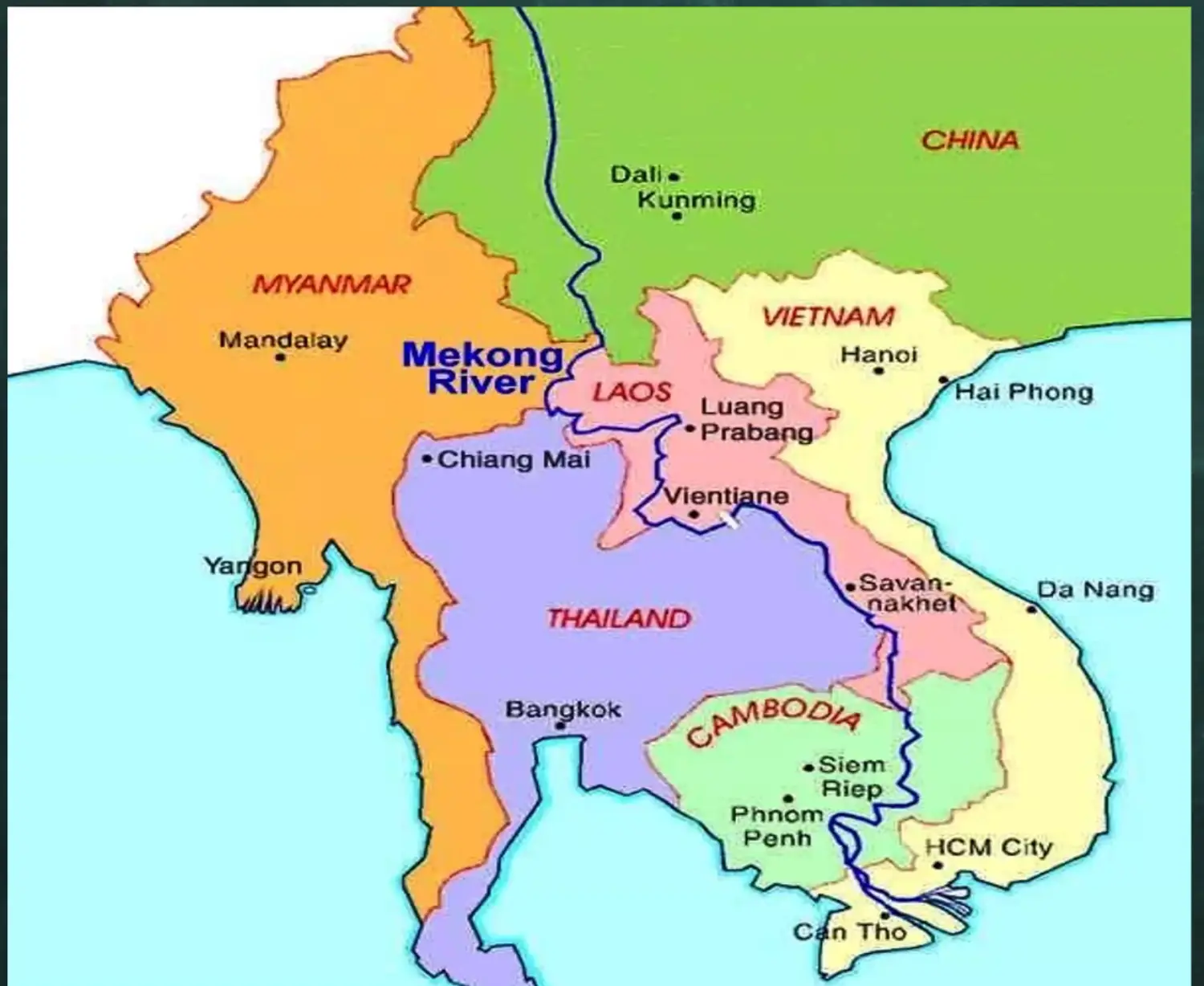
Mekong
Irawaddy - Life Line of Myanmar
Delta Formation - Salaween
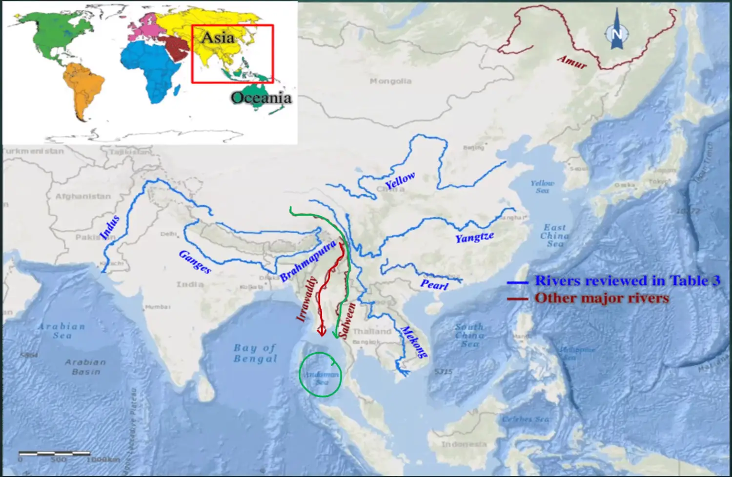
Gulf of Mataban
Yangze, Hwang He Yellow, River Pearl, Si Xiang,
Why China doest live Tibet - Moajority rivers of china come from tibet
- Water blockaed will finish them
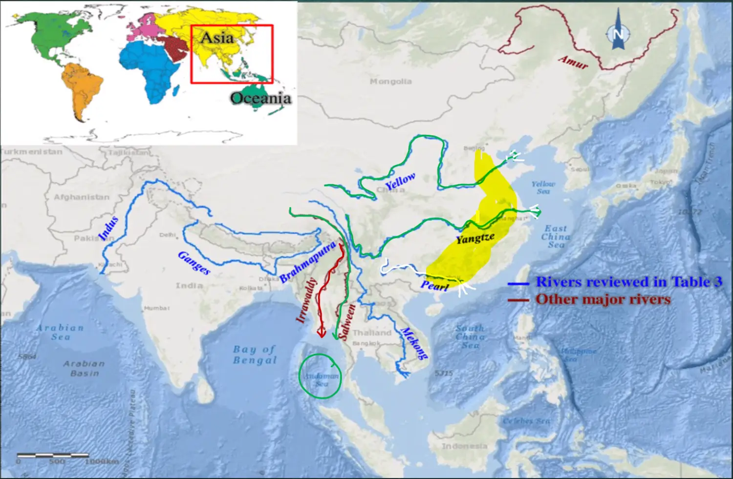
River Yhang Ze is largest river of Asia
Indus -
Laike Baikal
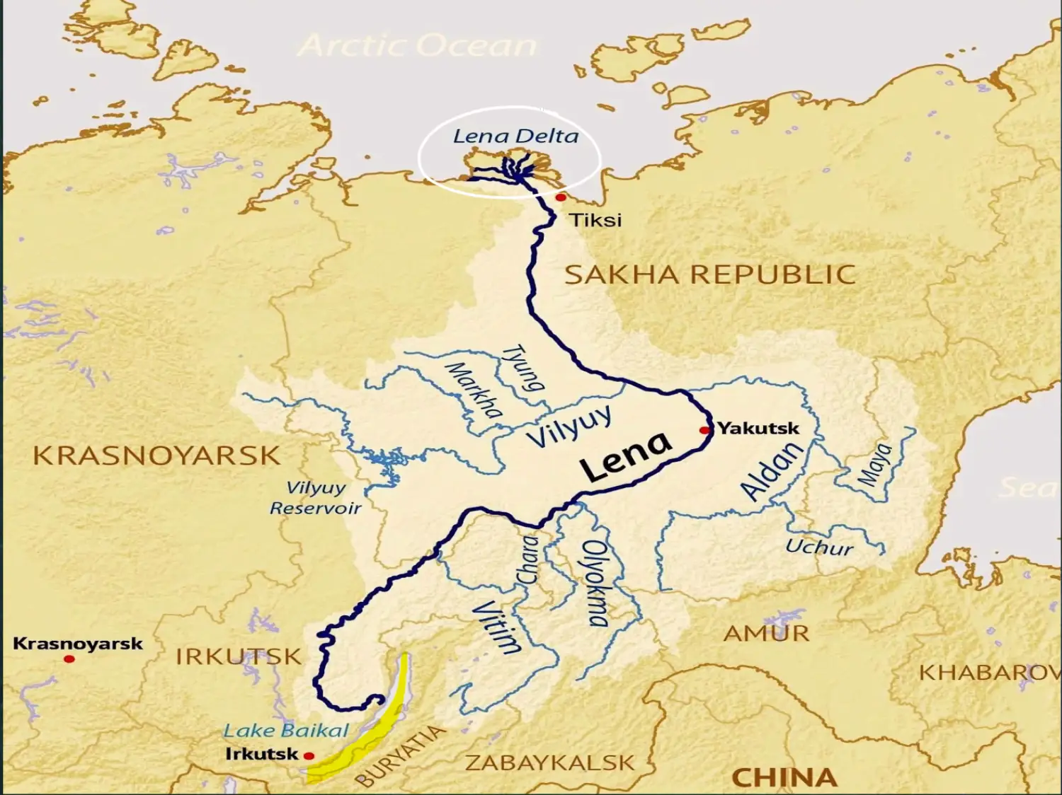
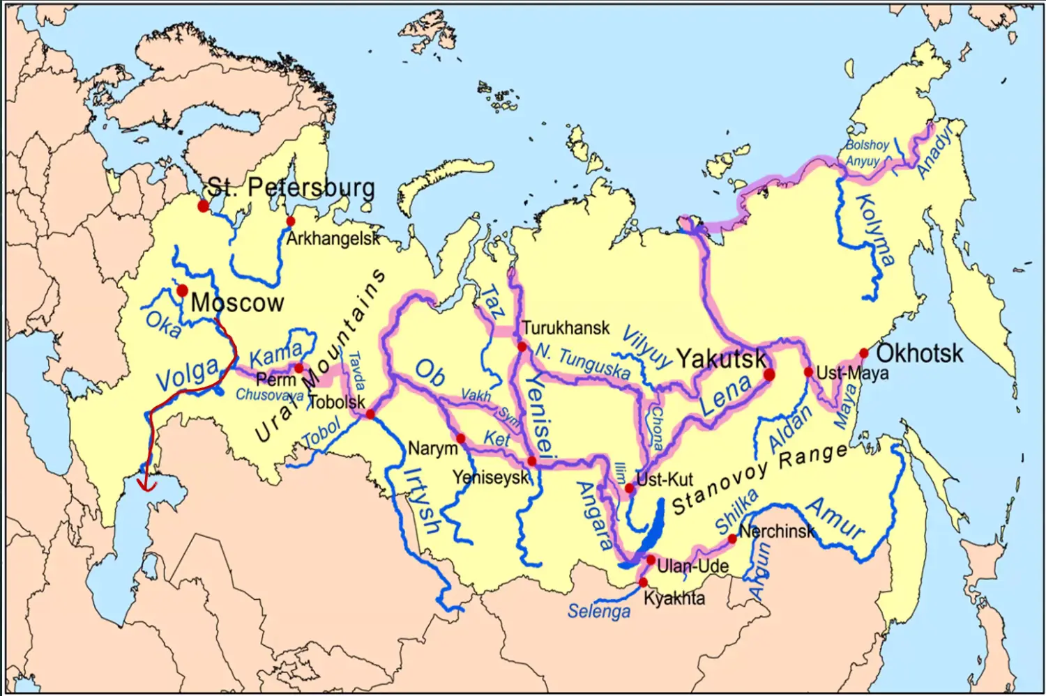
River Volga
Origin from Oka
Drain in Caspian Sea
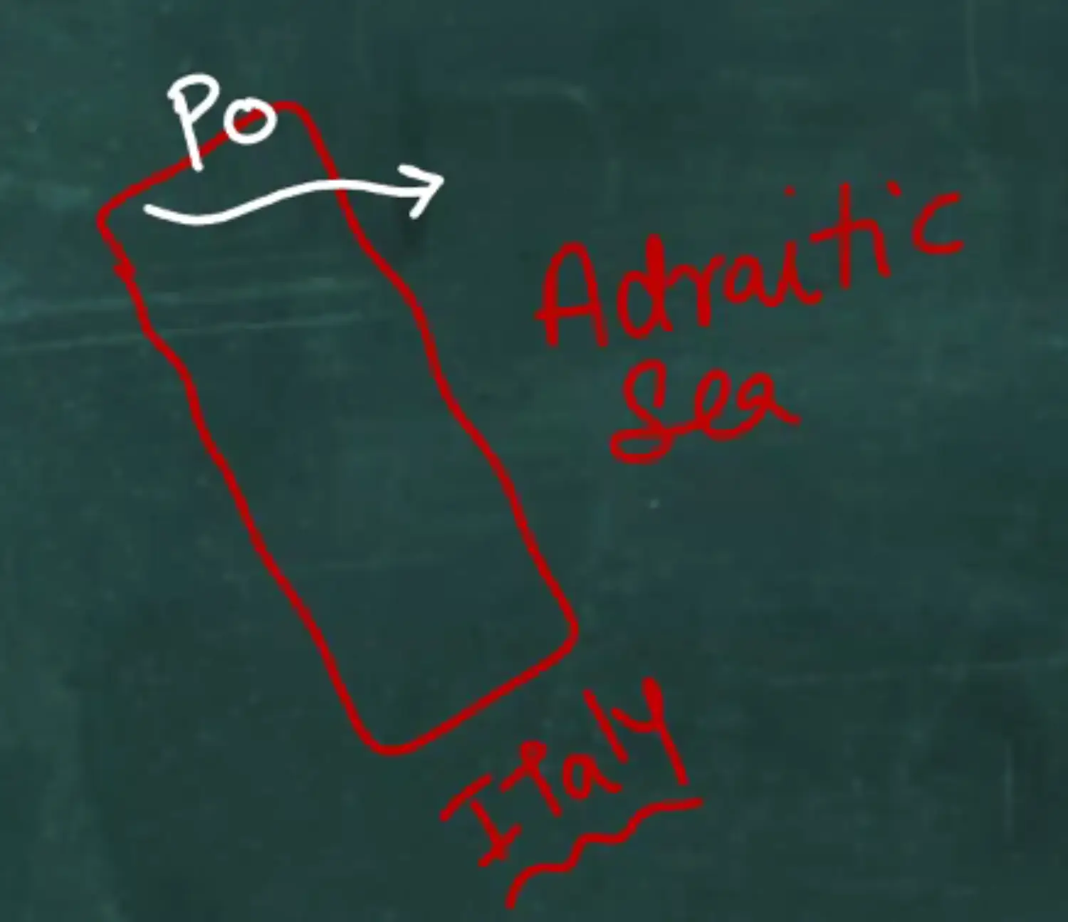
River Po -
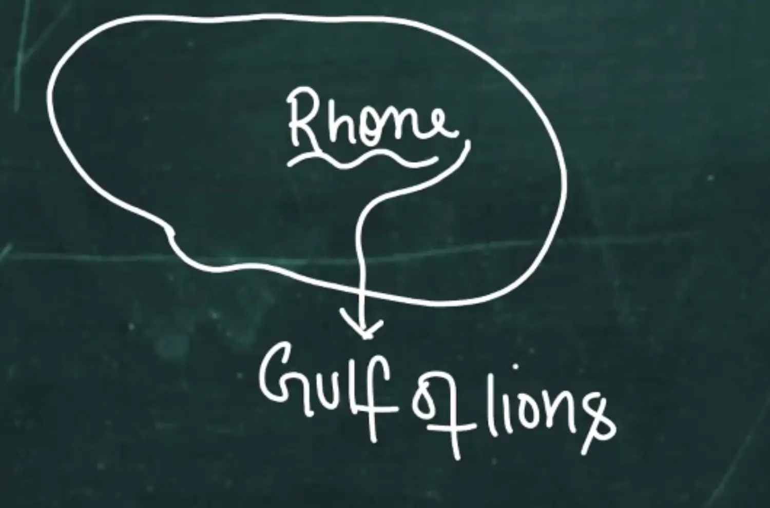
Rhone - SOuth Floing Rivers
Bird Foot Delta - Finger Shape Delta
Diagram
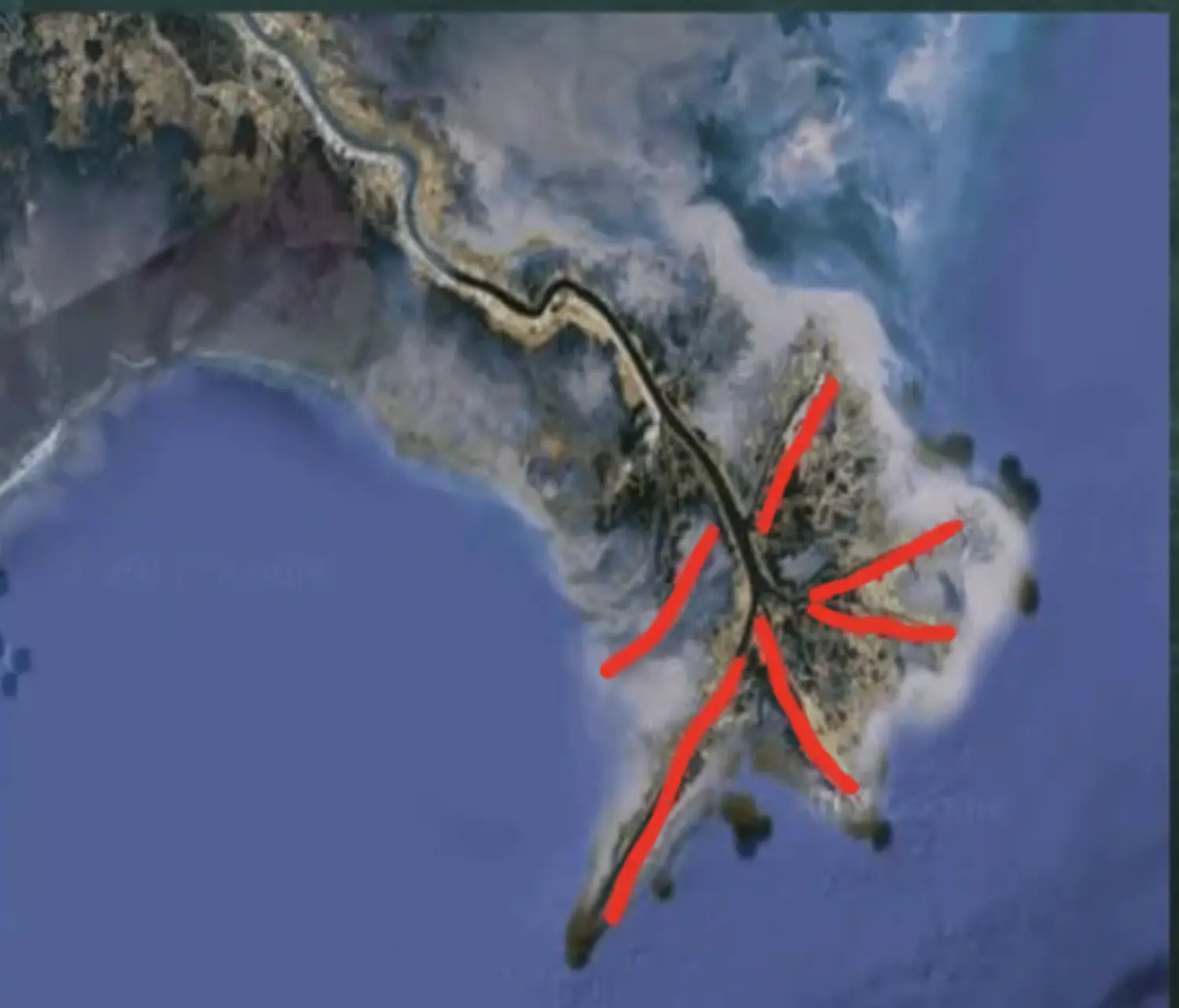
- Looks like claws of Bird
- Formation
- River Water Lighter, Sediment in Suspension, Lighter than Sea Water
- Example
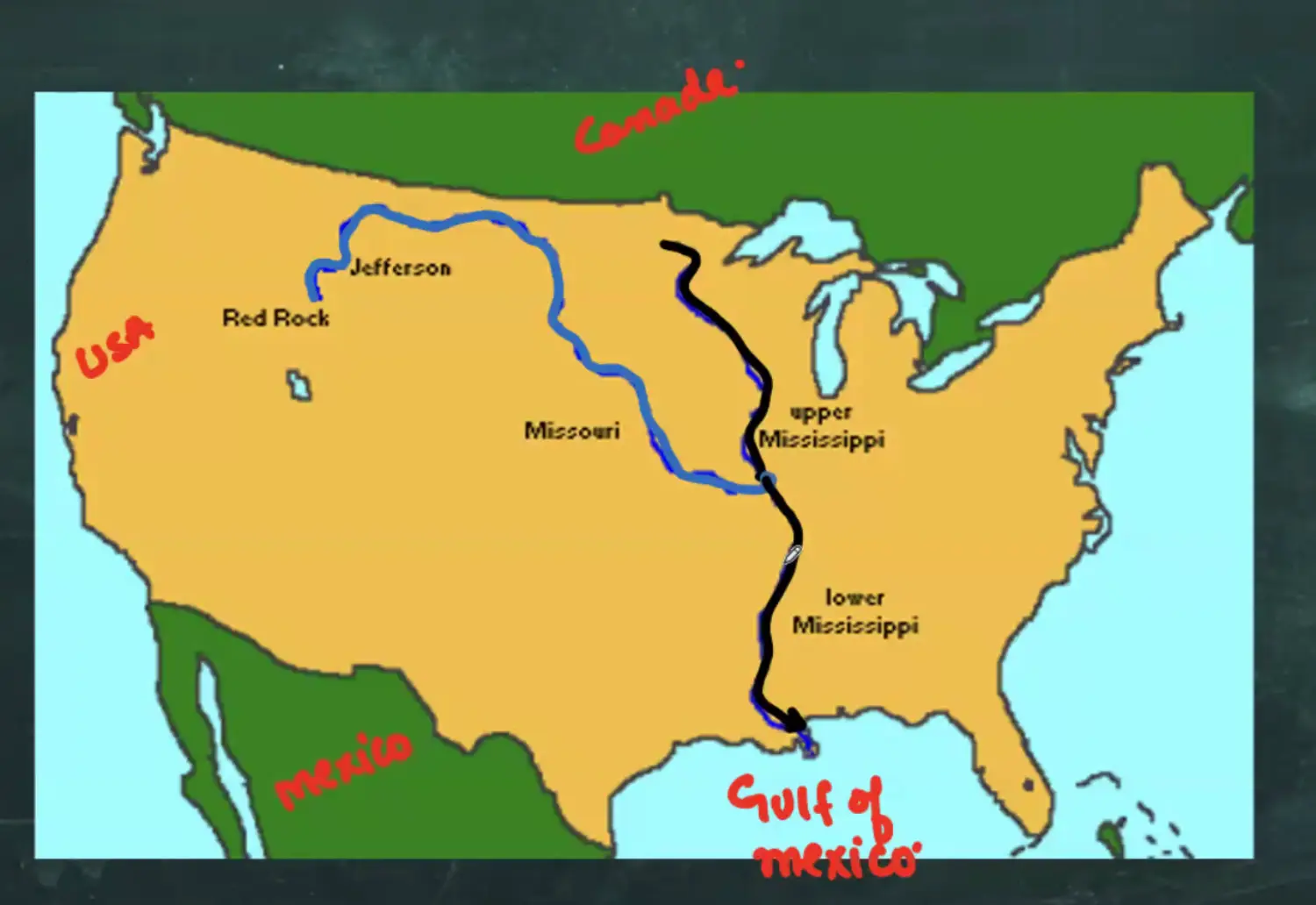
Mississippi & Missouri - Largest River System of America
Area : Gulf of Mexico | Place : New Orleans
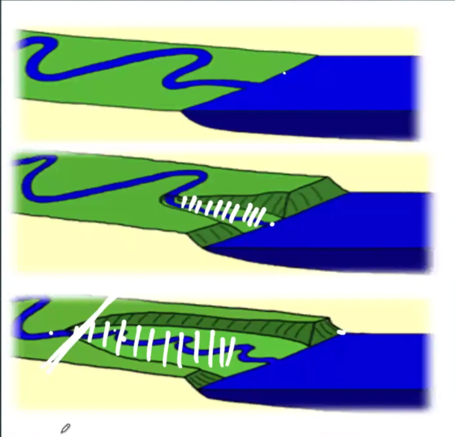
Estuarine Delta - Long and Narrow
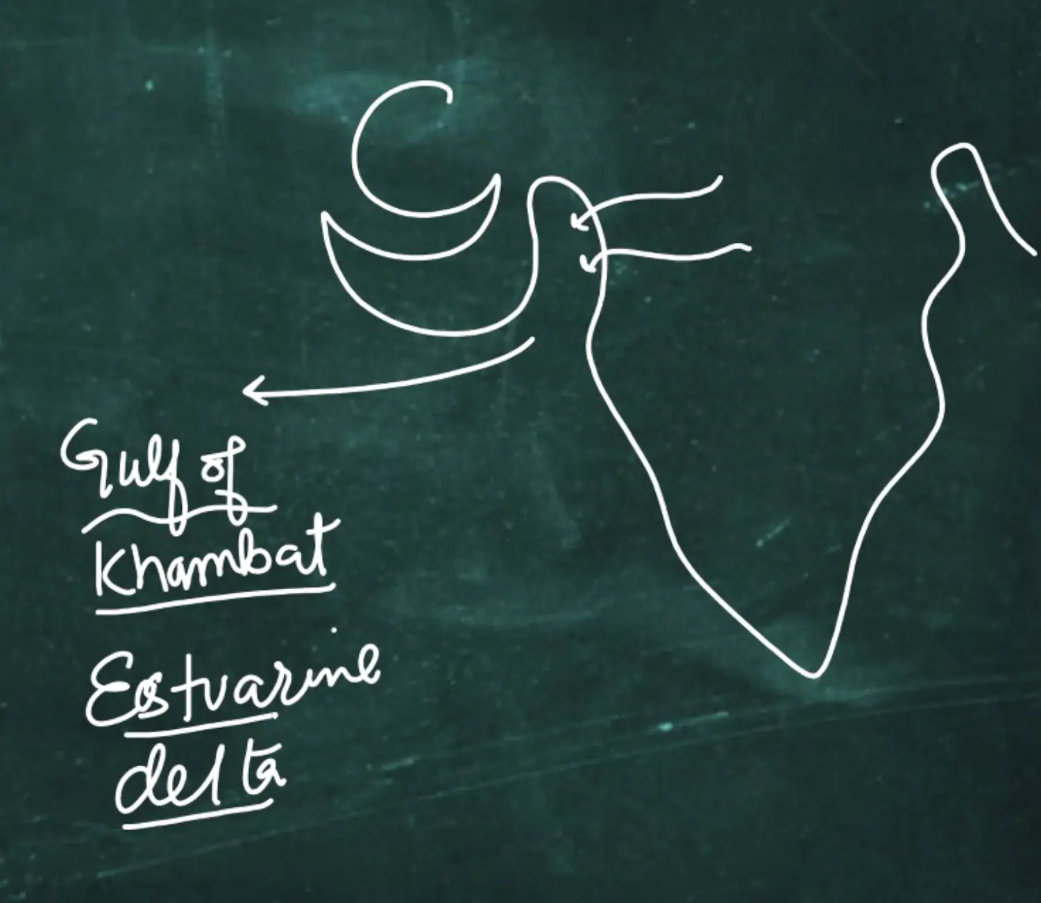
In India, In Gulf of Khambath, Narmada and Tapi make - Estuarine Delta - West Coast of India
Estuaries are Submerged mouths of River under Sea
Formation
- Filling of Estuaries of a River - Estuarine Delta
- Estuary - Mouth of River submerge under Sea Water
- Sub Merging of Mouth of River
- By Tectonic Activity
- By Sea Level Rise - Regression & Transgression
Diagram
- Example
India - Narmada Tapi
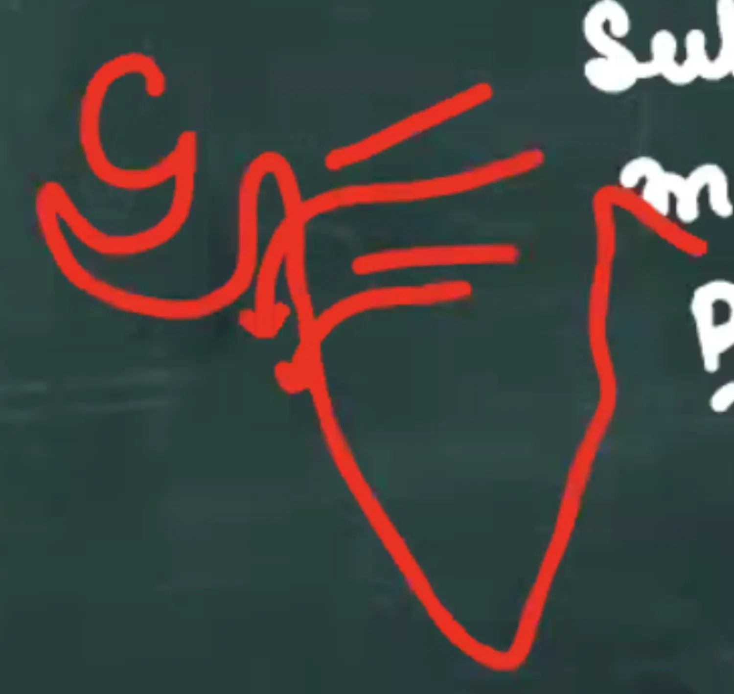
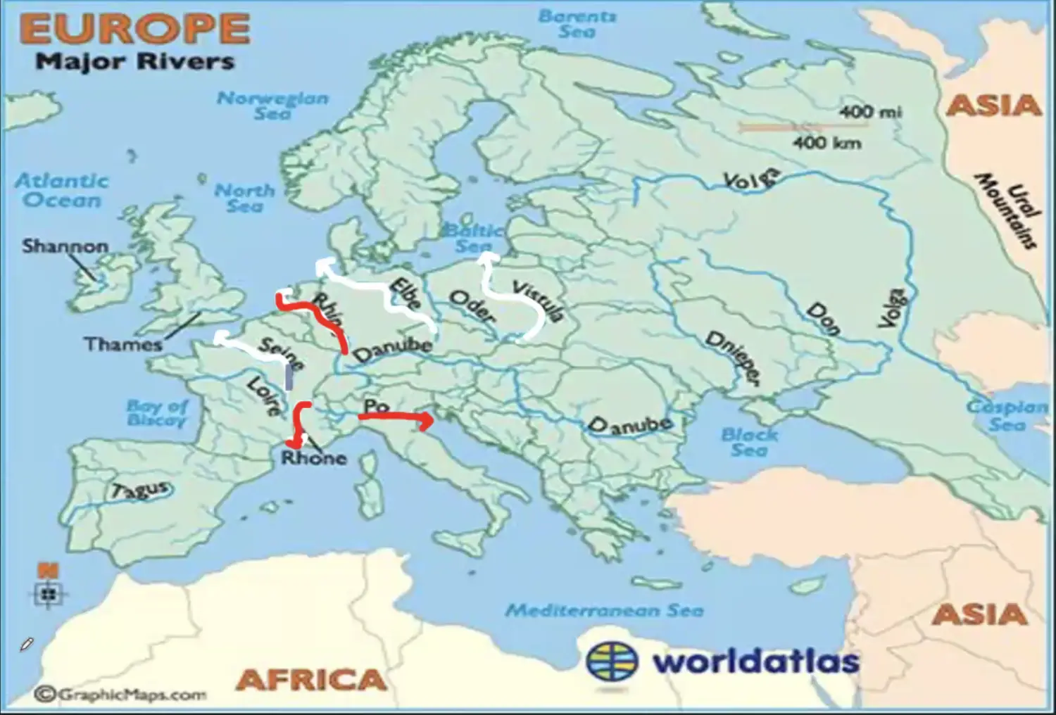
Europe - River Seine English Chennal, Elb North Sea, Oder, Vistuala baltic Sea
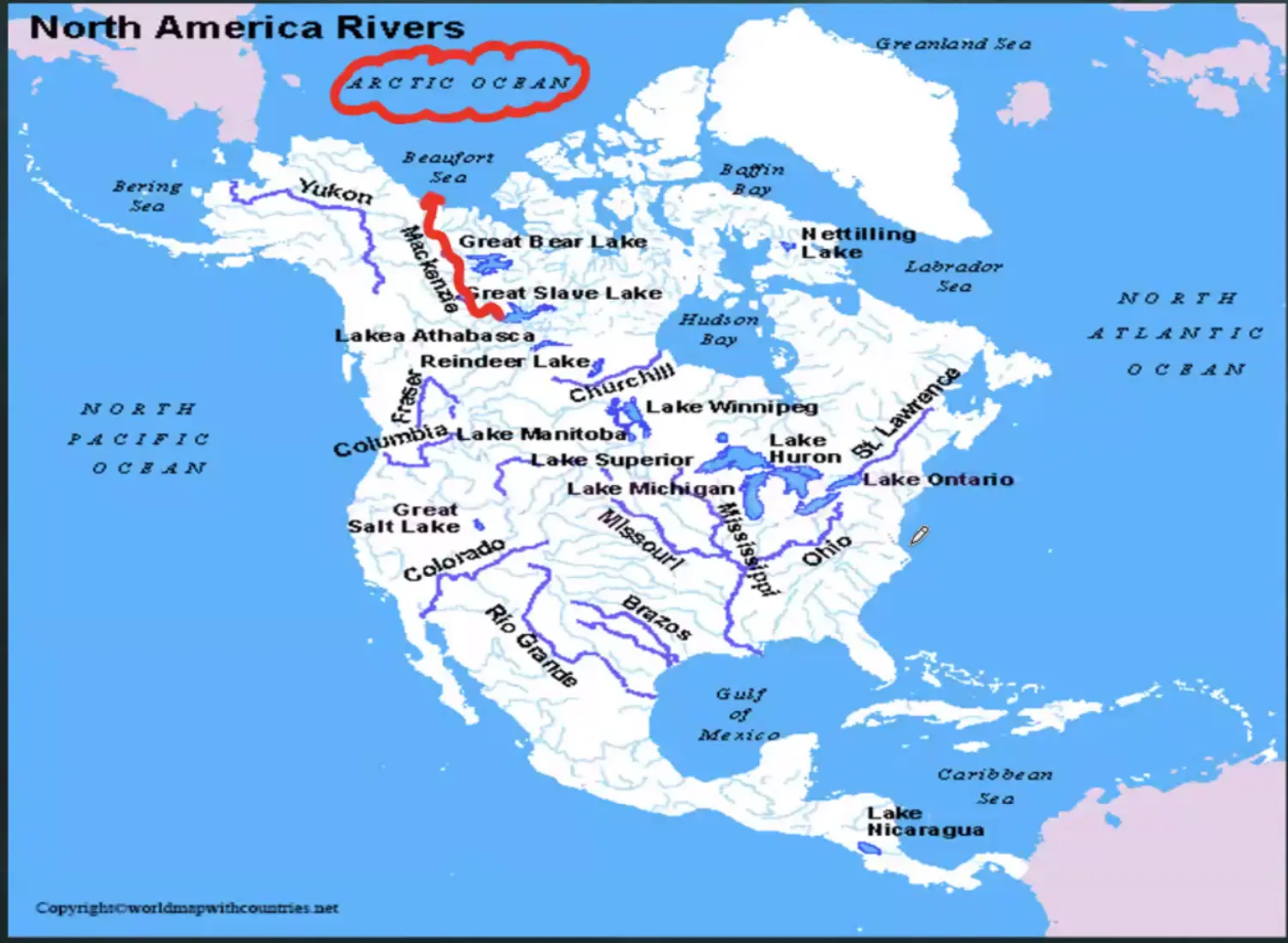
North America - Great Slave Lake Mackenzi - Beufort Sea in Arctix OCean
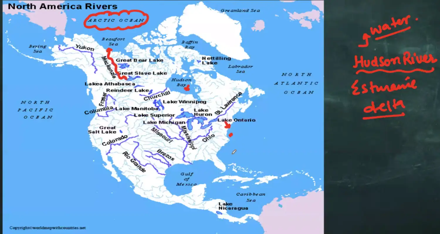
America - Hudson River
Diagram
Blocked Delta - No Growth Erosion More
Progradation Hampered
- More Erosion By Sea and Ocean
- Supply of Sediments Hampered - Decreased
- Climate Change
- Water Heat - Volume Increase - Velocity Double - Sediment Low
- Due to Catchment Area
- All regions from where river draws its water - Catchment Area
- During Dry - CA Inc During Flood - CA Dec
- Catchment Area Hamper
Ex canal or detour
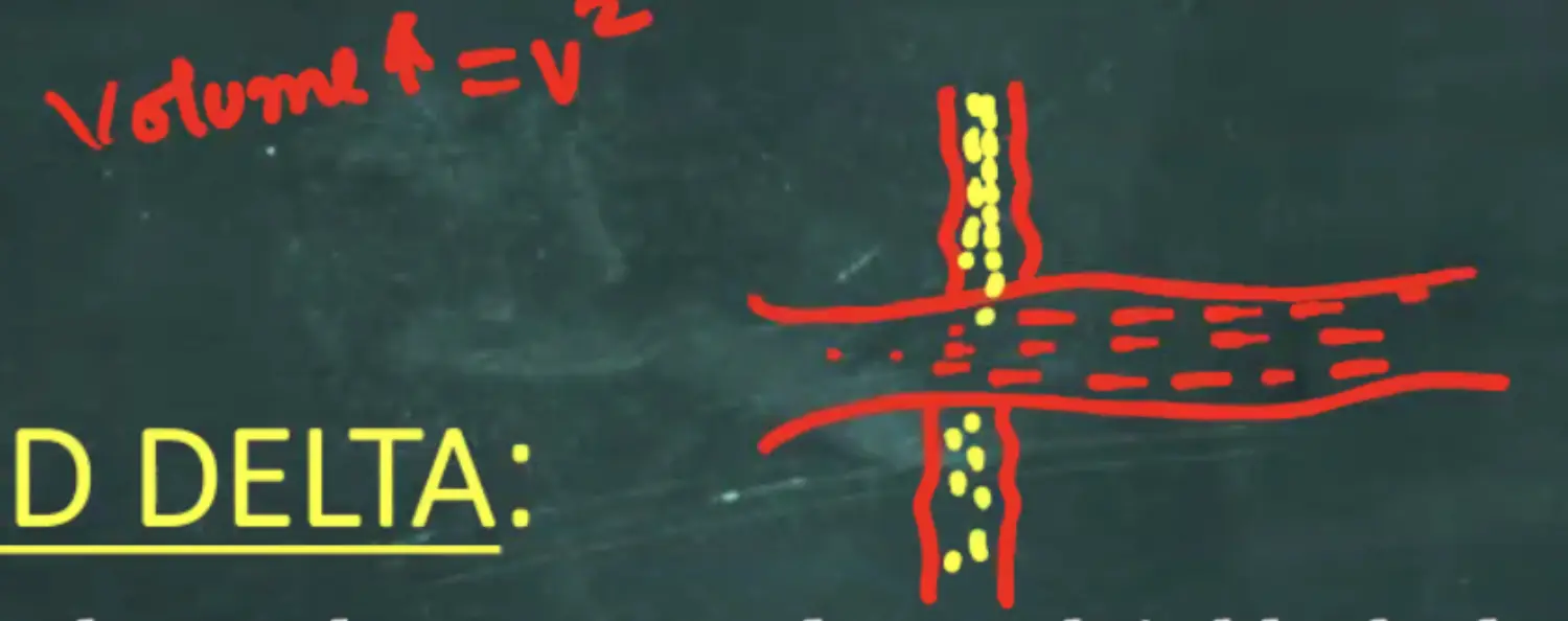
Dam
- Climate Change
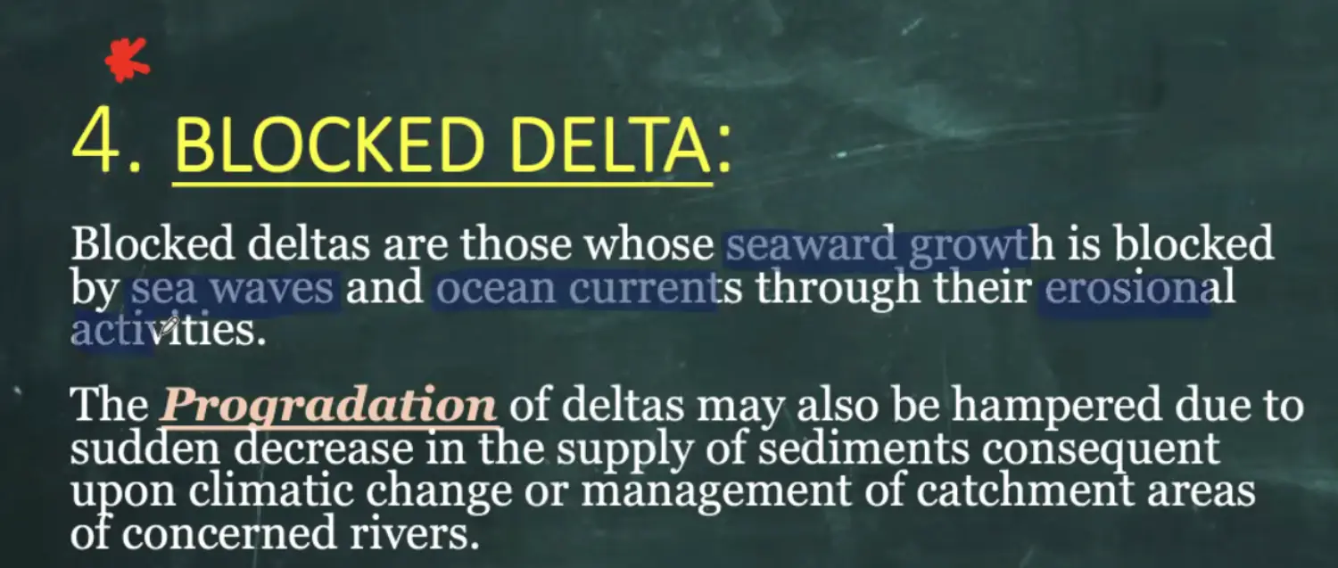
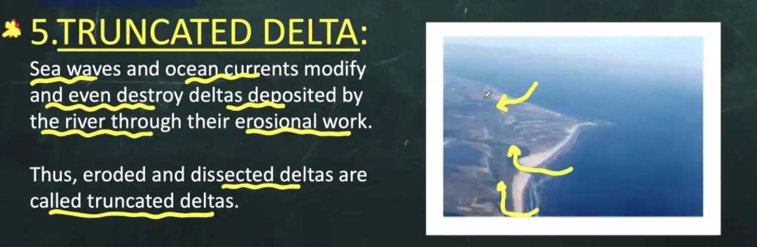
In Blocked - Absolutely No Progradation | In Truncated - Less Progradation Due to Erosion
Truncated Delta - Broken
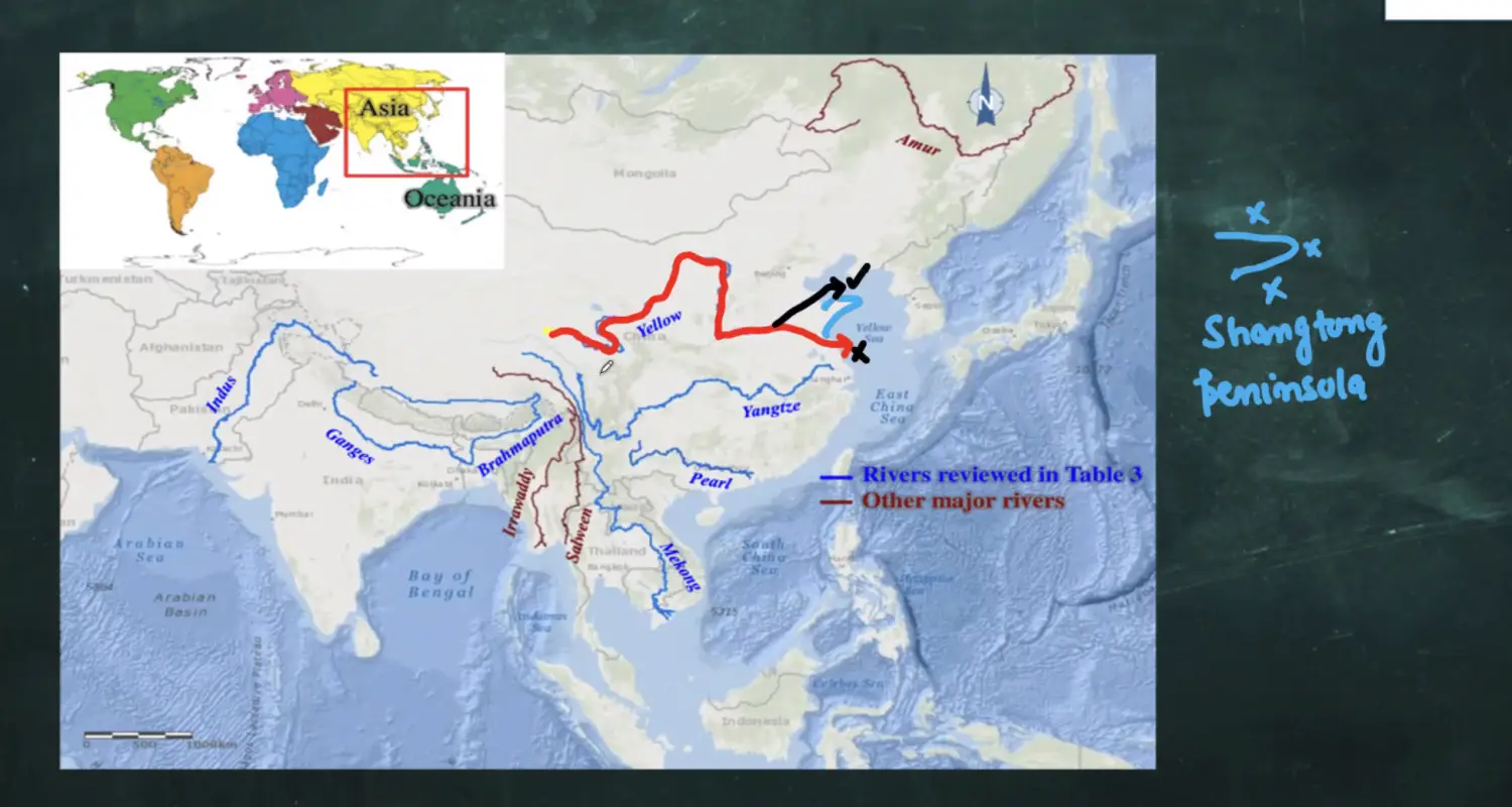
Abandoned Delta - River Can Change of Course ( Man Made, Meandering)
Example : Hwang He
Now in Gulf of Buahi - North
Earlier - South of Pensiual
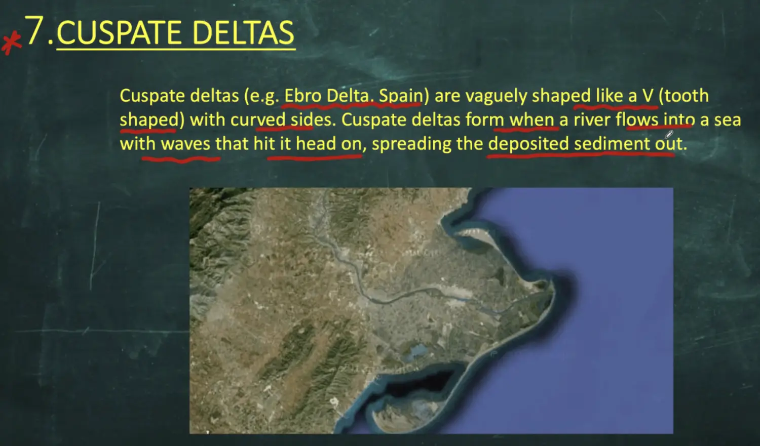
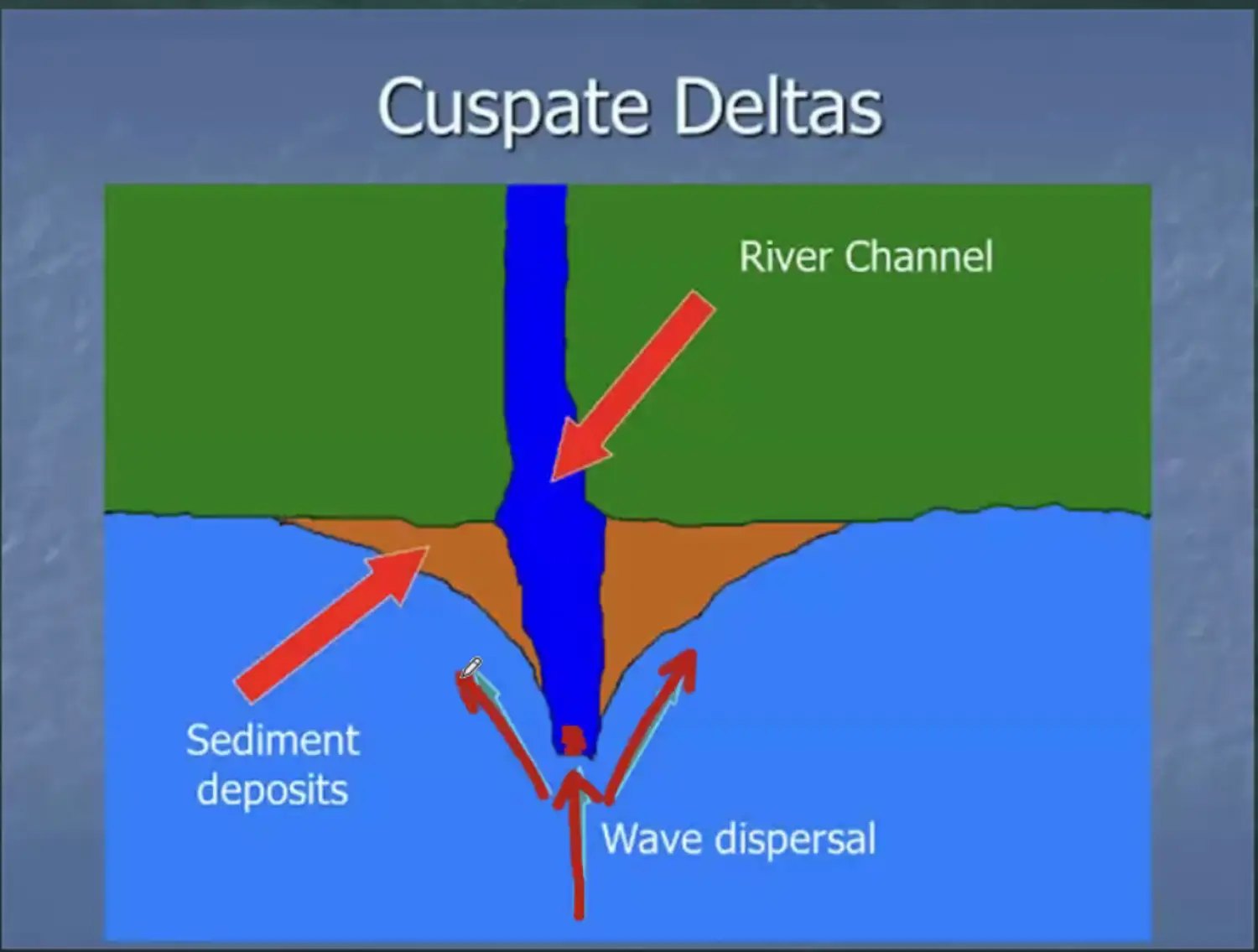
Cuspate Delta - Tooth Shape or Vague Letter “V” Shape
Exmaple
Formation
Types of Questions
In Mains Diect Question - Classfiication one line
Indian Geography - Why East has More Delta and west only one
Prelims - One Side name and Shape of Delta
- Exogenic Forces
Both are Helped by Gravity
Climatology
- Space & Universe
- Detailed Process of Big Bang
- Astronomical Distance Measurement
- Planet Earth
- Shape of Earth
- Movement of Earth
- Major Movements
- Revolution
- Intro
- If Earth was revolving in a “Vertical Non Tilted Axis”
- If earth was revolving on a “Tilted Axis”
- 4 Important Tilt Values
- Effects of a Tilted Axis
- Intro
- Effect 1
- Effect 2
- Effect 3
- Causes of Revolution
- What Would Happen if Earth would only revolve and not Rotate ?
- Solstices & Equinox
- Importance of Polar Circles
- Duration of Day & Night
- Final Summary
- Earth Tilted
- Earth Not Tilted
- Rotation
- Causes of Rotation
- Concept of Time
- Time Zone
- Day Light Saving Time
- What & How
- Demand for 2 Time Zones by NE States
- International Date Line
- Eclipse
- Solar Eclipse
- Lunar Eclipse
- Causes of Eclipse
- Revolution
- Minor Movements
- Obliquity
- Precision
- Eccentricity
- Effect of Minor Movements
- Major Movements
- Latitudes & Longitudes
Shape : Geoid
New Delhi : 28 N 77 E
Important Parallels of Latitude
Latitudinal Heat Zones of Earth
Arctic Circle
Tropic of Cancer
Equator
Tropic of Capricorn
Antarctic Circle
- Geographical Poles
- Equator
- Latitudes
- Longitudes
- Prime Meridian
- Duration of Day & Night
- Atmosphere
- Atmosphere
- Introduction
- Composition of Earths Atmosphere
- Water Vapour
- Dust Particles
- Structure (Region)
- WRT Chemical Composition
- Intro
- Troposphere
- Stratosphere & Stratopause
- Mesosphere
- Thermo-Pause & Thermosphere
- Exosphere
- Beyond Exosphere
- WRT Temperature
- Intro
- Factors Affecting Insolation
- Rotation of Earth Causing Day & Night
- Revolution of Earth on a Tilted Axis
- Different Latitudes Receiving Different Amount of Sunlight
- Transparency of Atmosphere affects Insolation
- Sun Spots
- Slope & Aspects
- Process Causing Heating of Atmosphere
- Intro
- Process of Heating
- Radiation
- Conduction
- Convection
- Advection
- Vertical Heat Budget
- Horizontal Heat Budget
- WRT Chemical Composition
- Atmosphere
- Weather & Climate
Difference b/w Weather & Climate
Elements of Weather & Climate (7)
- Temperature (Atmospheric)
- Intro
- Definition
- Importance
- Factors Affecting Temperature
- Latitude
- Altitude
- Continentality
- Maritime Effect
- Ocean Currents
- Air Masses
- Slope Shelter & Aspect
- Natural Vegetation
- Types of Surfaces
- Representation of Temperature
- Latitudinal Heat Balance
- Intro
- Bending & Key Rules
- Which Season Bending is More
- Temperature Range
- Diurnal Range
- Annual Range
- Inversions
- Temperature Inversion
- Types of Temperature Inversion
- Radiation Inversion
- Valley Inversion
- Marine Inversion
- Frontal Inversion
- Temperature Inversion
- Pressure & Winds
- Atmospheric Pressure
- Concept of HP & LP
- How HP & LP Conditions are generated in the Atmosphere
- Intro
- What is Wind
- Explanations
- Pressure Gradient
- Relation Between Isobar Spacing, Wind Speed & Strength
- Relation Between Isobars & Pressure Gradient
- Factors Affecting Winds
- Driving Force
- Steering Force
- Coriolis Force
- Intro
- Movement of Different Latitudes Place on Earth
- Characteristics of Coriolis Force
- Frictional Force
- Centrifugal & Centripetal Force
- Coriolis Force
- Winds on Earth Surface
Basic Concepts
Low Pressure Condition
HI - Horizontally Inward
VO - Vertically Outward
High Pressure Condition
HO - Horizontally Outward
VI - Vertically Inward
Non Rotating Earth - Imaginary Situation
Rotating Earth - Real Situation
Atmospheric Movement b/w → (Surface & Upper Atmosphere) & (Equator to Pole)
TriCellular Model - Hadley, Ferrel & Polar Cell
Outcome of Tri-Cellular Model on Earth
Naming of Planetary Surface Winds
- 0 to 30 Lat = Tropical Zone
- Btw 00 to 30 Lat - Easterly Winds
- Btw 30 to 60 Lat - Westerly Winds
- Btw 60 to 90 Lat - Easterly Wind
Shifting of Pressure Belts & Hence Shifting of Planetary Winds
- March June - North Ward
- June Sep - South Ward
- Sep Dec - Southward Further
- Dec March - North Wards
Formation of Pressure Cells & Breaking of Pressure Belts
- Summer Phenomenon
- Winter Phenomenon
- Effect
Analogy of Winds & Rivers
- Types of Winds
- Planetary Surface Winds
- Tropical Easterlies
- Westerlies Winds
- Polar Easterlies
- Tertiary Winds & Characteristics
- Created By
- Land & Dea Breeze
- Mountain and Valley Winds
- Cold and Warm Winds
- Created By
- Upper Atmospheric Winds
- GeoStrophic Winds
- Rossby Waves
- Jet Streams
- Polar Night Jet Streams
- Polar Frontal Jet Streams
- Sub Tropical Westerly Jet
- Tropical Easterly Jet Stream
- Small Jet
- GeoStrophic Winds
- Secondary Winds
- Intro
- Whirlpool & Vortex
- LP Region (Cyclonic)
- HP Region ( Anti Cyclonic)
- Atmospheric
Monsoon
Other Oscillation in Different Oceans
- Southern Pacific - El Nino / El Nina
- North Pacific - Madoki
- Planetary Surface Winds
- Humidity
- Various Ways of Measuring Humidity
- Absolute Humidity
- Relative Humidity
- Specific Humidity
- Moisture Holding Capacity
- Condensation
- Intro
- Conditions for Condensation
- Various Ways of Measuring Humidity
- Clouds
Intro
Classification of Clouds in the Basis of
- Heights of Clouds on Earth Surface
- Cirrus - 12K-8K Mt High
- Alto - 8K-2K Mt High
- Stratus - < 2K Mt High
- Expanse
- Cumulus - Vertical
- No Word - Mixed
- Stratus 0 Horizontal Cloud
- Rain Ness / Rain Bearing Capacity
- Nimbus - High Rain Capacity
- Heights of Clouds on Earth Surface
Four Major Cloud Groups
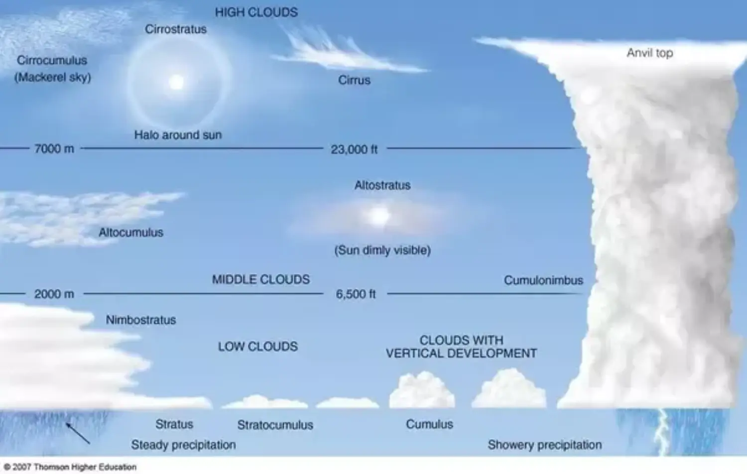
- High Clouds
- Cirrus ( High Clouds )
- Cirro Stratus ( Halo Sun )
- Cirrocumulus ( Mackerel Sky)
- Middle Clouds
- Alto Stratus
- Alto Cumulus
- Low Clouds
- Stratus
- Stratocumulus
- NimboStratus
- Clouds with Vertical Development
- Cumulus ( Fair Weather Cloud)
- Cumulonimbus ( Steady Precipitation )
- Thunder Shower Cloud with Anvil Top (Showery Precipitation)
- High Clouds
Effect of High & Low Cloud
Clouds above Tropopause
- Precipitation
- Intro
- Forms/Types of Precipitation
- Rain
- Snow
- Hail Sleet
- Sleet Formation
- Hail Formation
- Process Causing Precipitation
- Types of Rain (Precipitation)
- Convection
- Orographic Rain
- Cyclonic Rise
- Cloud Swelling
- Rain Fall Distribution of Earth
- General
- On Basis of Precipitation
- Par Humid (>200cm)
- Humid Region (100-200cm)
- Semi Arid Region (50-100cm)
- Arid Region (<50 cm)
- Sunshine
- Visibility
- Temperature (Atmospheric)
Important Concepts wrt Cyclones
- Doldrums
- Thermal Equator
- ITCZ
Tropical Cyclones
- Cyclonic Conditions
- General Characteristic
- Formation of Cyclones
- Naming of Cyclones
- Reasons of Maximum Cyclones in Northern Indian Ocean Region
- Why More Tropical Cyclones in BOB
- Speed & Type of Cyclones
- Indian Regions Affected by Cyclones
- Disturbances by Cyclones
- Micro
- Meso
- Macro
Tornado
- Formation of Tornado
- Water Sprouts
- Thunderstorms
- Lightening & Thunder
- Cloud Burst
- Flash Floods
Monsoon - The Phenomenon
- Regions of Monsoon
- Broad Factors Affecting Monsoon
- Land
- Ocean
- Upper Atmosphere Winds
- Surface Winds
- Phenomenon Taking Place outside Monsoon Region
- Specific Factors Affecting Monsoon
- land ans Sea Breeze on a Larger Scale ( Local Wind)
- Role of Tropical Easterlies (Planetary Global Winds)
- Role of ITCZ
- Role of Upper Atmosphere Winds ( Jet Stream)
- Role of Himalayas and Tibetan Plateau
- Role of Somali Jet Streams
- Role of Phenomenon - El Nino & IOD
Oceanography
- Southern Pacific Oscillations
- El Nino - Warm Phase
- La Nina - Cold Phase
- Enso So
- SO Index, SOI
- Walker Circulation
- Three Phases of Oscillations
- Normal Years - Normal Phase
- Intro
- Process
- Outcomes
- Cold Water in Tropical South American Coast
- Upwelling(Tropical Western SA Coast), Nutrient Availability, Good Fish Catch
- Warm Water Accumulation on Tropical Australian Coast
- Creation of Counter Equatorial Current un Equator Region
- La Nina - La Nina (Cold Phase)(in 7 to 8 Years)
- Outcome
- More Upwelling of Colder Deeper Water
- More Nutrients → More Fish Availability & Better Fish Catch than Normal Years
- Outcome
- El Nino - El Nino (Warm Phase)(in 2 to 5 Years)(Nov Dec)
- Broad Outcomes
- Eastward Flow of Water from Australia to Peru
- Cooler Water Australian Coast
- Warmer Water Peruvian South American Coast
- in Opposition ti Trade Wind Effect
- Peruvian Cold Current is Also not allowed ti reach tropical south American Coast
- Poor Fish Catch at Peruvian Coast because No Upwelling
- Broad Outcomes
- Normal Years - Normal Phase