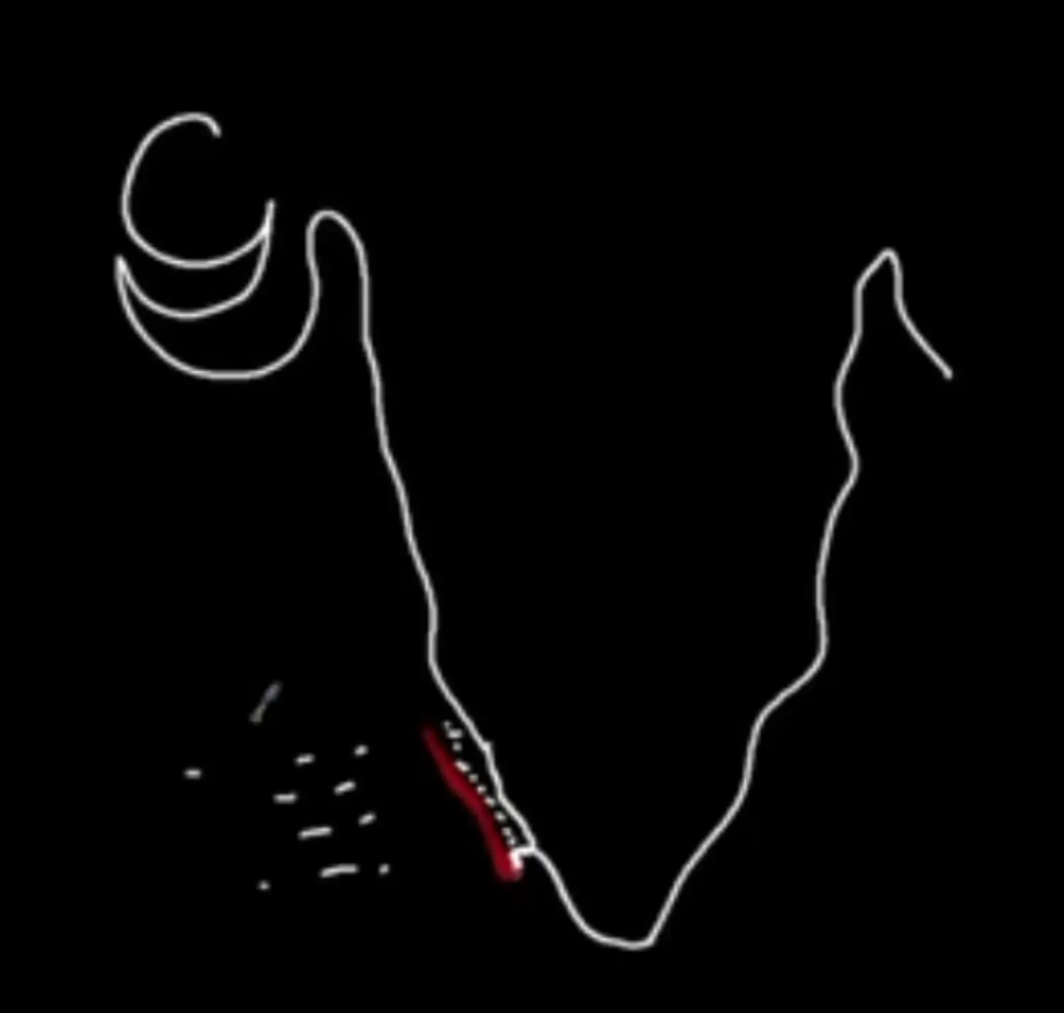
1 Physiography - Study of Physical Features of India
Indian Geography
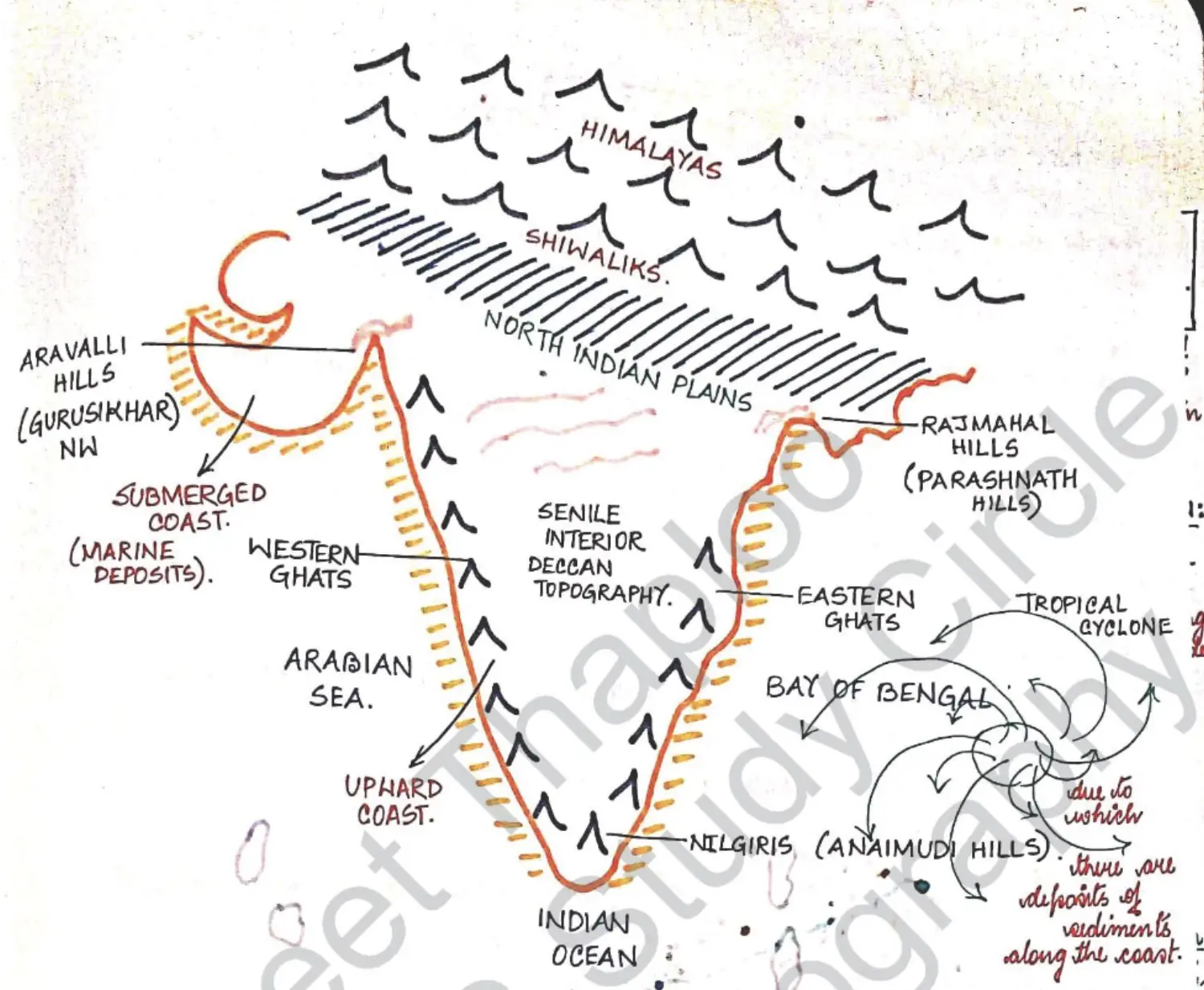
Image of Indian Physiography
1 Northern Mountain System
Introduction Data
Formation of Himalayas
Geosyncline Theory : Hall and Dana
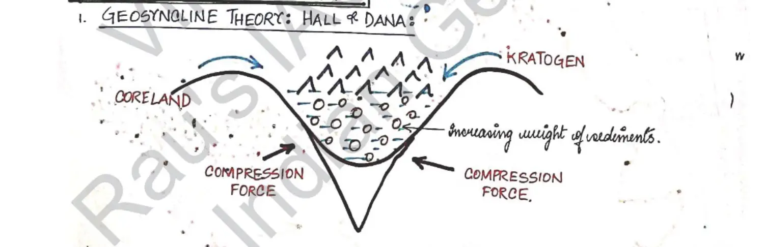
- Background of Theory
- Very Old Theory
- Actually Wrong
- Geo Earth
- Syncline Depression
- Drawbacks of Theory
- Weight of Sediments cannot be enough into Contraction of Moutains as Lofty as Himalayas
- As Present there is no Geosyncline, then how Himalayas are Growing
- Assumption of Theory
- Believed that there was a Huge Depression
- Water & Sediment Drip
- Sides Compress and Contract
- Geosyncline Infllining
- Water Moves Out by Compression Force
- Time Taken Million of Year
- Sediments Remains
- Background of Theory
Plate Tectonics : John Tojo Willson
- Meta Terms
- Abduction / Obduction : Oceaninc Plate Trapped between Two Plates
- Why is Oceanic Plate Denser : It is made up of Maphic Minerals → Mg, Ferrous, Basalt Constituent
- Subduction Angle
- 45 Degree → Average Angle of Subduction
45 Degrees → Steep Slab Subdcution - Reaches Asthenosphere
- Accretion Zone is called Benioff Wendatti Zone
- Process of Plate Tectonics for Himalayas
Abduction of Tethys Plate between Indian & Eurasian Plate
Before Indian Continental Plate could Interact with Tethys Plate, It Intreacts with Eurasian Plate
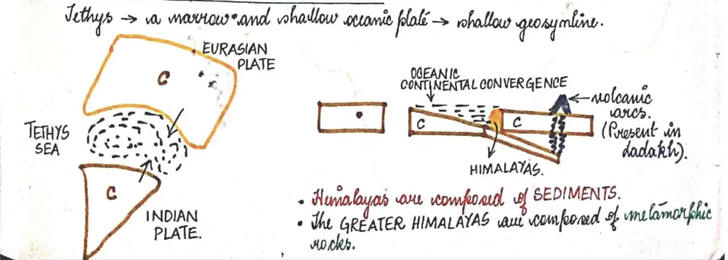
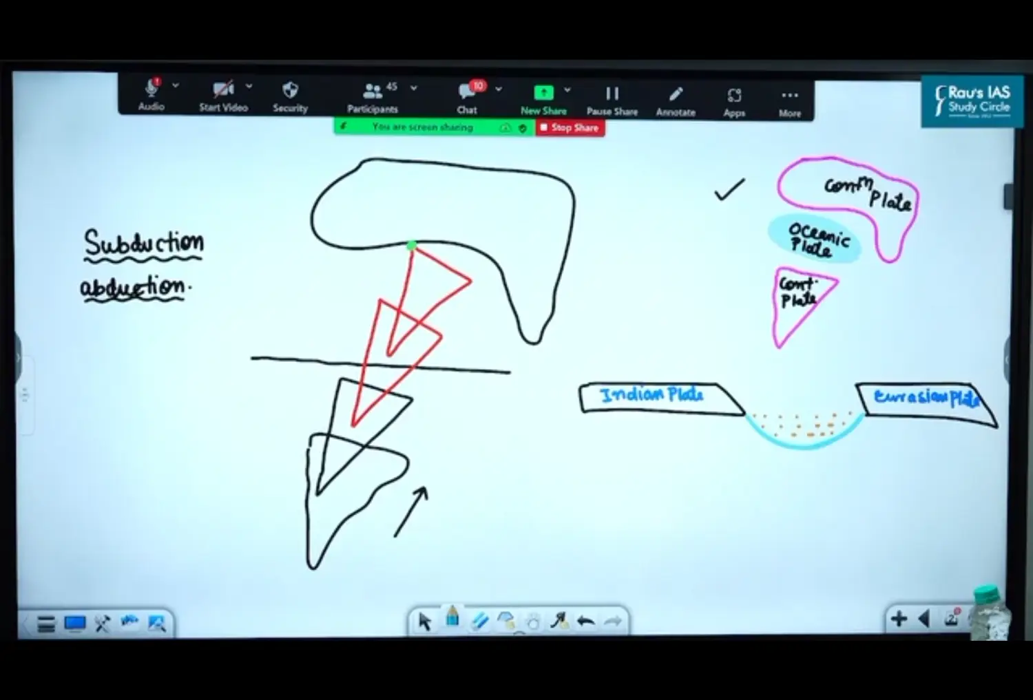
Tethys Oceanic Plate Subducts Below Eurasian Continental Plate
Leads to Accretion on the margins of Eurasian Plate
Leads to Formation of Volcano in Eurasian Plate (in Tibet Region) → Due to Subduction of Tethys Below Eurasian, at this time even Himalayas werent formed
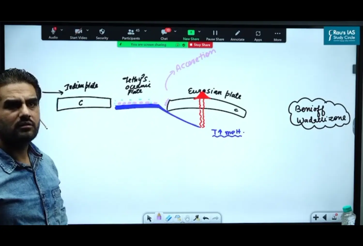
Tethys Plate Completely Subducts under Eurasian Plate(C) and Melts due to High Temperature of Asthenosphere
As and when Tethys(O) plate subducts, Indian(C) Plate keeps coming towards Eurasian Plate
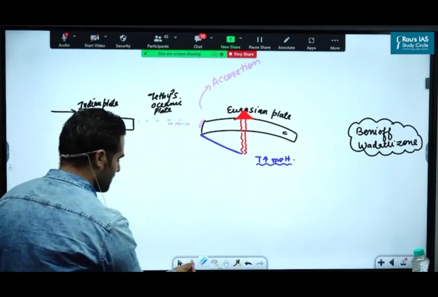
Leads to Convergence between Indian (C) && Eurasian (C) Plate
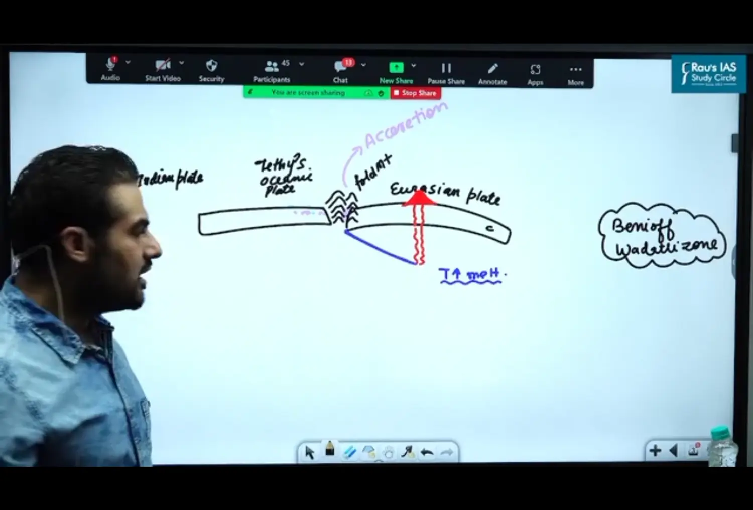
Hence Summarising
When Stidyign Himalayas, there are rocks with Marine Sediments → Giving Proof of existence of Tethys Plate
Indo Tsangpo Suture Zone : Place where Indian Plate and Eurasian Plane
Western Margin Interacted first with Eurasian Plate
Western Coastline
Southern Coastline - Emerged
Kerala Karnataka - No Such Resources
Highest Peak of Wetsern Ghats - Anaimudi
Northern Coastline - Submerged
Gulf of Khambat - Rich Oil Resources
Eastern Coastline
Submerged
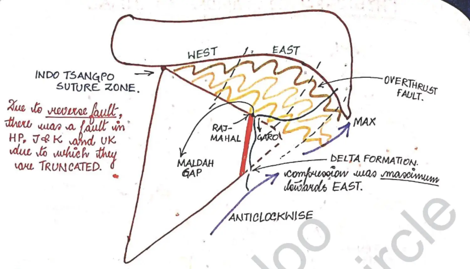
Compressional Force Towards East - Leading to Lofty Mountain in Nepal Side and Not in J&K
- Meta Terms
Aravali's
Orientation is from → South West to North East
More Lofty in → South West
Haryana Delhi Denuded → North East
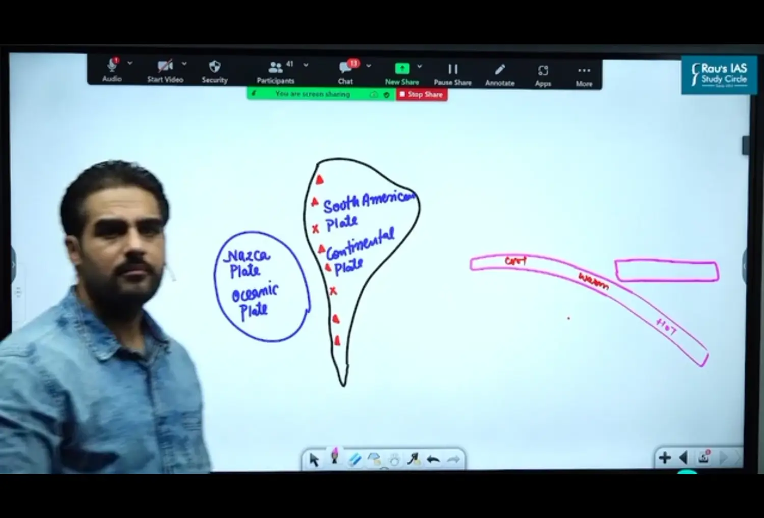
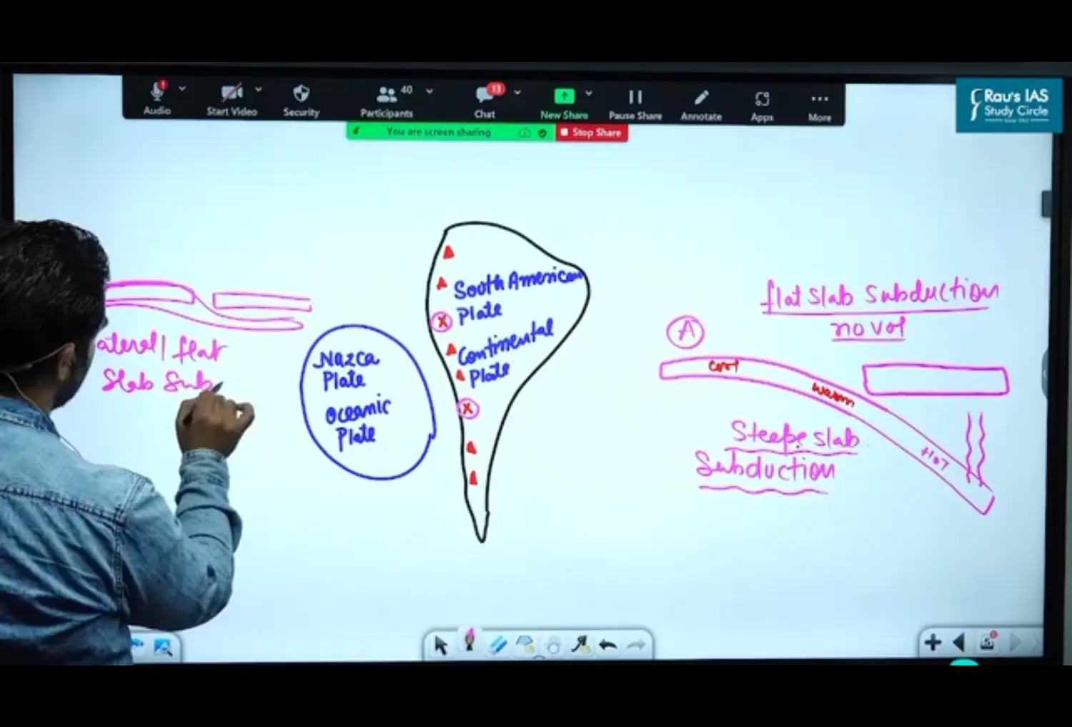
Is it necessary that when oceanic and continental plates subducts, there will always be formation of Volcano ?
No its not Necessary
Concept of
- Lateral / Flat Slab Subduction
- Stepe Slab Subduction → > 45Degree
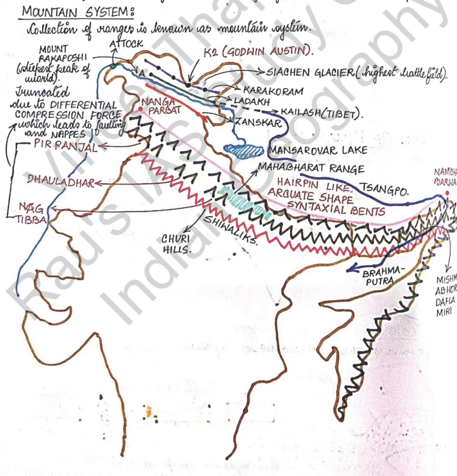
Mountain System of India - General
Diagram of Indian Himalayan System
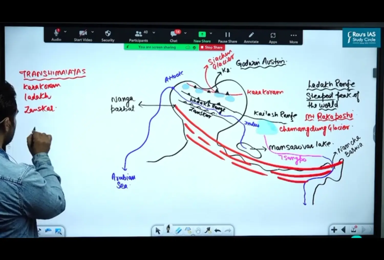
Trans (Beyond) Himalayas Range - Beyond Himalayas
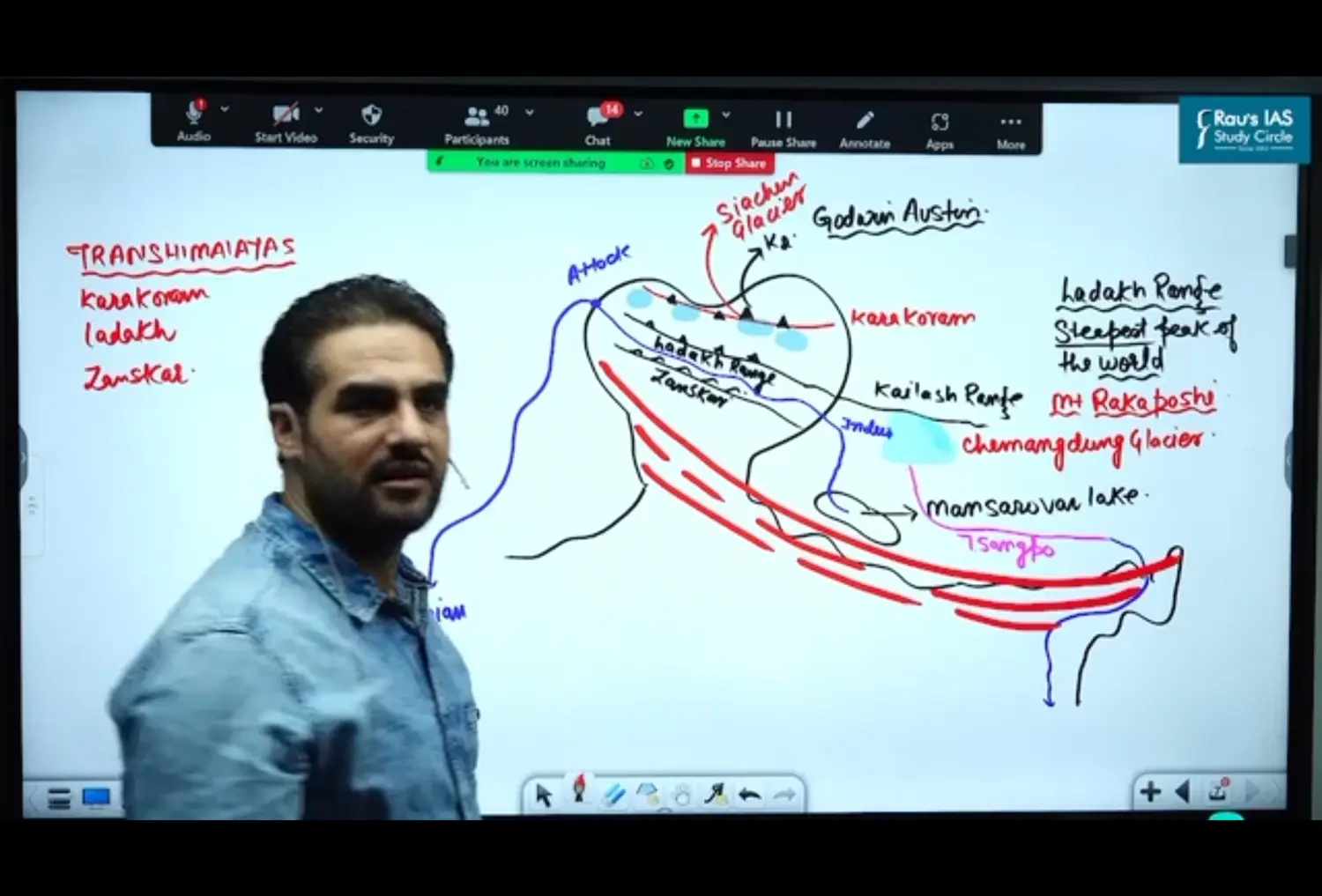
West of Pamir Knot
Hindukush
Afghanistan
Pakistan
and Then Iran
East of Pamir Knot 👇
From North to South
Karakoram Range
- Peaks
- K2 Peak
- It is in Pakistan Occupied Kashmir
- It is the Highest Peak in these Ranges
- Second Highest in the World
- Highest Peak of India is K2
- Sadhal Peak
- Goshal Bham Peak
- Hashal Bham Peak
- K2 Peak
- Glaciers
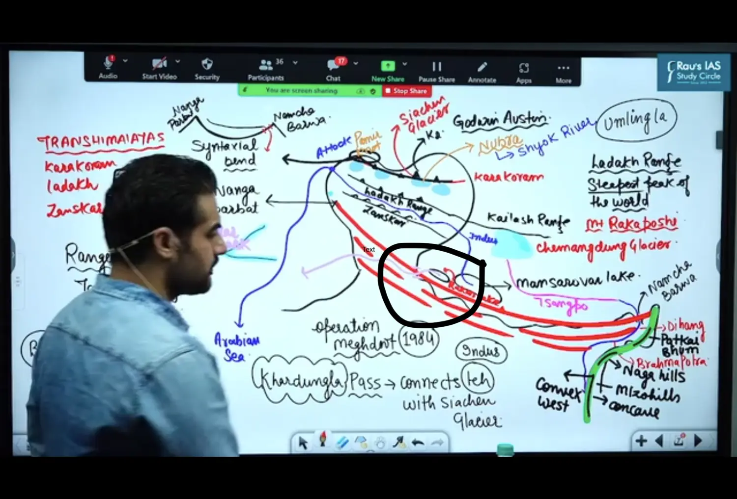
- Siachin Glacier
- Largest Glacier beyond Sub Polar and Polar Regions
- It is also the Highest Glacier of the World
- It is Source of River Nubra which is a Tributary of Shyok River
- India Developed Control over Siachen Glacier through Operation Meghdoot
- It is also the Highest Battlefield of the World
- Amount Spent on Maintaining Army here is Approximately more than 4 Crore per Day
- Rimo
- Hisper
- Baltoro Glacier
- Siachin Glacier
- Basic Facts
- Karakoram Range Originats from Pamir Knot
- Karakoram Mountain is also called as Krishnagiri
- It forms Indias Frontier with
- China
- Turkmenistan
- Afghanistan
- Pakistan
- Karakoram Pass
Connects POK with China
It is an Old Silk Route
Silk Route was used to Export Silk from China to
- India
- West Asia
- Europe
- Peaks
Ladakh Range
- Extension of Ladakh Range Towards China/Tibet : Kailash Range
- Mount Rakaposhi
- Highest Peak of Ladakh Range
- Ladakh Range is steepest peak of the world
- Khardung La Pass
- Khardung La Pass connects Leh with Siachen Glacier
- These Pass is maintained by BRO - Border Road Organisation
- It is maintained by Project Himank
- It has the Highest Motorable Road in the World
- Umling La
- Its a Strategic Pass
- Higher Than Khardung La
- Not Open for Civilians
- It is only for Civilians
- Eastern Most Village of Ladakh with China
- Leh
- In Ladakh there is a City called Leh
- Leh lies on the banks of River Indus
- Chatar Pass on Frozen Zanskar and Indus
- Hydroelectric Power Plant Present
- From Mansarovar Lake in Tibet
- River Indus Originates
- Travels Westward
- Creates Gorge
- Flows between Ladakh & Zanskar Range
- Forms a Gorge here in Attock
- Enters Pakistan
- Flows through Plains of Pakistan
- Goes into Arabian Sea
- Through which Countries do India Flow
- India
- UT of Ladkah
- China
- Pakistan
- Attock
- India
Zanskar Range
Kailash Range
Chimag Dung Glacier
From Here - Brahmaputra Originates
Called Tsangpo in Tibet
Creates a Gorge (Gaddha)→ Dihang Gorge
Enters India Through Arunachal Pradesh called Dihang
From Dibru to Sadiya in Assam → called Brahmputra
Why does Brahmpautra take a U Turn in Namcha Barwa
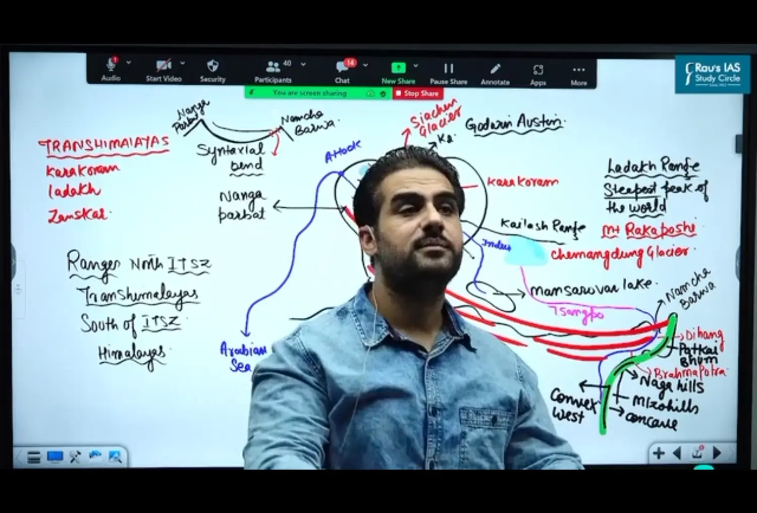
It is due to Syntaxial Bend
Indo Tsangapo Suture Zone - North & South
North - Trans Himalayas
in Between - Indus Tsangpo Suture Zone
South - Himalayas
Mountain System of India - Himalayan Range
Facts and Concepts
Diagram of Himalayan Range
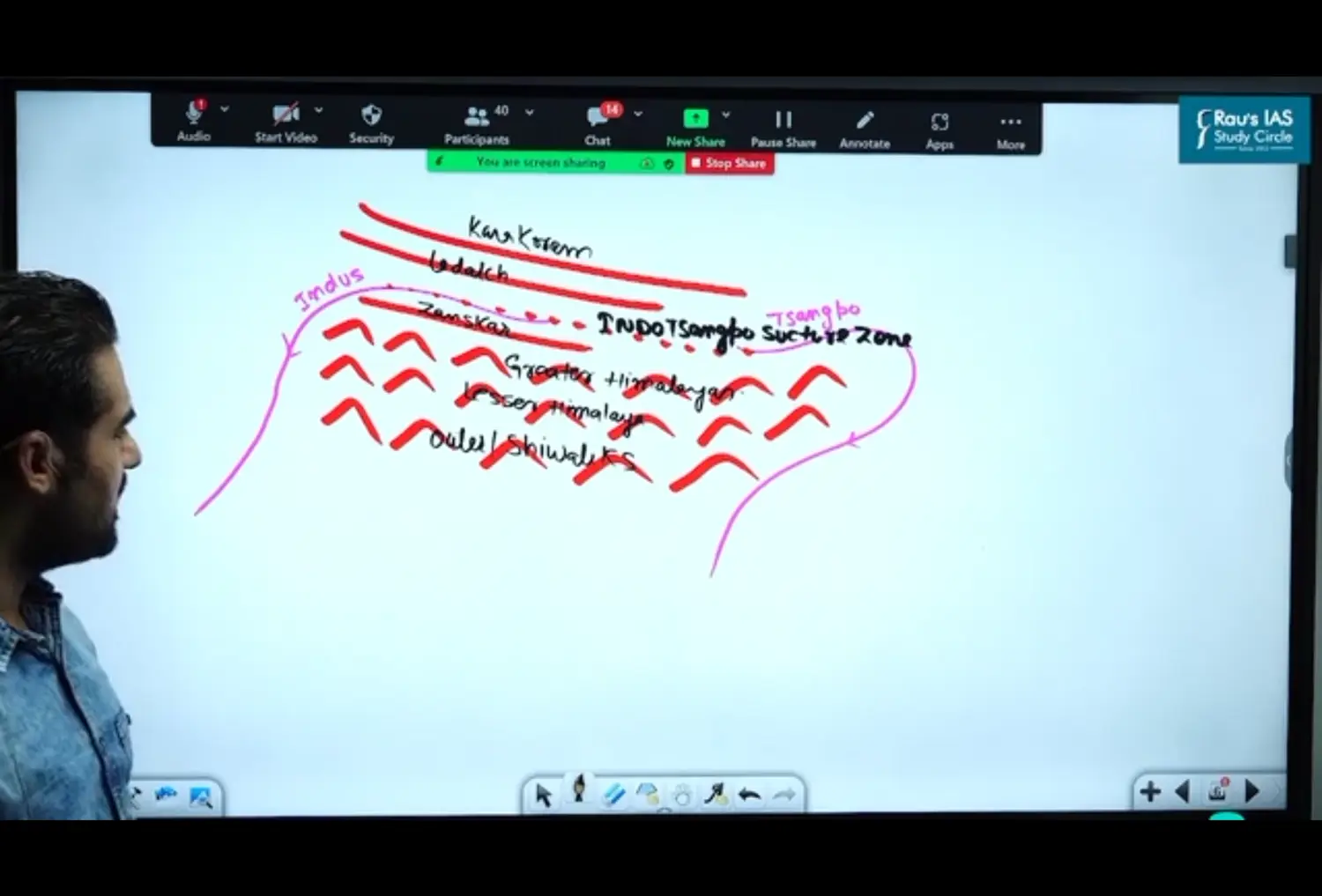
Himalayas Lie Between
Indus and Tsangpo
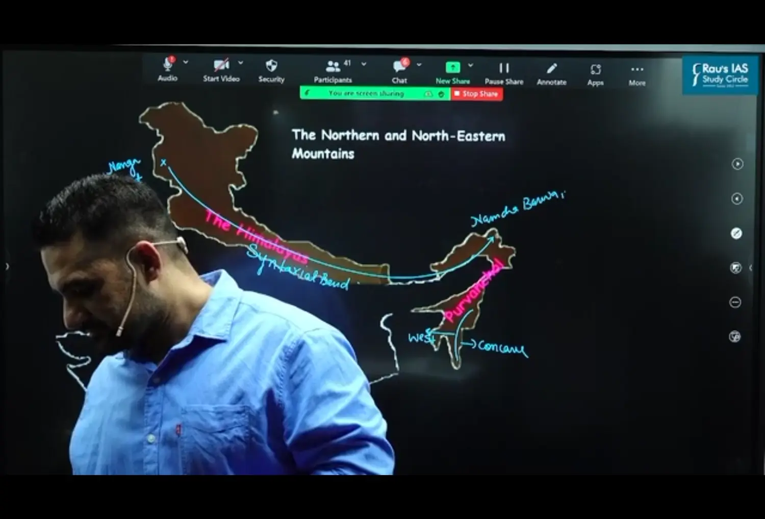
Syntaxial Bend of Himalayas
- Over All Shape of Himalayas - Hairpin Like Structure → Syntaxil Bend
- Entire Shape of Himalayan Region is called Syntaxial Bend
- Bends in Syntactical Bend
- Bend of North Western Axis - Nanga Parwat
- Bend of North Eastern Axis - Namcha Barwa
Himalayan Range - Spacing
- Western - Clearly Defined
- Eastern - Clubbed and All Regions are Joining towards Each Other
Southward Turn of Himalayas
- Due to Eurasian Plate
- This Southward Turn is called Purvanchal
- Parts of Purvanchal
- WB - Patkai Boom
- Nagaland - Naga Hill
- Mizoram - Mizo Hills
- Barel Ranges
- These 3 Shape
West - Convex
East - Concave
Slope of Himalayas
Southern Slopes of Himalayas are steeper since force of Compression originate in the South
From North to South
Greater Himalayas - Oldest - Metamorphic Rocks - Higher Himalayas or Himadri
Diagram of Greater Himalayas
Extent of Greater Himalayas
- West - Nanga Parbat
- East - Namcha Barwa
Question on Himalayas are made up of which Rocks ?
Not only Himalayas, but any Rocks is made up of Sediments
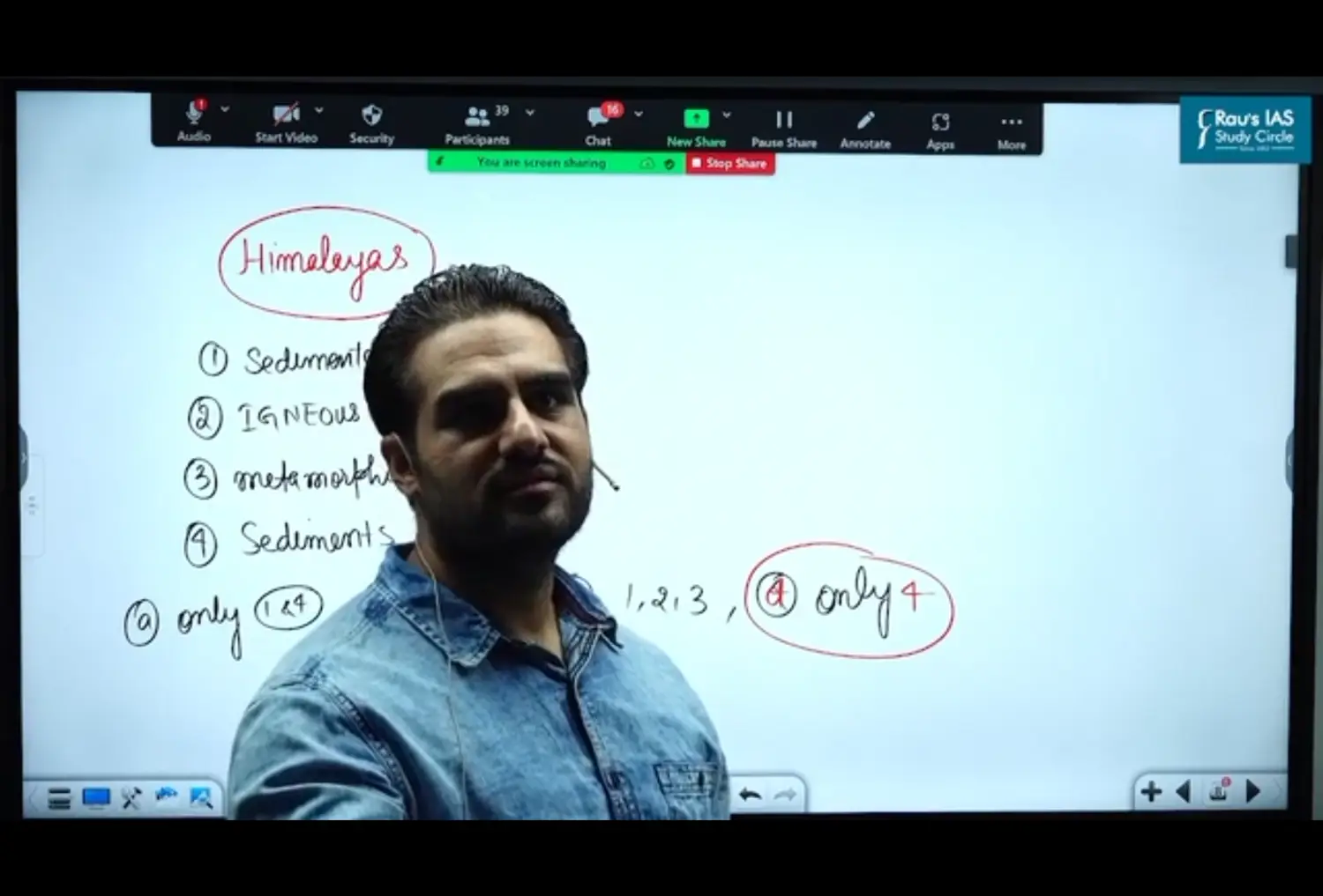
What Type of Rocks are there ?
- Greater Himalayas - Metamorphic Rocks
- Lesser Himalayas - Metamorphic Rocks
- Shiwaliks - Sedimentary Rocks
Important Passes of Greater Himalayas - In Sequence from North to South
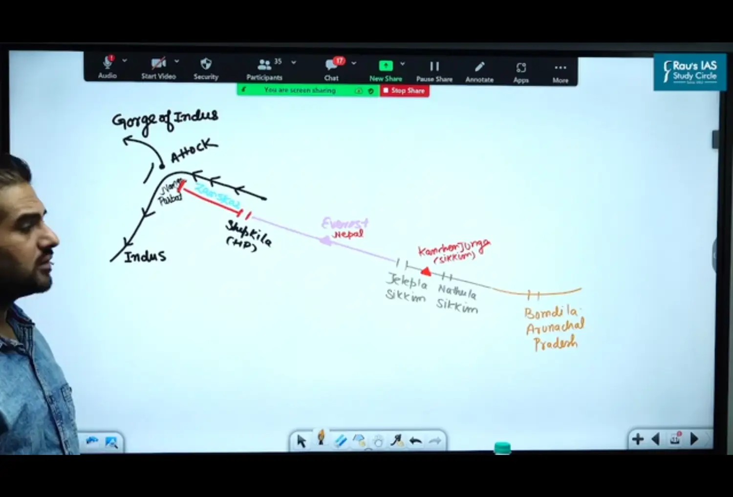
Shipki La Pass
- Gorge of Indus is made at Attock in Pakistan
- Next to Mansarovar Lake - Rakas Lake → River Sutlej Originates
- Flows North
- Sutlej Enters into India → at Shipki La Pass at Greater Himalayas
- Shipki La Pass → Road → Shimle to Tibet (Lhasa)
Everest Peak
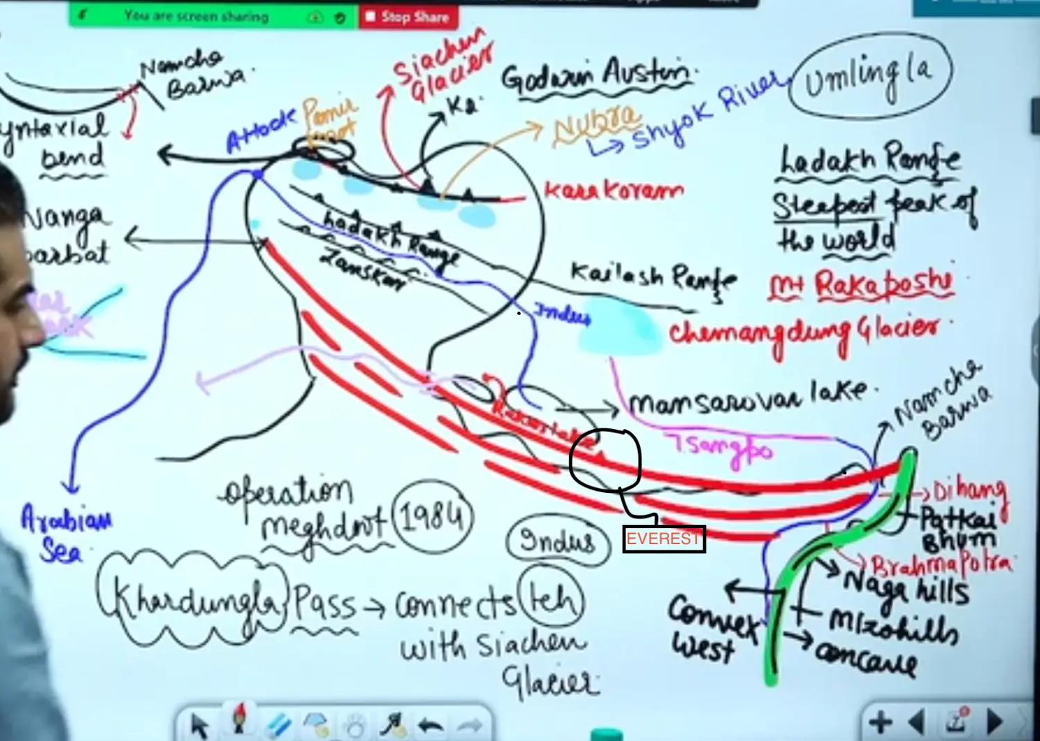
Jelep La - Sikkim
Kanchenjunga - Second Highest Peak of Himalaya
Nathu La Pass - Sikkim
Bomdi La Pass - Arunachal Pradesh
Namcha Barwa - Tibet
Dihang Gorge == Gorge of Brahmaputra
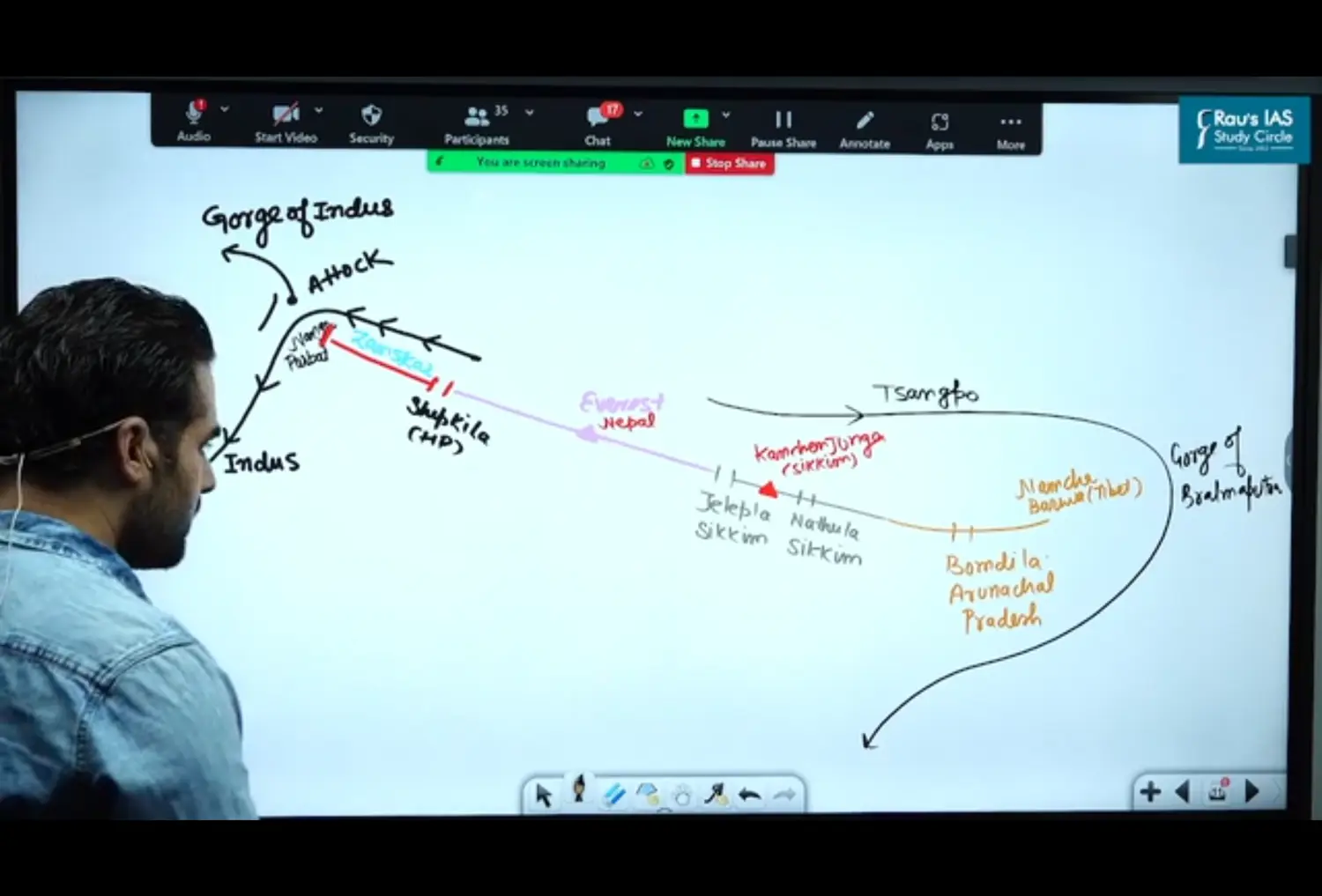
- Himalayas are More Wider are in West than East ( East Had More Compression Force and Hence All the Ranges Clubbed Towards One Side)
- and its width varies from 400 KM - Kashmir 150 KM - Arunachal Pradesh
- It is because compressive forces were more in east, than in the west that is why highest peak Everest and Kanchenjunga are in the east
- Average width is 25 KM’s
- They are formed mainly of crystalline and metamorphic rocks such as granite, Gneiss, schist,
- Greater Himalaya’s are a continuous range - Means there is NO GAP
- Antecedent River - Rivers formed before the upliftment of landforms - BSI
- Brahmaputra
- Sutlej
- Indus
- Ganga & Yamuna is NOT Antecedent
- Greater Himalaya is an almost continuous range but there are some gaps provided by some Antecedents rivers. For Example Gorge Formed by
- River Indus
- River Brahmaputra
Ranges in Himalayas
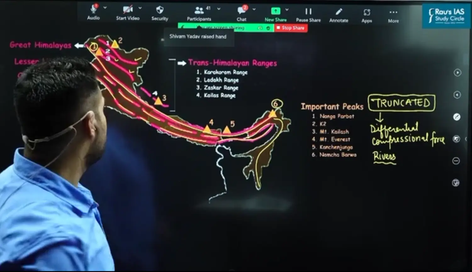
- Continuation of Ladakh Towards China is Kailash
- Middle of Lesser Himalayas
- Truncated = Broken = Dissected
- North West - Broken because in west differential compressional force was more and Due to Erosion of Rivers
- East - Ranges Get Clubbed
- South West Bend from Namcha Barwa
North Eastern Himalayas - Purvanchal - Running Notes
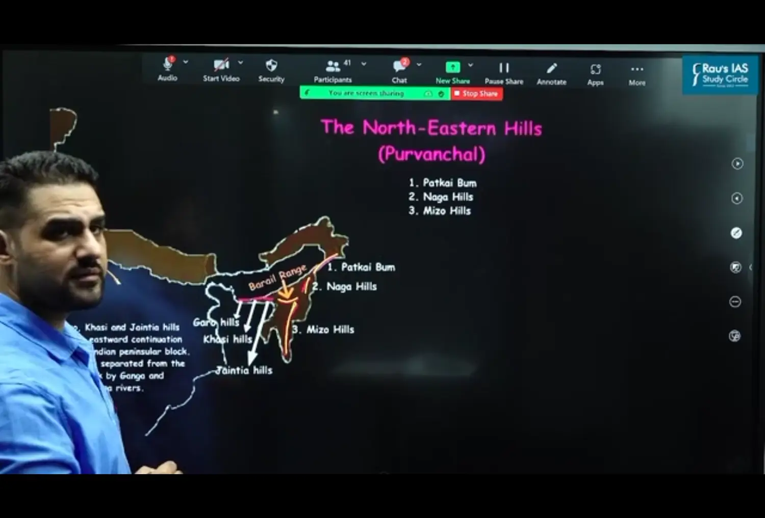
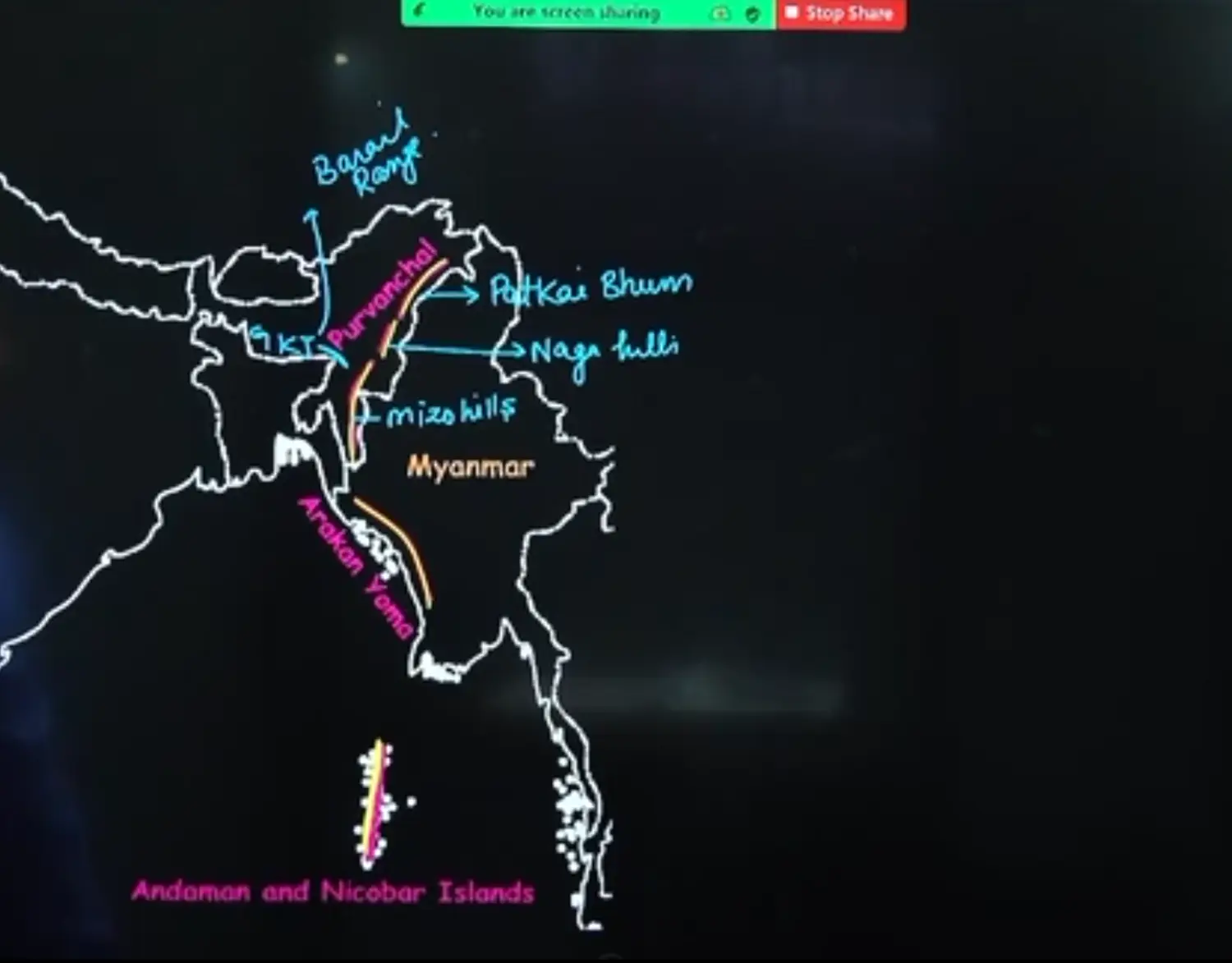
- Patkai Boom in North of Purvanchal
- Pataki Boom Extension to South in Purvanchal is Arakan Yoma
- After Ice Age - Arakan Yoma Range is Andaman and Nicobar Island
- Garo Khasi Jaintia are NOT Himalayan Hills, Rather They are Part of Peninsula and Hence they are Peninsular Hills
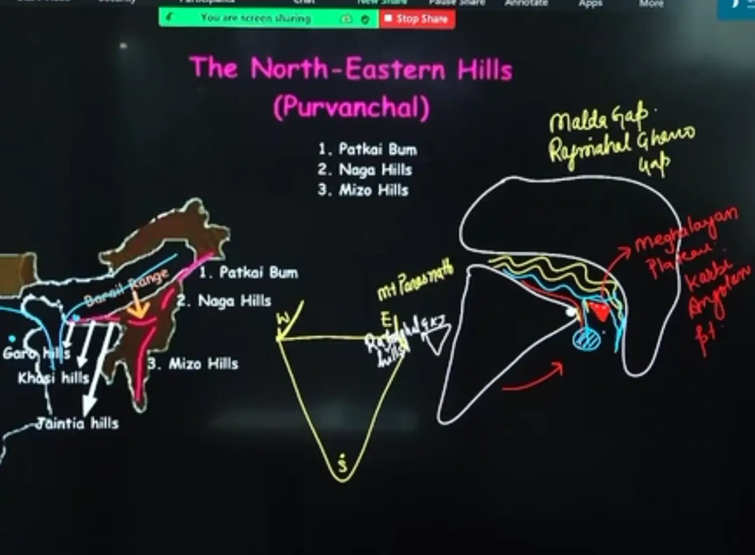
- Megalim Plateau / Karbi Angolan Plateau → developed from the Crack of Eastern Peninsula of India
- The Gap That was Created between Indian Peninsula is called Malda Gap or Raj Mahal Gharo Gap
- In the Indian Plateau - Highest Peaks
Eastern Side - Mount Parasnath Peak of Rajmahal Hills
North Western Side - Mount Guru Shikhar of Aravali Range
Southern Side - Anamudi Hills of Western Ghat
North Eastern Himalayas - Purvanchal - Class Dictation
They are also Called North Eastern Hills
Purvanchal Hills are Convex in the West and Concave in the East
They are composed of
- Patkai Boom which is the Border Between Arunachal Pradesh and Myanmar
- Naga Hills
- Manipuri Hills - Border Between Manipur and Myanmar
- Mizo Hills
Pataki Boom and Naga Hills form the watershed between India and Myanmar
Watershed - It is any upland / highland region which divides two neighbouring drainage basins
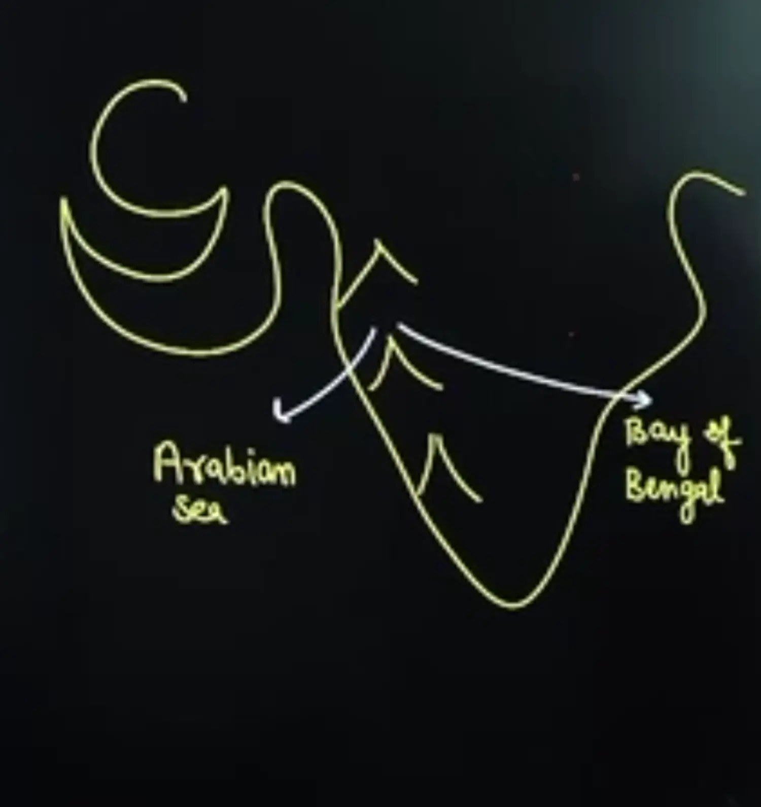
Sample Diagram of Watershed as Western Ghat
Extension of Purvanchal continues to Myanmar as Arakan Yoma and then to Andaman and Nicobar Island
Loktak Lake in Manipur is a Tectonic Lake. National Floating Park of Keibul Lamjao is Located on this Lake.
River that Flows in Myanmar Making Delta there is River Irrawaddy
Northern and North Eastern Mountains - Over All
Fact Sheet of Greater Himalayas
Called Himadri & Elevation
Covered Throughout Year with Ice
Average Elevation 6000 Meters
Himalaya Means Abode or House of Snow Derived from a Sanskrit Word called Him Meaning Snow && Aalaya Meaning Home or House
They are Youngest Fold Mountains
There is No Vegetation
Oxygen Concentration Decreases
Bacterial Activity Decreases too
Middle Himalayas - Metamorphic Rocks - Lesser Himalayas
- Lesser or Middle Himalayas Lie Between in South and Greater Himalayas in the North
- There Avg ELevation is 3500 to 4200 Meters
- This Range is Highly Dissected and Uneven. It Mainly Consists of Metamorphic Rocks
- It is Characterised with or famous for Temperate Climate, Alpine Forests, Temperate Grasslands, Terrace Farming
- Local Names for this Range is
- Pir Panjal in Jammu and Kashmir
- Dhauladhar in Himachal Pradesh
- Mussoorie Hills in Uttarakhand
- Nepal - Mahabharat Range
- They are discontinuous due to Differential compressional force and rivers
- Most of the Hill towns or resorts are located in this range like in
Jammu and Kashmir - Gulmarg, Patnitop, Son Marg → On Pir Panjal Ranges
Marg Means Valley
Himachal Pradesh on Dhauladhar → Shimal, Dharamshala, Kullu Manali
In Mussoorie Ranges → Nainital
It Passes through Hill Area of West Bengal in Darjeeling
- Gentle Slopes of the Eastern Part of this Range are COvered with Dense Forests
- South Facing Slope of Other Part of this Range are Very Steep and Generally devoid of Any Vegetation
- The North Facing Gentle Slopes of this Range are Covered by Dense Vegetation
- Slope
- South Facing Slope - Facing Sun - Adret Slope
- North Facing Slope - Not Facing Sun - Ubac Slope
Shivalik - Youngest - Sedimentary Rock - Lower Himalayas
Shivalik Range is Made up of Sedimentary Rocks
Altitude Varies from 1000 to 1500 Metres
Hills are Highly Prone to Landslides due to their Sedimentary Region. Here Masswaring will be very high
Shiwalik Ranges Are called
- Nepal - Churia Hills / Churia Ghats
Note
- Dhauladhar is a Range in Middle Himalayas
- Dhaulagiri is a Peak in Greater Himalayas
The Shiwalik Extending Towards North East ; Ranges are called Abhor, Mishmi, Dafla, Miri
Width Varies from West to East.
- It is 50 Km in Himachal Pradesh to Less than 15 Km in Arunachal Pradesh
It is composed of unconsolidated sediments brought down by the rivers from the north of Himalayas
They are almost unbroken chains of Low Hills except a gap of 80 to 90 Meters which is occupied by the Valley of River Teesta
Teesta is a Tributary of Brahmaputra
As the Shiwaliks were formed they obstructed courses of Rivers draining from Himalayas
The Debris Brought down by the Rivers were deposited in these Lakes, After the Rivers had cut their course through the shivalik Ranges the Lakes were drained away leaving behind plains
These are called as
- Doons in the West
- Duars in the East
Region btw Greater Himalayas and Middle Himalayas like
- Kashmir Valley
- Kangra Valley
- Kathmandu Valley
Chaus
Eastern Part of Shiwalik Range upto Nepal is covered with thick forest. However Forest Cover becomes thin in the west. The Southern Slope of this Range are almost devoid of forests cover in Punjab and Himachal Pradesh. They are Highly Dissected by Seasonal Streams called as Chaus
We can see them in Hoshiarpur District of Punjab
Glaciers and Snowline
The Lower Limit of Perpetual Snow is called as Snowline
Treeline Starts where Snowline
Snowline in Himalayas has Different Height. It depends on Latitude, Altitude, Precipitation, Moisture, Slope and Local Topography
The Snowline in Western Himalayas is at Lower Altitude than Eastern Himalayas
Example: the Glaciers of Kanchenjunga in Sikkim Hardly Moves Below 4000 Meter and those in Kumaon, Lahaul and Spiti move to 3600 Meters
The Glaciers of Kashmir Himalayas may decent upto 2500 Meters above the Sea Level
Reasons
It is because of Increase in Latitude from 28 degree north in Kanchenjunga to 36 degree north in Karakoram
Thus Lowering the Latitude, Warmer the Temperature, higher the Snowline
The Eastern Himalayas rise Abruptly from the Plains without the Intervention of High Ranges
The Total Precipitation is less in Western Himalayas and Mainly takes place in the form of Snow
In Greater Himalayan Ranges, Snowline is at Lower Elevation on the Southern Slopes than in Northern Slopes
Because Souther Slopes are Steeper and Receive More Precipitation as compared to Northern Slopes
Diagram
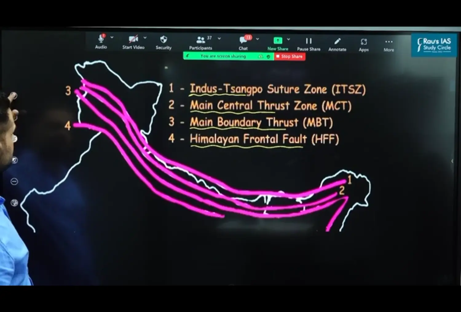
From North to South
Cross Sectional Diagram
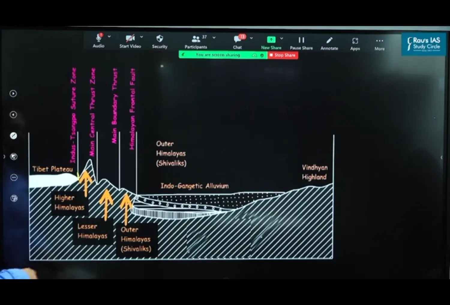
ITSZ - Indo Tsangpo Suture Zone
- It represents a Belt of tectonic compression between Indian plate and Eurasian plate (Tibetan Plate)
- It marks the Boundary Between Indian Plate and Eurasian Plate
- The Suture Zone Stretches from North West Himalayan Syntaxes Bordering the Nanga Parbat to Namcha Barwa in East
- The Karakoram, Ladakh and Zanskar Range lies to North of Indo Tsangpo Suture Zone
MCT - Main Central Thrust Zone
- It Separates Greater Himalayas and Lesser Himalayas
MBT - Main Boundary Thrust
- It is a Reverse Fault Separating lesser Himalayas and Shiwaliks
HFF - Himalayan Front Fault
- It separates or marks a boundary between Shiwaliks from Himalayan Province from Alluvial Expanse of Indo Gangetic Plains
Regional Division of Himalayas
Jammu & Kashmir, Himachal & Punjab Himalayas
This Region of Him lies b/w River Indus and Sutlej
Kumaon / Garhwal Himalayas
This Region of Him lies b/w River Sutlej and Kali
Nepal / Sikkim Himalayas
This Region of Him lies b/w River Kali and Teesta
Assam Himalayas
This Region of Him lies b/w River Teesta and Dihang
Important Passes to Study
- Pir Panjal Pass
- Bani Hal Pass
- Zoji La Pass
- Shipki La
- Bara Lacha
- Rohtang
- Niti
- Nathu La
- Jelp La
Significance of Himalayas - Add from Self As Well
Prevent Cold Siberian Winds to Enter India because of their Altitude. Had there been No Himalayas, India would be a Cold Desert
They Help in Orographic Rainfall. In India Orographic Rainfall is Maximum
in Ancient Times they acted as a Barrier and protected from Foreign Invasions
They act as National and International Borders
India China LAC
They are Source for Perennial Rivers (Flow Throughout the River, In Ganga in winters Water Volumes will slightly Decrease)
North Indian Rivers - Perennial River
South Indian Rivers - Monsoon River
Source of Fertile Soil
Source of Generating Hydro Electricity
- Tehri Dam
- Salal Dam
- Bhakra Nangal Dam
Abundance of Forests Wealth - Timber & Gum
Temperate Fruits - Apple, Apricot & Orchids
Tourism and Pilgrimage
Amarnath Yatra - National Integration & Communal Brother Hood
Himalayan Region is Rich in Minerals like Gold, Silver, Copper, Lead
- Coal (Tertiary Coal Fields with Skeet) is Found in Kashmir
- Anthracite Coal (Highest Carbon Content) is only found in Rajouri District
However with the Present Technology are NOT Being Exploited there
It Supports Bio Diversity
Kareva Soil of Kashmir
Source from Saffron by Means of Zafran
2 Great North Indian Plains
Introduction
Rivers Sediments Deposited have created these North Indian Plains
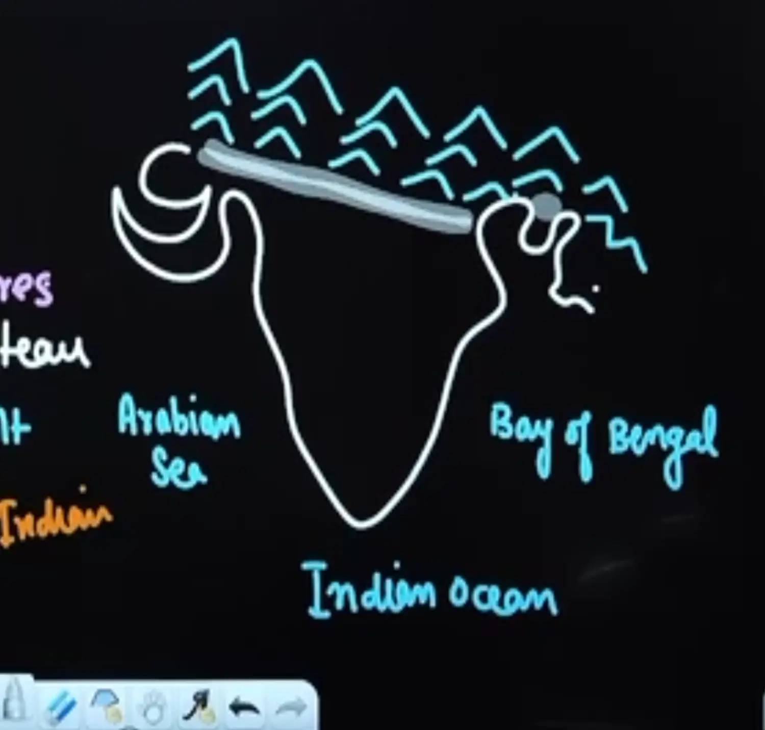
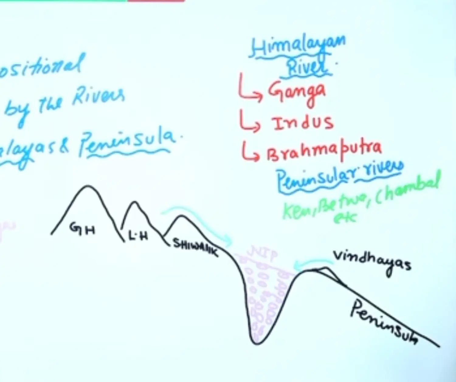
They are formed due to Depositional Activities performed by the River coming from Himalayas and Peninsula
South of Himalayas and North of Vindhyas
- Rivers from Him were - Ganga, Indus, Brahmaputra
- Rivers from Vindhyas were - North Flowing Rivers like Kane, Betwa, Chambal
Sediments from Coarse to Finer
- Boulder
- Cobble
- Pebble
- Gravel
- Sand
- Silt → River can carry this to max distance
- Clay
Due to Upliftment of Himalayas Northern Part of Indian Plate got Subsided and Formed a Large Basin, this Basin was filled with Sediments from the Rivers which came from the Mountains in the North ( Himalayas ) and from the Peninsula in the South
These Extensive Alluvial Deposits led to the Formation of North Indian Plains
The Rivers from Himalayas Bring Large Quantity of Sediments with Pebble Studded Rocks and Finally Fulfill this Depression
Chief Characteristics of North Indian Planes
- North Indian Plains Range from Mouth of Indus to Mouth of Teesta
- The North Plains of India are formed by three Major Rivers or River System :
- Indus River System
- Ganga River System
- Brahmaputra River System
- Amongst the Plains of the World → These are the Largest Alluvial Track of the World
- There are Plains on the Foothills of Mountains
Great Plains of USA
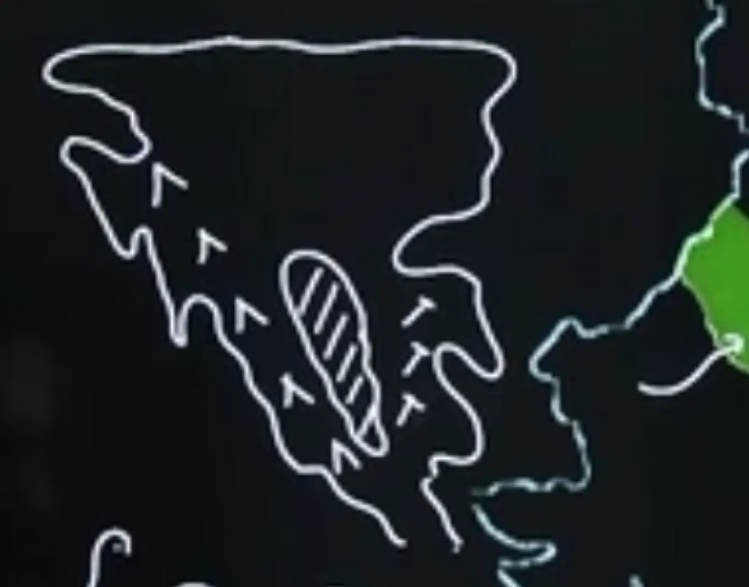
Central Plains of Europe
- These Plain Extend Approximately from 3200 KM from West to East
- Average width of Plain Varied Between 150 - 300 KM
- In General Width of North Indian Plain Increases from East to West
- 90 - 100 KM in Assam
- 500 KM - Punjab
- The Exact Depth of Alluvium Plain has not yet been fully determined. However according to recent estimates
- The Average Depth of Alluvium Avg Depth of Plain Varied from 1300 1400 M where as towards Siwaliks the Depth of Alluvium Increases
- The Extreme Horizontality of this Monotonous Plain is its Chief Characteristics
- The Highest Elevation is Near Ambala(West of Haryana) which is 291 M from the Mean Sea Level
- Lowest Elevation is Near Calcutta i.e 10 MSL
- Ambala Region of North Indian Plains create a Watershed Between Indus and Ganga System
- These North Indian Plains are Broken at Micro Levels by the Rivers
Structure of North Indian Plains
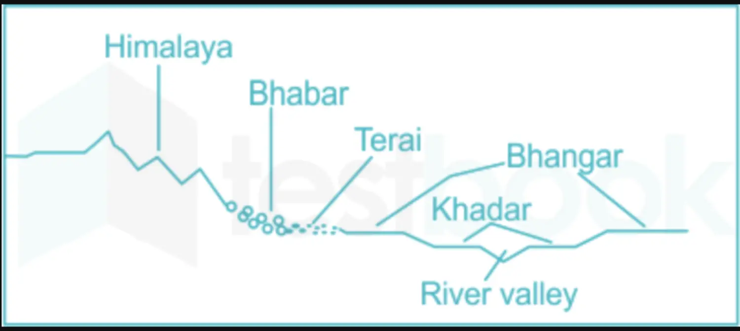
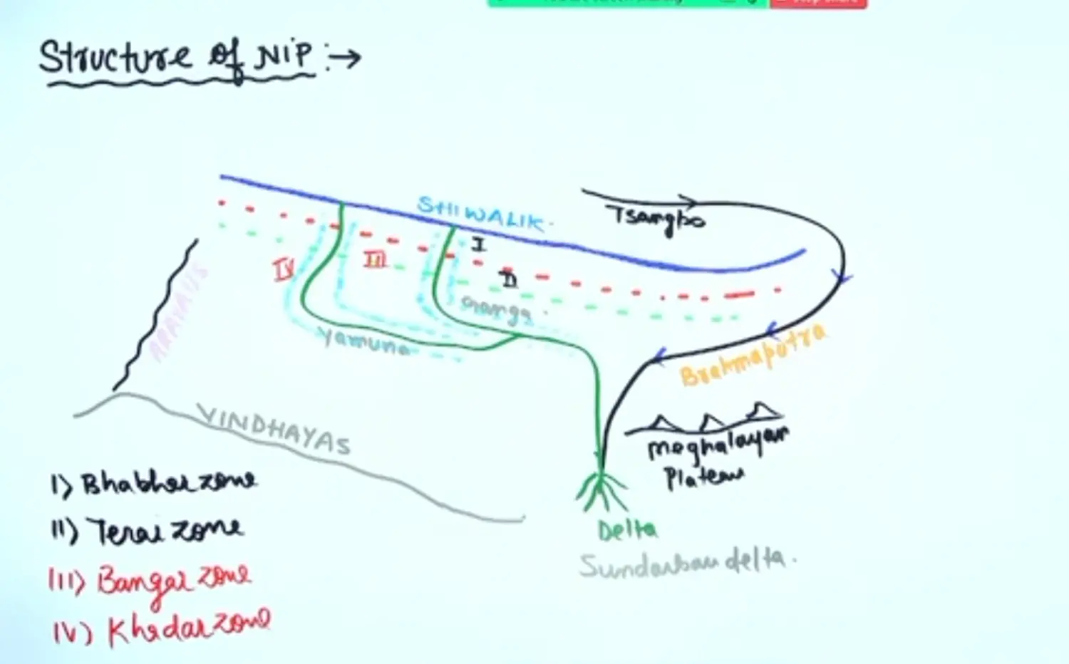
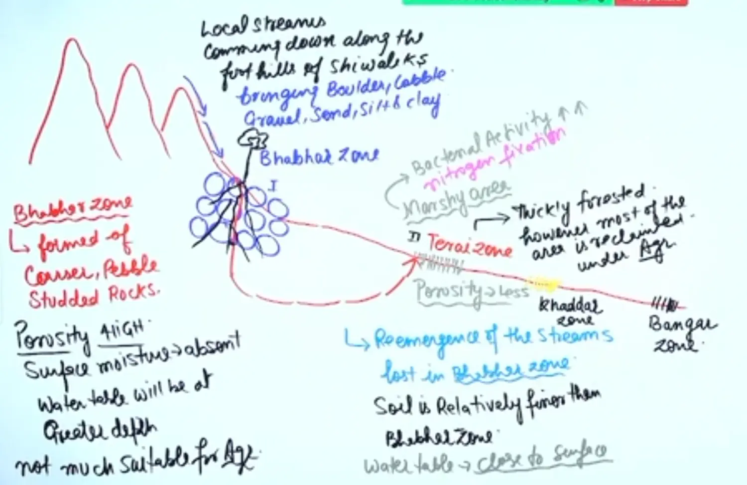
Characteristics Features of Bhabhar Zone
- It is formed of coarser, pebble studded rocks,
- Its porosity is very high
- the Surface Moisture will be absent
- Water Table will be at Greater Depth due to Higher Porosity
- It is not good for agriculture, as it is not fine soil and has deep water. only those vegetations which have deeper roots will survive here
- People do agri here but it is not much suitable for agri, a lot of area of bhabhar zone is under agru by means of modern irrigation
Characteristics Features of Terai Zone
It is the re emergence of streams which disappeared at Bhabhar Zone
Soil is relatively finer at Bhabhar Zone
Water Table will be close to the surface
Here Sediment Size is Finer. Hence Porosity is very Low
It is a Swampy Marshy Area. Here Bacterial Activity is very High.
Hence it helps in Nitrogen Fixation → Soils are rich in N2
Hence they are fit for agri
They were thickly forested, however most of the area has been Reclaimed under Agri
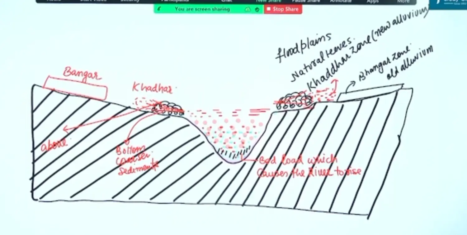
Creation of Khadar and Bangar Zone & Concept of Flood Plains
Read the Characteristics from Handout
Significance of North Indian Plains
- Cradle of Population
- 70% Popln lives in Plains
- It is suitable for Agri and Transport
The North Indian Plains has Three Parts
- 1 Punjab Haryana Plain - Indus and Tributaries
- Punjab Haryana
- 2 Ganga Plain - Ganga and Tributaries
- UP Bihar
- 3 Assam Plain - Brahmaputra and Tributaries
- Assam Region
3 Peninsular Plateau
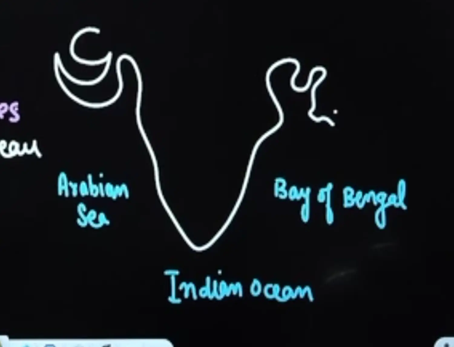
What is a Peninsula ?
Any Landmass Surrounded by Water from three Sides
Introduction
- It is geologically one of the oldest part of India
- It is roughly in the shape of a Inverted Triangle
- It is Geologically the Oldest Physiography of India which contains hills, plateaus and coastal plain
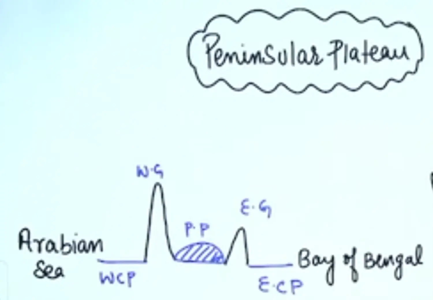
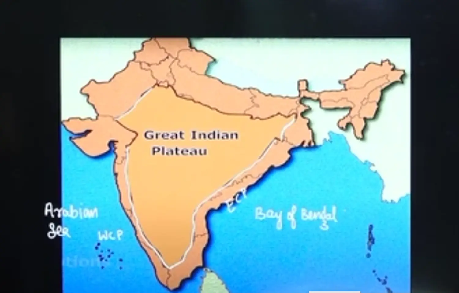
Cross Sectional View of Peninsular Plateau
WCP - Western Coastal Plain
ECP - Eastern Coastal Plain
WG - Western Ghats
EG - Eastern Ghats
PP - Plateau
Bird Eye View of Indian Peninsular Plateau
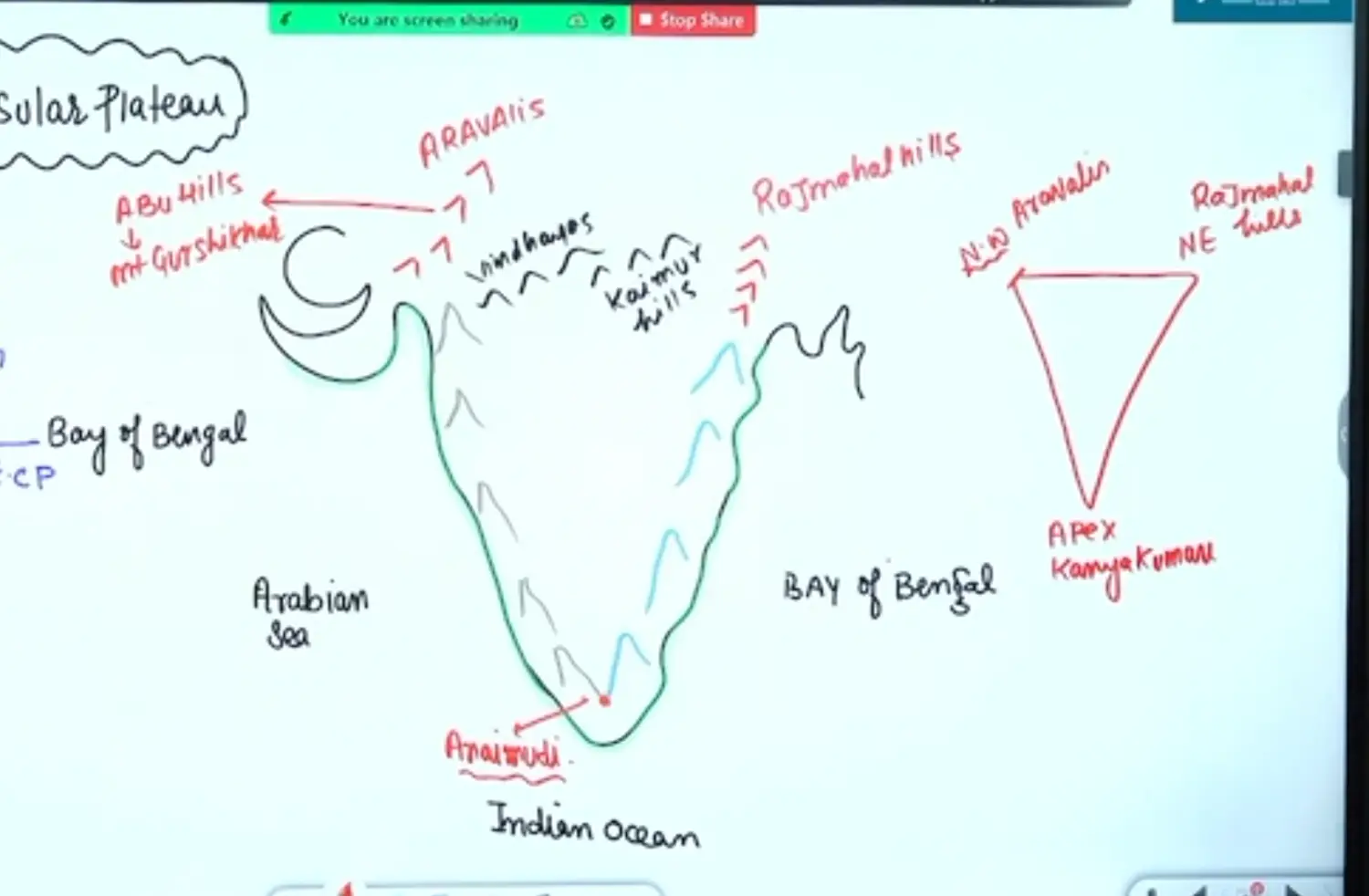
Indian Peninsular Plateau is surrounded by water on the three sides but at the same time is Surrounded by Hills from all the Sides. Namely
- To the East - Eastern Ghats
- To the West - Western Ghats
- They Generate Orographic Effect on the South West Monsoon Winds
- Highest Peak of Indian Peninsula & Western Ghar is Anaimudi in the South. Due to When Indian and Eurasian Plate Collided , Indian Plate from the South was Lifted.
- To the South - Nilgiri
- Western Ghats and Eastern Ghats meet at
- Highest Peak is Doddabetta
- To the North West - Aravallis
- Highest Peak of Aravali is Abu Hills Mt Guru Shikhar
- In Gujarat They Have Denuded.
- Here we have Gir Ranages and Gir Forests also called as Daand Forests
- To the North - Vindhyas
- Highest Peak of Vindhyas Sadbhavna Shikhar
- To the North East is Kaimur Hills
- To the East is Rajmahal Hills
- Highest Peak of Raja Mahal Hills is Parasnath Hill
- Here the Central Deccan Plateau is Relatively Dry due to it being in the Shadow Zone
Indian Peninsular Plateau has primarily Two Parts
Hills on three Sides
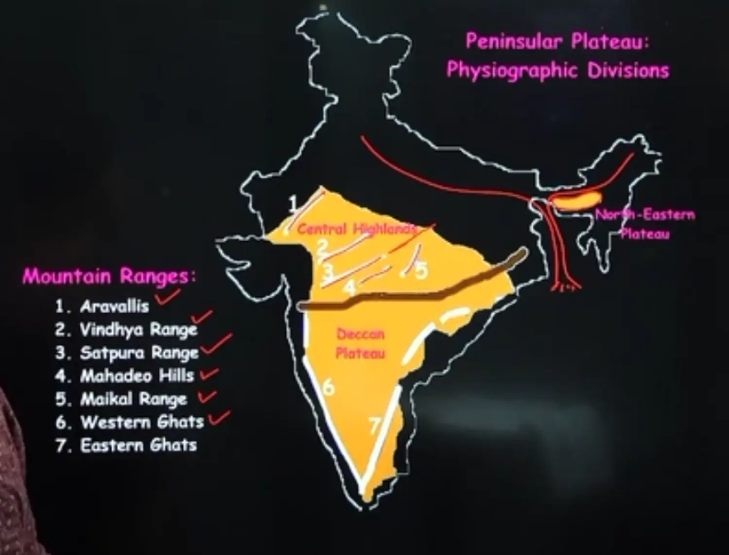
Hill Ranges of the Peninsula
Highest Peaks of Various Ranges
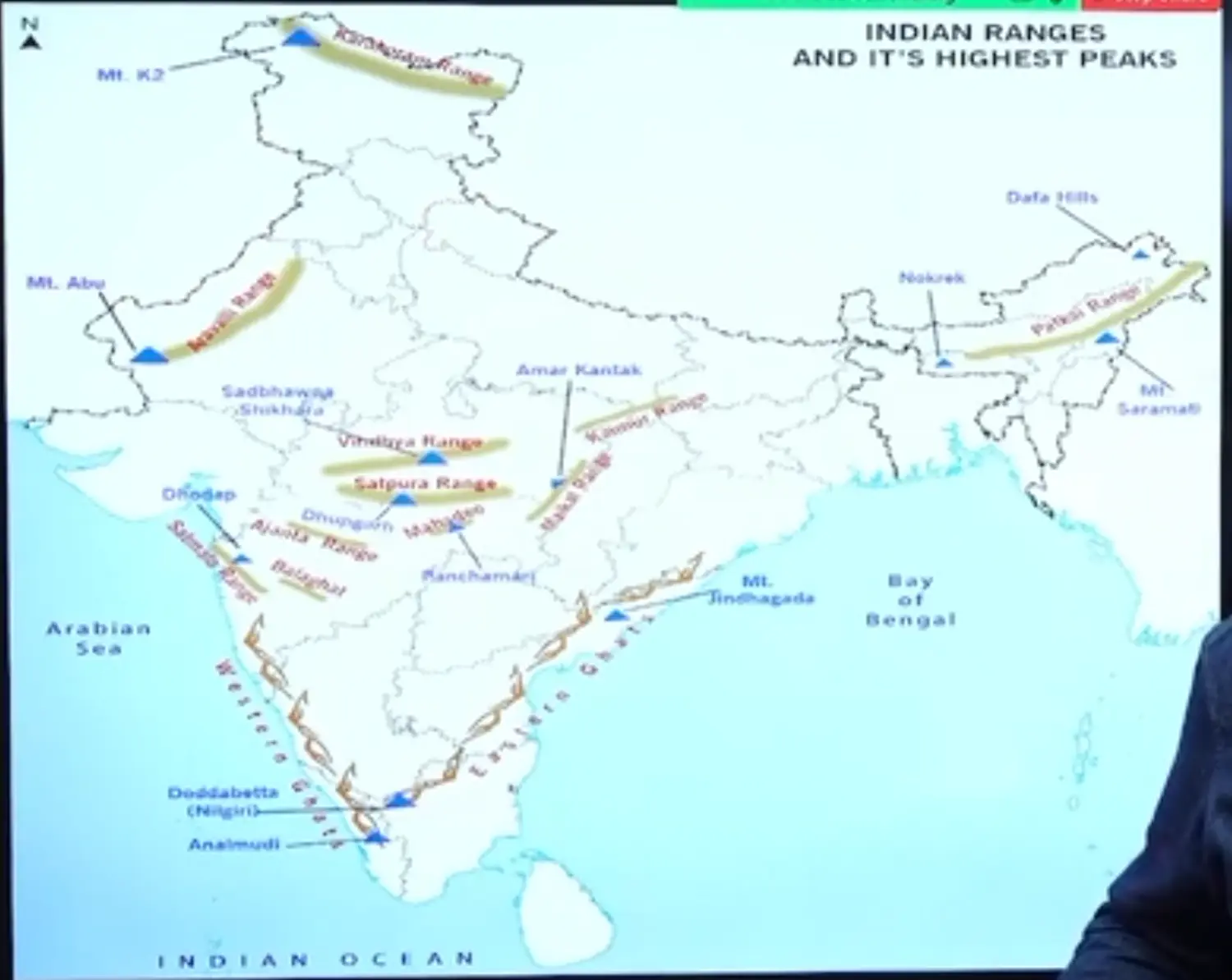
- Karakoram - K2 Peak
- Aravali - Mt Abu - Guru Shikhar
- Western Ghat - Anamudi
- Nilgiri - Dodabeta
- Eastern Ghat
- In Orissa - Mahendra Giri
- Over All - Mt Jindhagada
- Maikala Ranges - Amar Kantak
- Vindhya - Sadbhawana Shikhar
- Satpura - Dhupgarh
- Sahyadri - Dhodap
Aravallis Range
- Aravallis the Oldest Fold Mountain of the World extending from Gujarat in the South West (Palanpur) towards Rajasthan
- It is more elevated in South West Region
- They continue till haridwar also where it is buried under alluvium of Ganga Plain
- It highest Peak is Mt Guru Shikhar ( in Rajasthan)
- It acts as a Water Divide Between Indus and Gangetic Plains
Vindhya Range
- Extends from Gujarat in the West to Kaimur Range in Bihar to the East
- Its Altitude is Low i.e 300 to 600 Meters
- It acts as a Water divide between Himalayan and Peninsular Drainage System
- It is a Block Mountain
Satpura Range
- It is a Series of 7 Mountains
- Sat - Seven Pura - Mountains
- It is a Block Mountain, Surrounded by the RIft Valley of Narmada
- They Stretch for around 900 KM’s
- Parts of Satpura have been Folded and Uphieved, thus they are regarded as Structural Uplift or Horst
Meaning of Horst and Graben
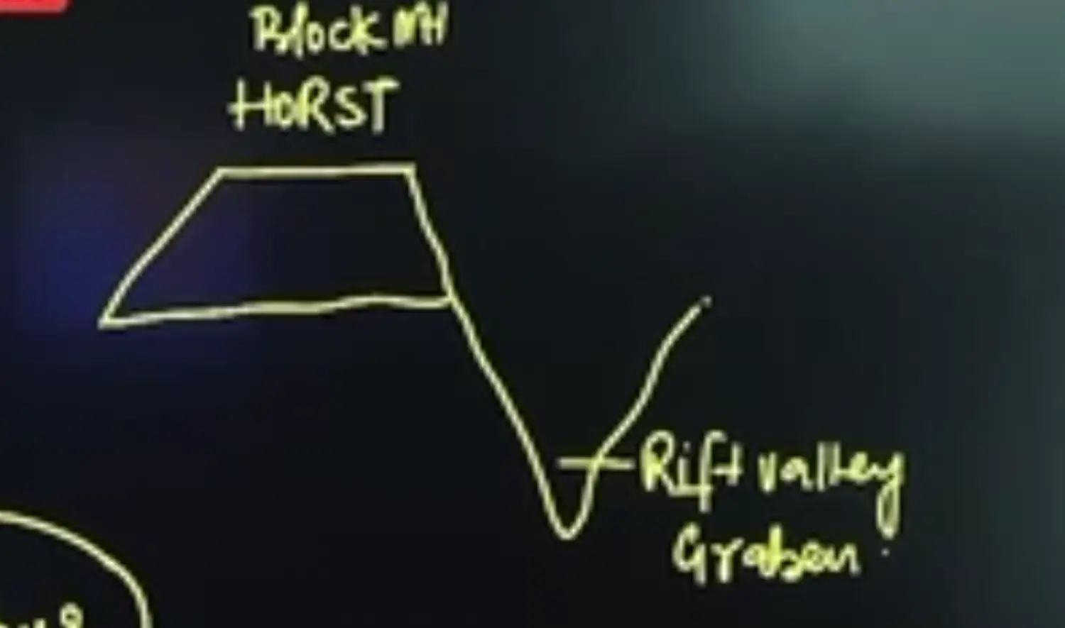
Block Mountain is also called a Horst
Rift Valley is also called a Graben
- It is called as
- Rajpipla Hills in Gujarat
- Mahadev Hills in MP
- Maikal Hills in MP & CG (Majority in CG)
- Some Facts
- Mount Dhoopgarh Near Pachmarhi on Mahadev Hills is the Highest Peak
- The Satpura Hills is a Water Divide Between Narmada & Tapi
Western Ghats
Introduction
- It acts as water divide between river flowing into arabian sea and bay of bengal
- They are barrier to South west monsoon winds and hence are responsible for orographic rains
- The Western Ghats Extend from Mouth of Tapi, till kanyakumari along the western coast of India
- Between 21 Degree North to 11 Degree North
- They Run in total for a Length of 1600 KM
- Their Average Elevation is 1000 Mtr from Sea Level
- These Western Ghats are NOT Real Mountains but they are the faulted edges of an upraised plateau
- When Indian Plate was moving over the Reunion Hotspot it experiences intrusion of Magma from Below → This resulted into Domal Upliftment
- The Track of the Uplifted Part Coincides with the Central Axial Region of Weakness. This led to Faulting and Subsequent Subsidence of Western Part of Peninsula into the Sea.
- The Western Ghat acts as a Watershed or Water Divide between East and West Flowing Peninsular Rivers
- Western Ghats Generates Orographic Effect to the South West Monsoon Winds. The Leeward Slope of Mountain has deccan plateau which is relatively dry due to Rain Shadow Effect
- In Gujarat they are called as Gir Ranges, but are not prominent due to denudation
Division of Western Ghats are
- Northern Western Ghats
- from Tapi to North of Goa, it is made up of Horizontal Sheets which is know as Deccan Trap
- Trap is a word for Stairs in Sweden. Due to Basaltic Lava being more fluid. It has many varied cooling thus giving a stair like appearance. Hence called Deccan Trap
- Mt Kalsubai is the Highest Peak
- Extends until Gujarat but has been denuded
- Central Western Ghats
- The Middle Part in total are called as Baba Budan Hills
- He Cultivated Coffee for the First Time by Going to Africa via Arabian Sea
- Two Indigenous Varieties of Coffee in INdia
- Arabica
- Robustus
- Pre monsoon shower good for their cultivation is Cherry Blossom Shower (Local Thunderstorm Associated)
- It extends from 16 Degree North upto Nilgiris
- Average Height is 1200 to 1500 Meters
- Important Peaks are
- In Middle Western Ghats the Highest Peak is Mullayanagiri
- Vavul Mala in Karnataka & Kerala Border - 2235 Meters
- Kudremukh - 1892 M - Rich in Iron Ore Extraction
- Pushpagiri - 1749 M
- The Middle Part in total are called as Baba Budan Hills
- Southern Western Ghats
- It has the highest peak of western ghats called Anamudi.
- It constitutes the Southern Hill COmplex comprising of Nilgiri, Annamalai & Cardamom Hills
- Imp Grasslands here are Shola Forests
- Nilgiri
- Meeting Point of Western & Eastern Ghats
- HIghest Peak of Nilgiri is Doddabetta
- Northern Western Ghats
Passes / Ghats (Man Made / Natural) in Western Ghats
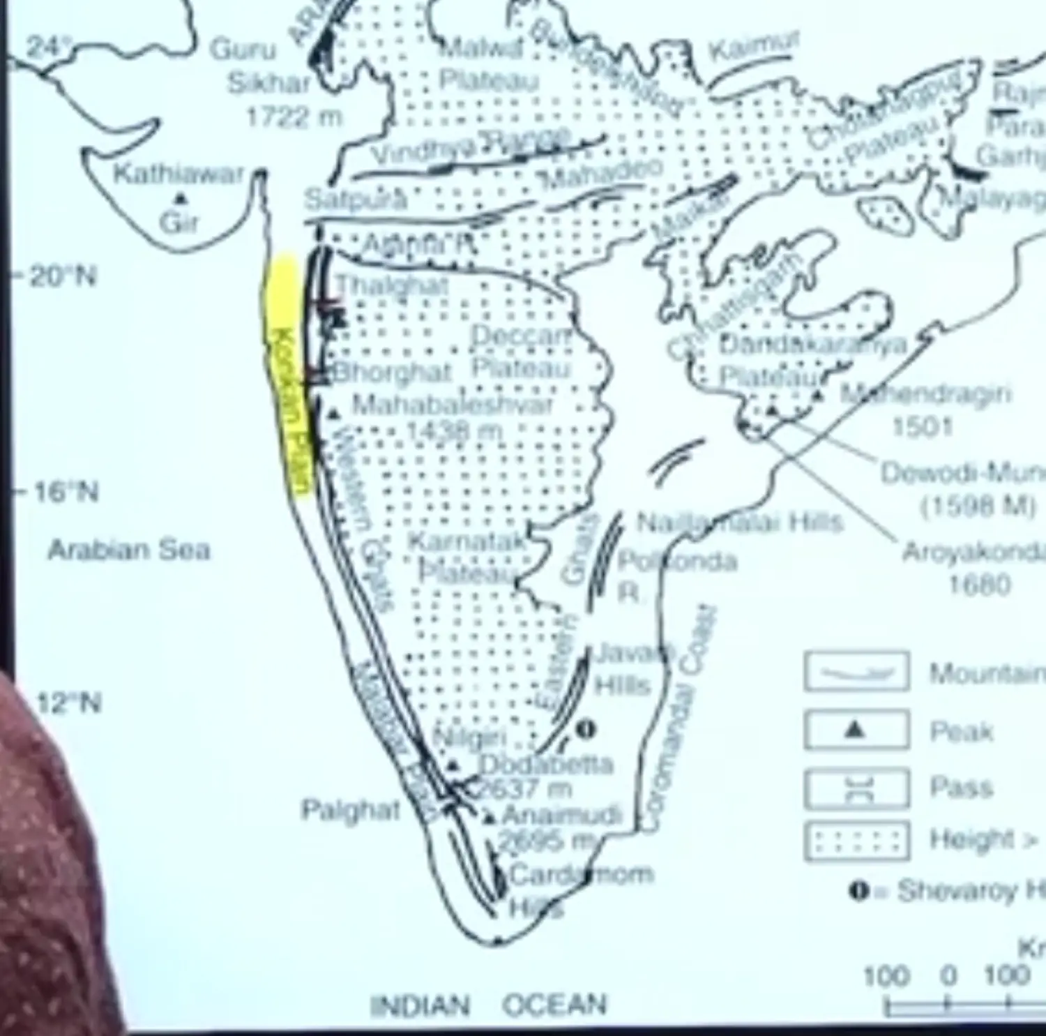
Thal Ghat / Thul Ghat && Bhor Ghat
Thal Ghat & Bhor Ghat provide passage by road and railway between konkan plains in the west and deccan plateau in the east
Plains of Maharashtra & Goa are together called as Konkan Plains
Eastern Ghats
- Bordering the Deccan Plateau, Eastern Ghats Run Almost Parallel to the East Coast of India.
- Eastern Ghat is a Group of Hills, Intersected by East Flowing Peninsular Rivers of Mahanadi, Godavari, Krishna, Kaveri, Kanara & Vagai (TN)
- Thus, they are not considered as Perfect Barriers
- It Joins the Western Ghats in Nilgiris
- The Important Peaks Comprising Eastern Ghats Are
- The Highest Peak of Eastern Ghat is Jindgarha (Andhra Pradesh)
- The Highest Peak of Eastern Ghat in Orissa is MahendraGiri
- The Important Hills Comprising Eastern Ghats Are
- Northern Circars, Orissa
- Nallamalai, Andhra Pradesh
- Velkonda, Andhra Pradesh
- Palkonda, Andhra Pradesh
- Javadi, TN
- Shevaroy, TN
Difference Between Eastern and Western Ghats
Eastern Ghats are discountuos as compared to western ghats
They are discontinuous due to flow of Rivers
Plateau in the Centre
Diagram of Divisions (Khands)
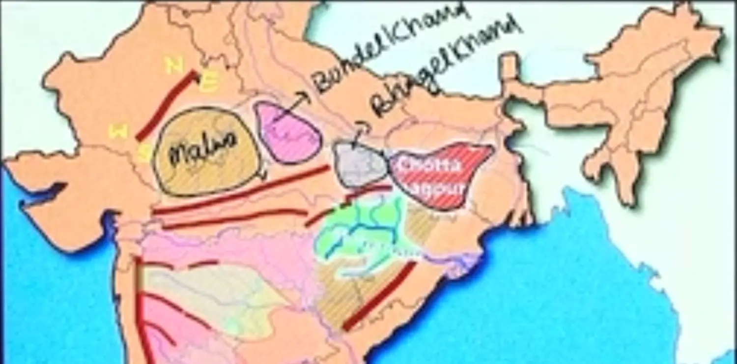
The Indian Peninsular Plateau is Divided into Parts called (Khands)
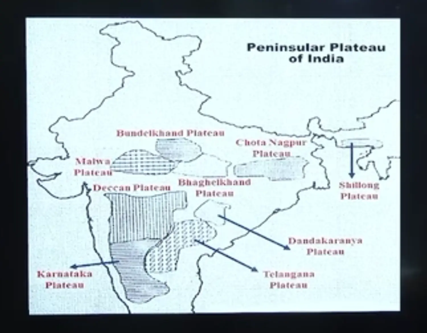
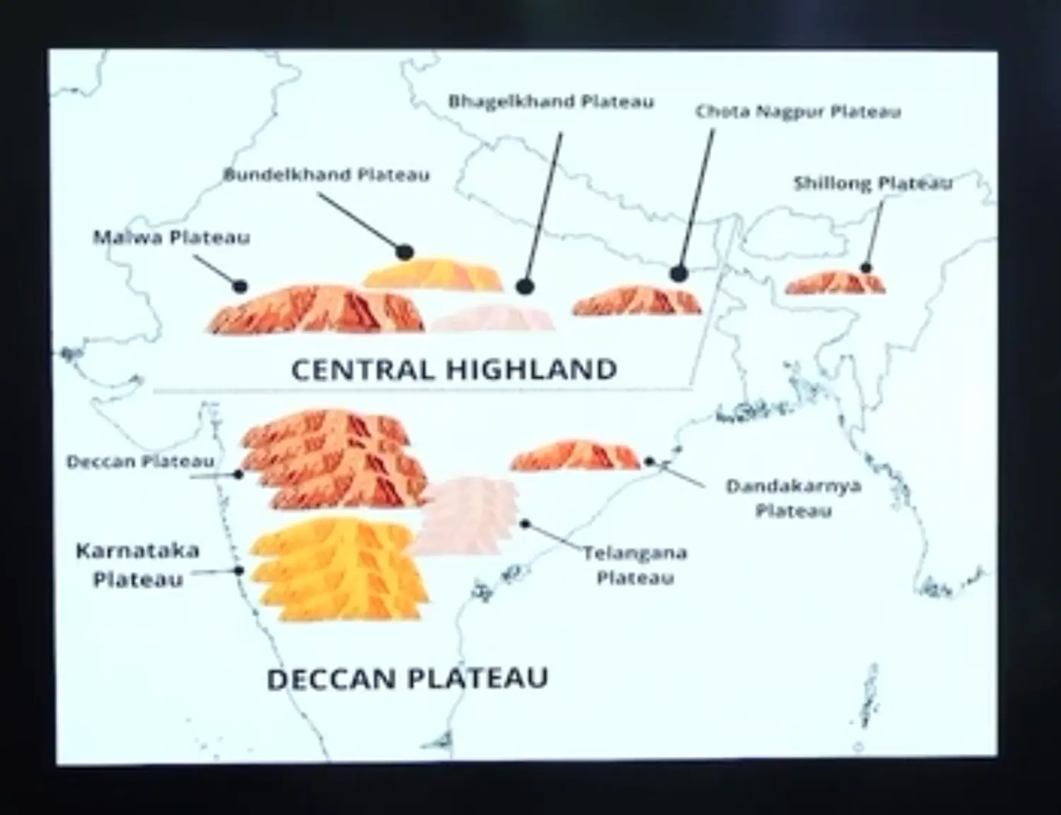
Three Parts of Plateau Region of Peninsula
- Central Highland - Madhya Bharat
Malwa
South of Ganga Plains, North East of Aravalis, North of Vindhyas, A Triangular Feature is called as Malwa Plateau (Also called Central Highlands)
It has extension towards east i.e Chota Nagpur Plateau
It is more wider in the west and narrower in the east
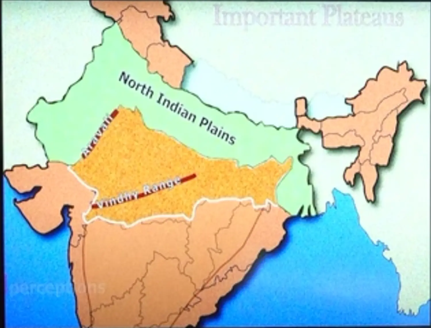
Towards west I merges with thar desert
Bundelkhand
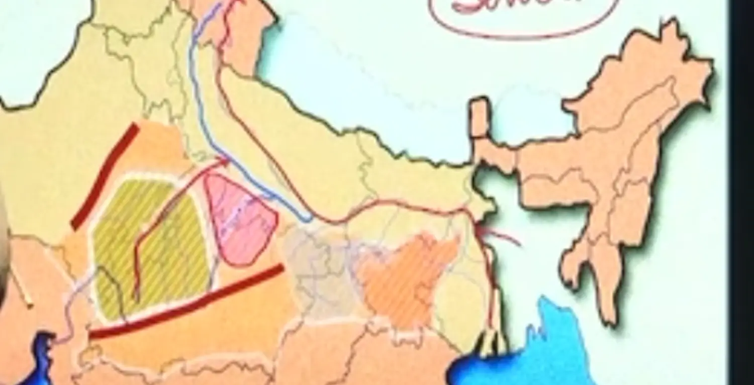
Prelims Based Facts for Bundelkhand Upland
- It is bounded by
- North - Yamuna River
- South - By Vindhya
- North West - North West
- It has a Senile Topography (it means featureless characteristics due to high erosion) which comprises of Small Rounded Hills of Granite, Niece and Stand Stone
- It is bounded by
Baghelkhand
It lies to the east of Maikala Range
It comprises of
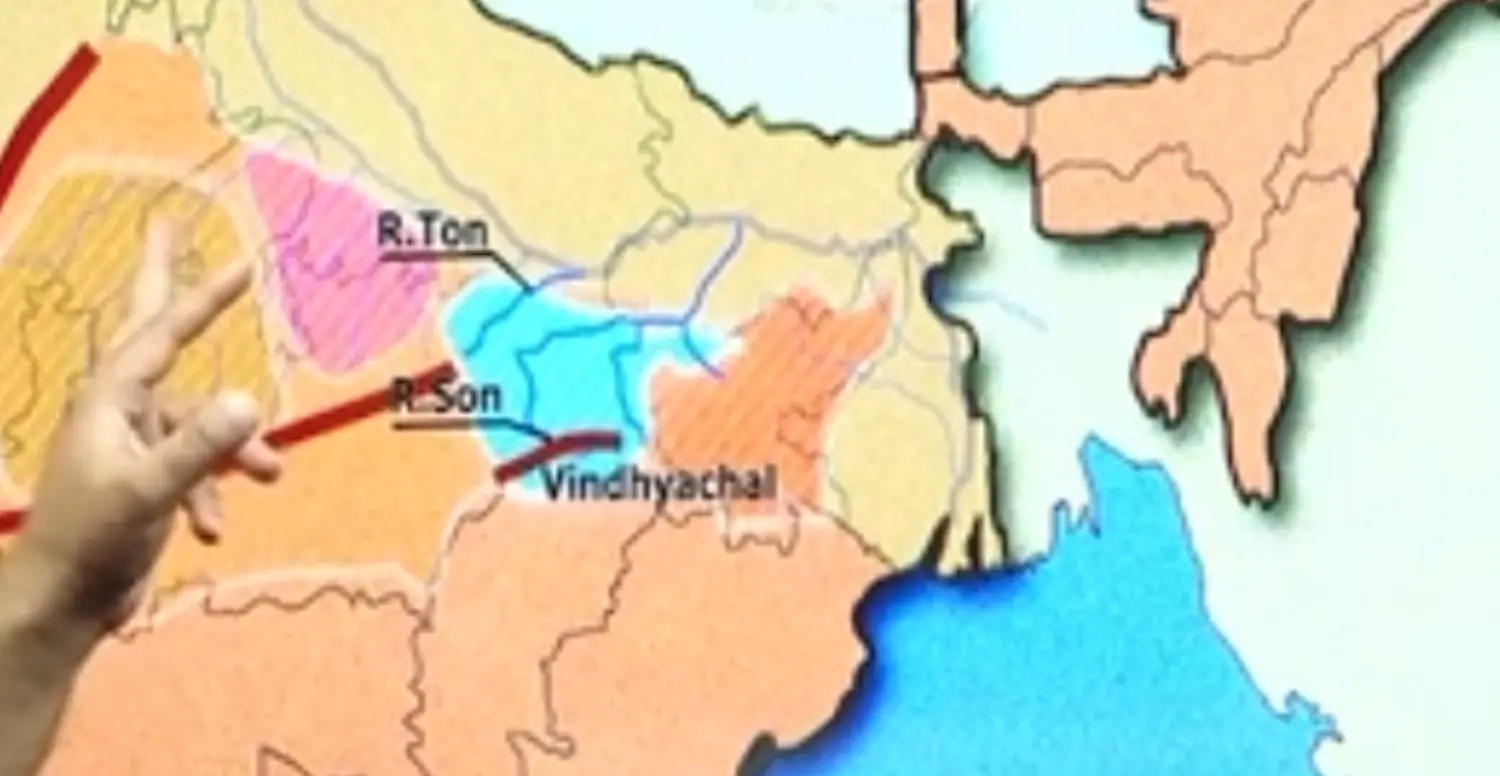
- Vindhyan Sand Stone
- River Soan Basin
- Thick Forest
Chota Nagpur Plateau
Northern Part - Hazaribagh
Southern Part - Ranchi Plateau
It Includes Jharkhand, Northern CG & Purulia in West Bengal
It has an average elevation of 700 Mtr. The Plateau consists of Series of Step Like Sub Plateau locally called as Patlands such as Hazaribagh and Ranchi Plateau
Examples of Pat Land - in a Series
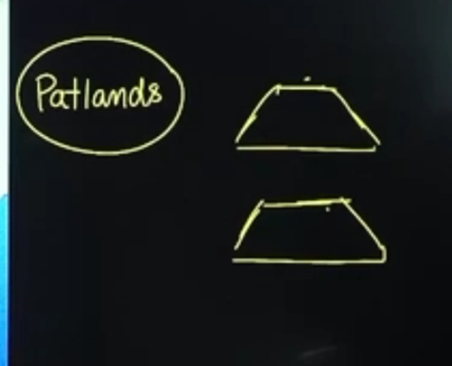
The North Eastern Projection of CNP is Raj Mahal Hills
Numerous Rivers Flow downward from this Plateau making Number of Waterfalls (The Drainage Pattern is called as Radial Pattern)
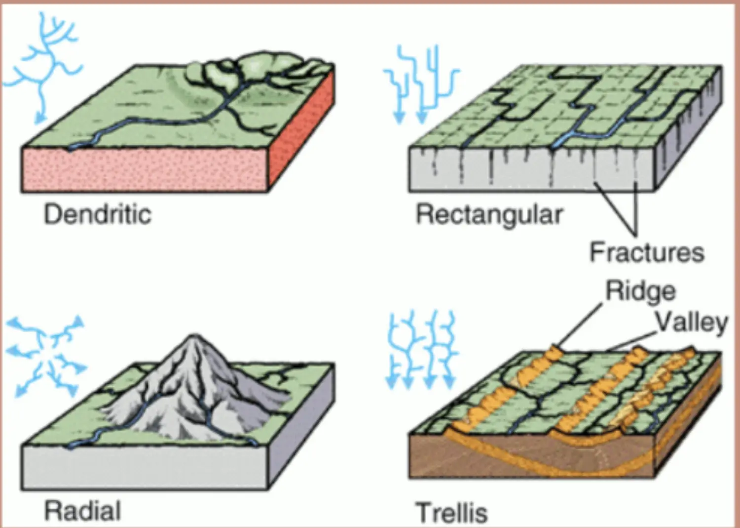
It is also called as Mineral Heartland of India
It is rich in terms of Metallic and Non Metallic Minerals
It is also called as Ruhr of India ( Ruhur is a Valley in Germany known for Coal Deposits)
- Deccan Plateau
- Over All Description of Deccan Plateau
- Surrounded by Mountains
- West - Western Ghats
- East - Eastern Ghats
- North - Satpura
- Surrounded by Mountains
Parts of Deccan Plateau Are
- Maharashtra Plateau
- Karnataka Plateau
- Telangana Plateau
- A Part of Telangana Plateau is Rayalaseema Plateau
- CG / Bastar / Dandakaranya Plateau
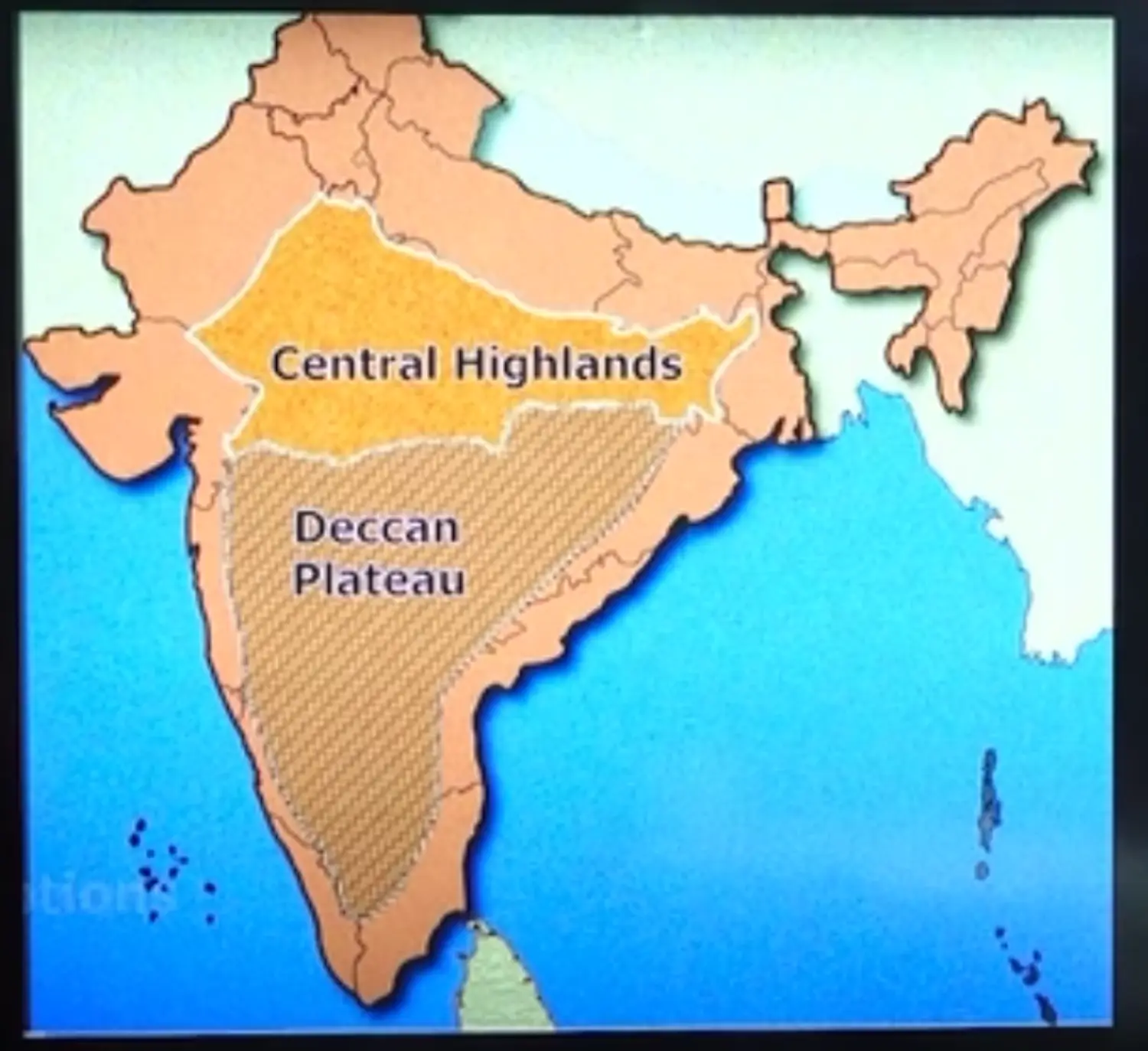
Division Between Central Highlands & Deccan Plateau
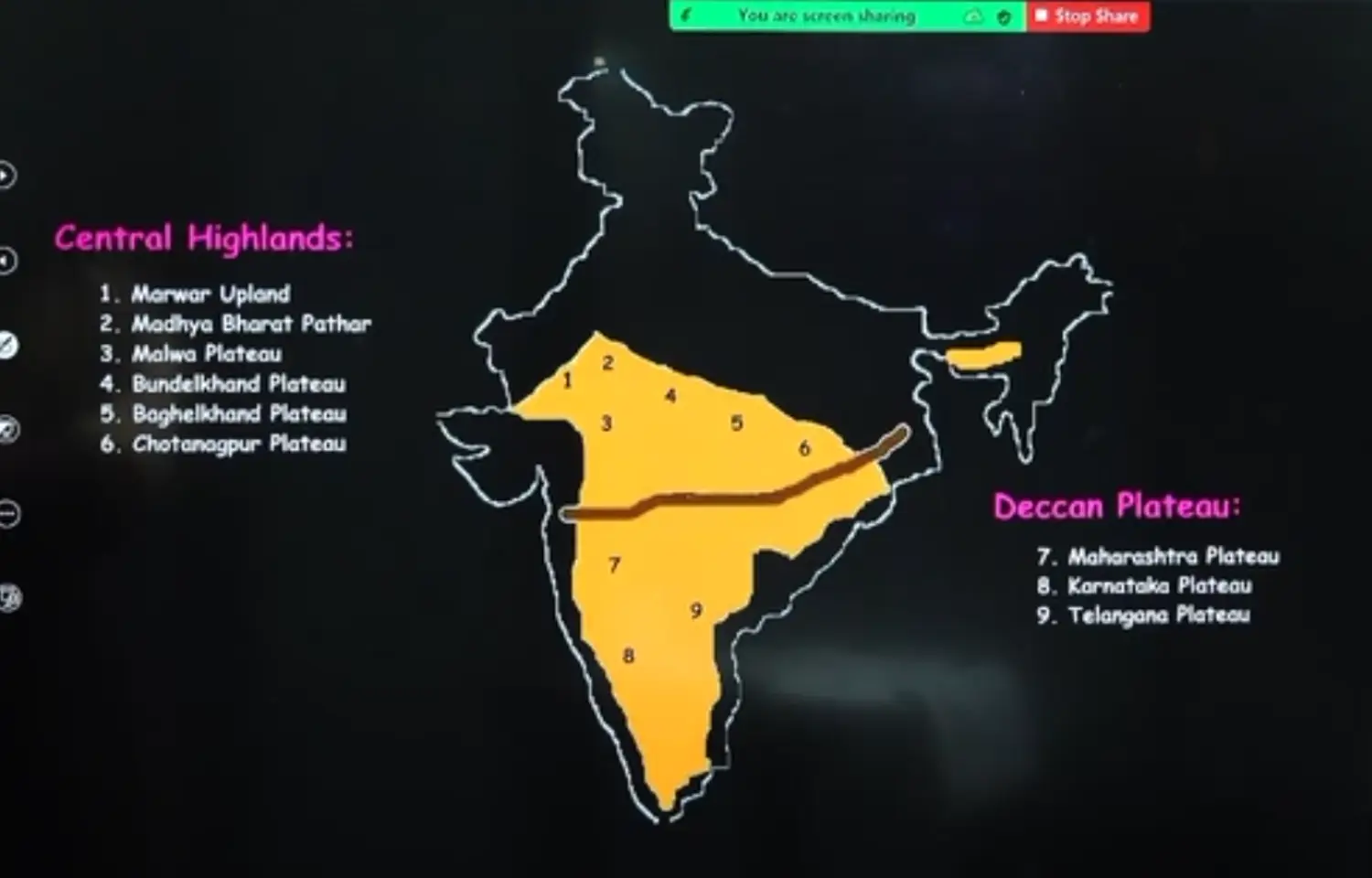
Central Highlands → North of Narmada
Deccan Plateau → South of Narmada River or Satpura Range
- North East / Purvanchal
- Shillong / Karbi Anglong / Megalin Plateau
Introduction
Karbi is an Autonomous Region of Karbi Tribe, has been recently declared as a District
Assam is a Plain formed by Brahmaputra, but has a plateau called Karbi Anglong Plateau
The Megalin Plateau is separated from Peninsula Plateau by Garo Rajmahal Gap
The Highest Peak of Plateau is Shillong
Region has Hills like Garo Khasi, Jaintia
It has 2 more hills called
Mikir Hills / Rengma Hills
Karbi Anglong Hills
It is an Extension of Megalin Plateau towards Assam
It is rich in mineral resources like
- Coal - Tertiary
- Iron Ore
- Limestone
- Uranium
This Area Receives Maximum Rainfall from South West Monsoon ; as a Result of this Megalin Plateau has Highly Eroded Surface
Cherrapunji Located in the Southern Slopes of Khasi Hills, displays a Bare Rock Surface which is devoid of any permanent vegetative cover
Raj Mahal Garo Gap
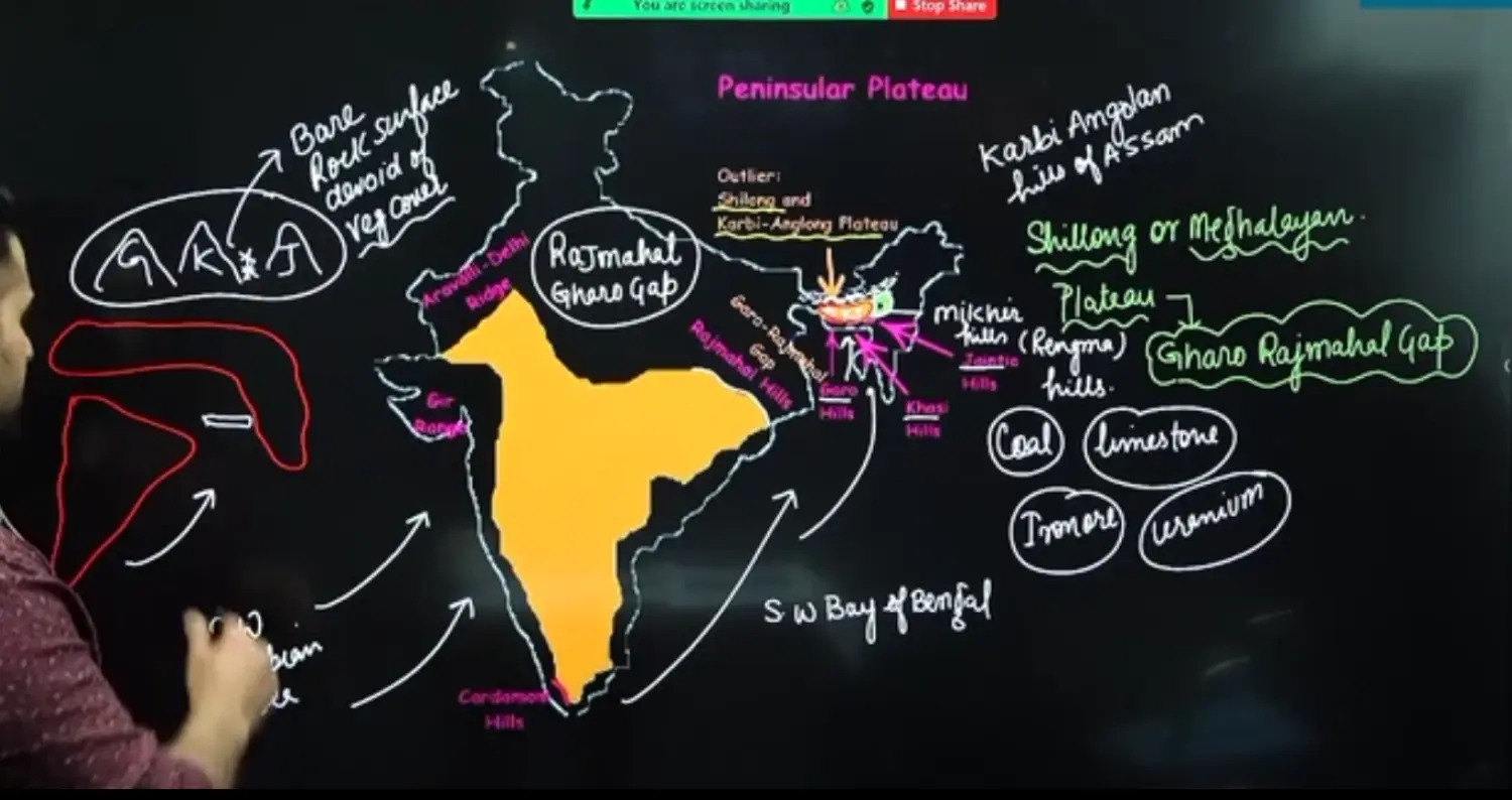
- The Two Disconnected Outline Segments of Peninsular Plateau are seen in Raj Mahal and Garo Khasi Jaintia Hills
- It is believed that due to force exerted by North West Movement of Indian Plate at the time of Himalayan Origin. A Huge Fault was created between the Raj Mahal Hills and Megalin Plateau
- Later this Depression got filled with Deposition Activities of Numerous Rivers. Especially River Ganga & Brahmaputra
- As a Result, today Megalin & Karbi Angolan Plateau stands attached from the main peninsular block
Plateau Categorisation on the Basis of Origin
Volcanic Plateau
- Process
- Volcanic Plateau are formed by the Cooling & Solidification of Basic Lava which is Basaltic in Nature
- Their Decomposition and Disintegration, results into the formation of Black Soil
Kathiawar Plateau, Gujarat
- Near Gulf of Khambhat
- Also called as Kutch Kathiawar Region
- This Region though is an extension of peninsular plateau (in kathiawar region there are rocks of deccan lava)
- Because Kathiawar is made up of deccan lava and there are Tertiary Rocks in the Kutch Area
- However as of now, they are treated as Integral Part of Western Coastal Plain, cuz they are now levelled Down
Malwa Plateau
Deccan Trap, Maharashtra
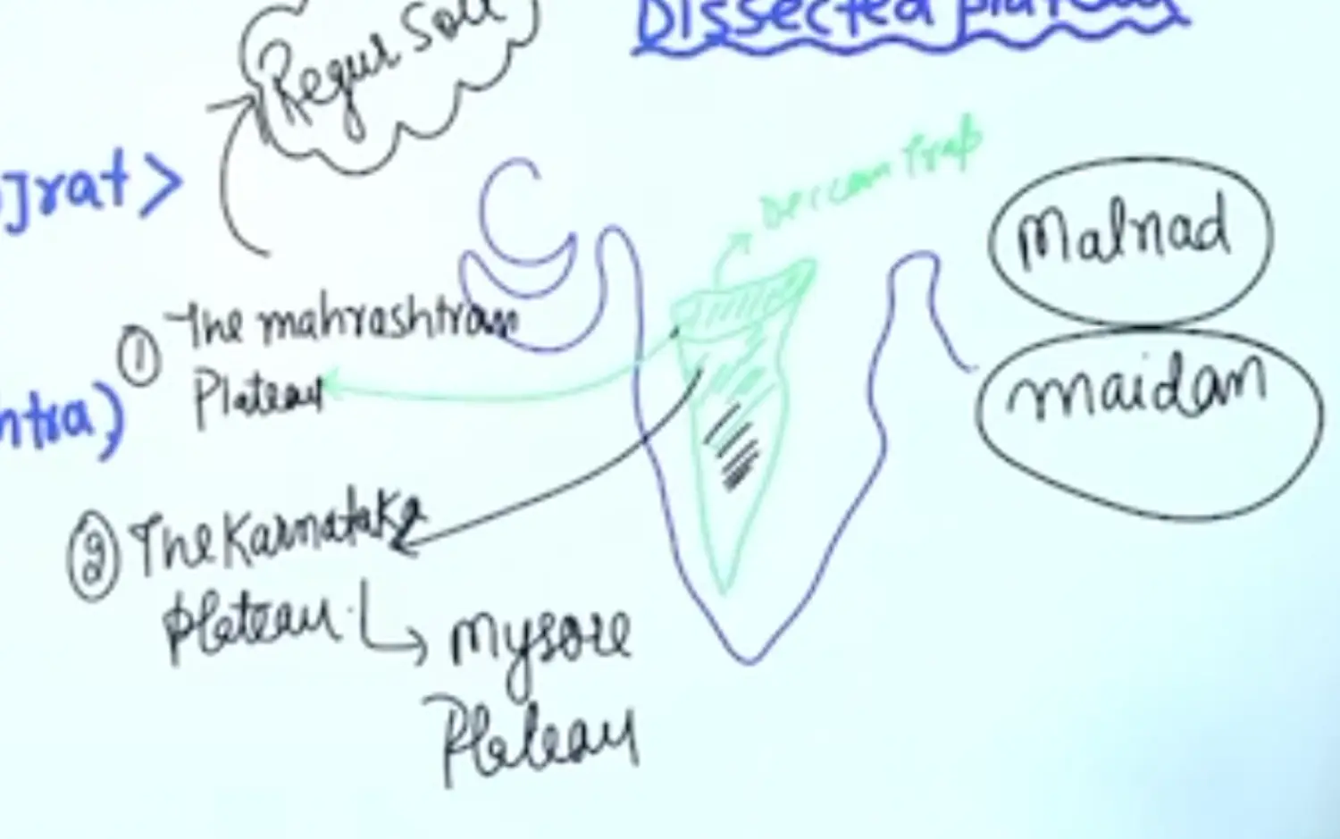
- If a Plateau is surrounded by Flat Top Hills, it is called as Trap.
- The hill surrounding it are, Ajanta, Balaghat, Harishchandra
- The Deccan Trap comprises of Three Parts as
Maharashtrian Plateau
- Has a typical deccan trap topography underlying by Basaltic Rocks
- Disintegrates into Black Soil or Regur. Good for Cotton Cultivation
Karnataka Plateau / Mysore Plateau
- It is divided into Two Parts
The Western Part is Hilly called Malnad
The Eastern Part is Rolling Plain called Maidan
Maidan Plains are known for Ragi Cultivation
- It is divided into Two Parts
Telangana Plateau
- Process
Dissected Plateau
- They are made up of Old Metamorphic Rocks. They are Erosional Plateaus with Low Altitude and Low Slope
- Examples Are
- Bastar Plateau of CG
- Telangana Plateau
- Rayalaseema Plateau
- Malanad Part of Karnataka Plateau & Tamil Nadu Plateau
4 Coastal Plains
Coastal Plains of India
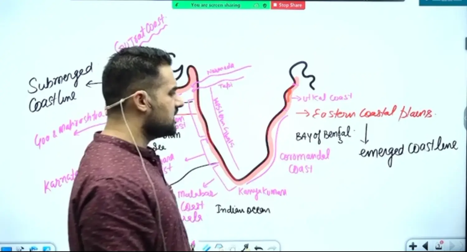
1 Western Coastal Plain - Guj, Mah, Kar, Ker
From Tapi till Kanyakumari
- Northern Part - Submerged Coastline
Gujarat Coast / Kathiawar Coast
Comprises of Kutch & Gujrat Coast
Kathiawar is a part of Indian Peninsula but due to denudation it has been levelled
There is a Range here called Girnar Peninsula. The Girnar Ranges here are not high enough to give them a suitable height of obstruction for orographic rainfall
Konkan Coast
Goa & Mah Coast
Canara Coast, Ktk
- Locally Referred Part of Western Coast is Canara Coast
- Southern Part - Emerged Coastline
- Northern Part - Submerged Coastline
2 Eastern Coastal Plains - Orissa, Andhra, TN
- Eastern Coastal Plains Stretch from Tamil Nadu in South to the West Bengal in North
- Over All Emerged Coast Line - Due to Delta
- Its constituents are
Utkal Coast
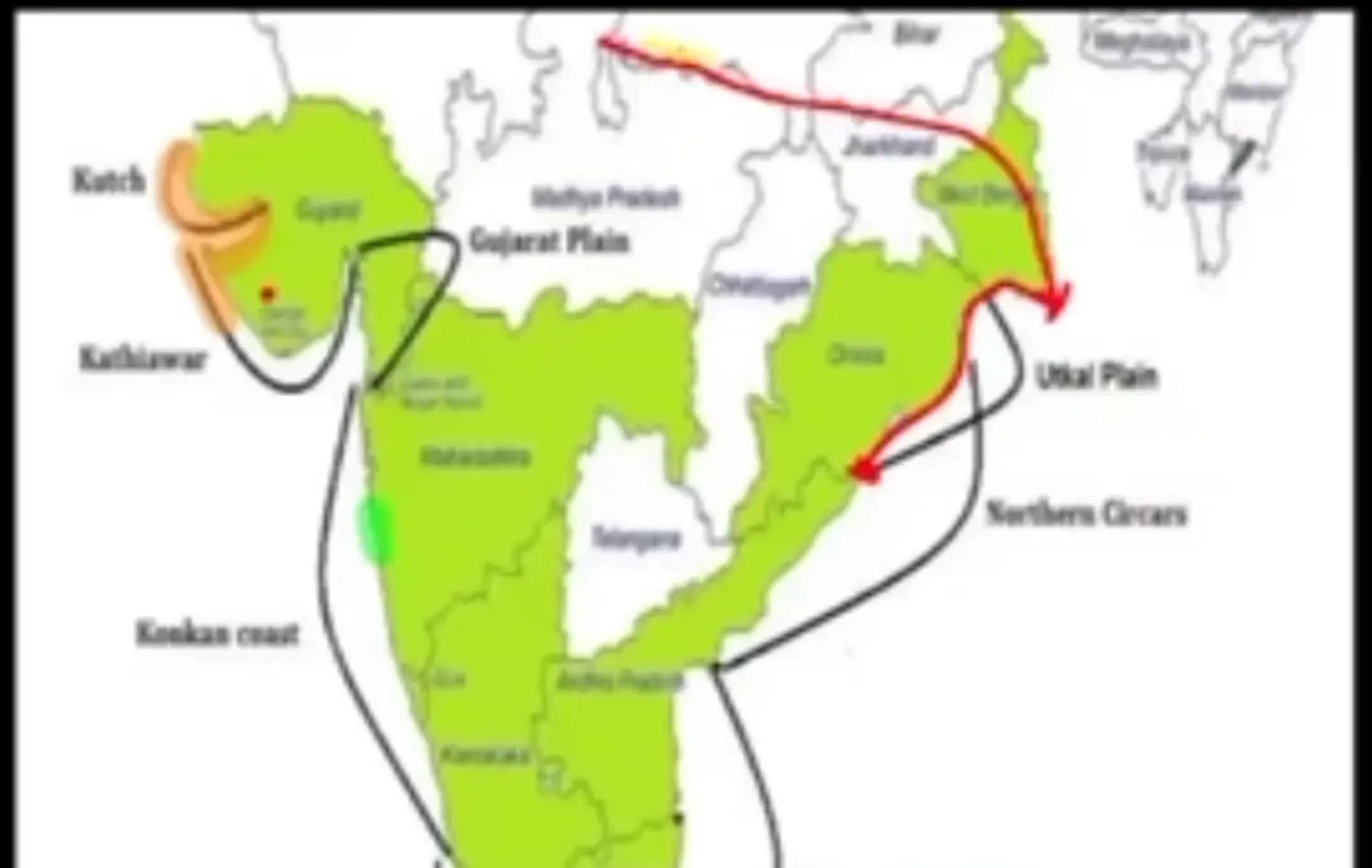
- It is a Deltaic Plain of Ganga Delta to Mahanadi Delta
- Here we have a Lagoon / Backwater called as Chilka Lake
Utkal Plains to Lake Pulicat contains Delta of Godavari & Krishna
Example: Kolleru Lake
The Depositional Activity of Krishna and Godavari, this lagoon is completely blocked from sea, due to its loss of connectivity to sea and at the same time, fresh water from Narmada and Godavari, It has turned into a fresh water lake
Northern Circars
- Lies Between Mahanadi and Krishna
Coromandel Coast
- It is between River Krishna & Kanyakumari
- It consists of cauvery delta
- Eastern Coast of India - Important Lagoons
- Chilika Lagoon, Orissa
- Kolleru, Andhra Pradesh - Fresh Water
- Lake Pulicat (Called Sriharikota Island Now)
5 The Islands
- 1 On Shore Islands
- 2 Off Shore Islands
No of Island
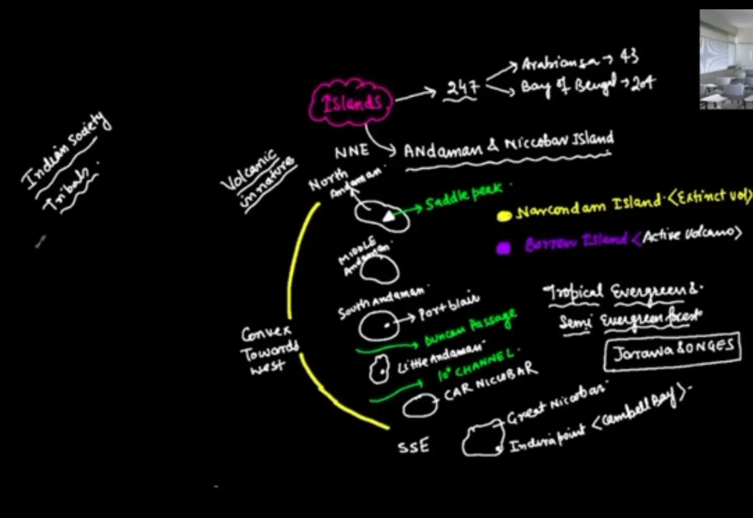
- Total - 247
- Arabian Sea - 43
- Bay of Bengal - 204
Andaman & Nicobar Islands
Introduction
- They are Convex to the West
- They are extensions of Arakan Yoma
- Its a Tropical Evergreen Semi Evergreen Forest type Vegetation
North Andaman
- Saddle Peak
- East of Saddle Peak is a Extinct Volcano called Narcondam Island which is inhabitable
- Below that is Barren Island, which is a Active Volcano
Middle Andaman
South Andaman
Duncan Passage
Little Andaman Separated by South Andaman by Duncan Passage
Little Andaman
10 Degree Channel
Car Nicobar
Great Nicobar
- Southernmost Point is Indira Point, half of it got submerged under water after Tsunami of 2005
Lakshadweep Islands Group
Created by Chagos Laccadive Ridge
Ridge - Long Liner Under Sea Mountain
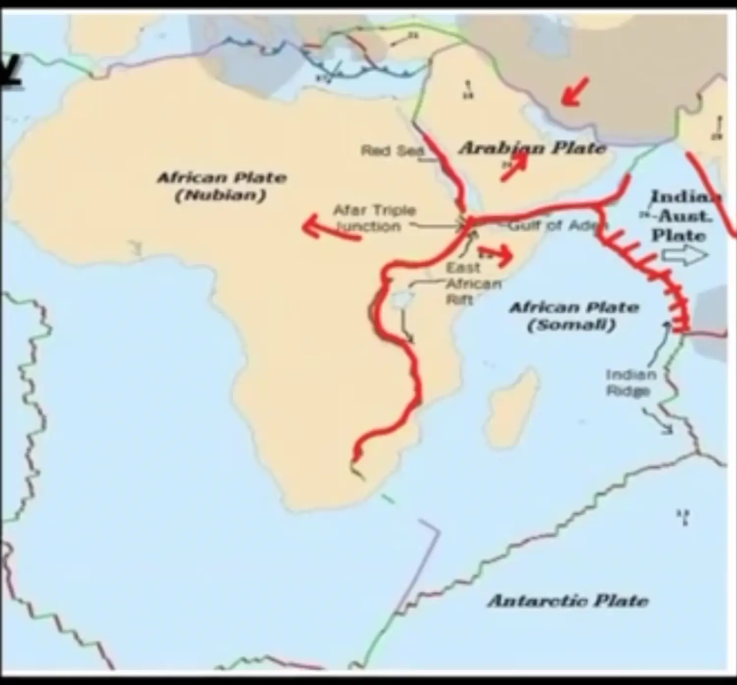
They are Organic in Origin because there are coral deposits
Examples
- Minicoy Island
- 9 Degree Channel Separates Minicoy Island from Kavaratti
- Karvati
It’s a Tiny Group of Island, These Islands are Organic in Origin. These are Coral Islands located over Mid Oceanic Ridge
Example of Mid Oceanic Ridge is Minicoy Chagus Ridge
These Coral Islands are circular or Elliptical with a Lagoon in the Centre also called as Atolls